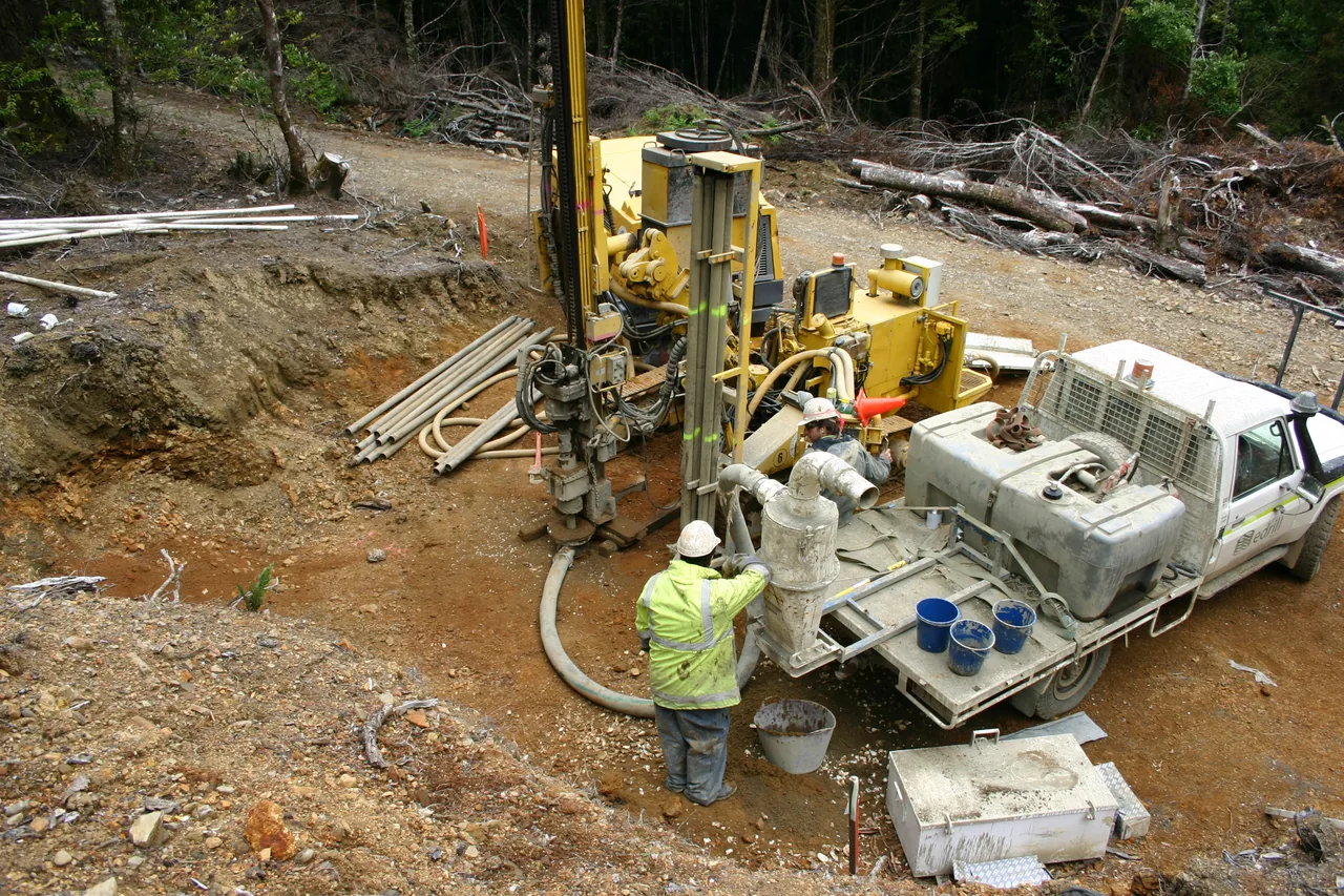
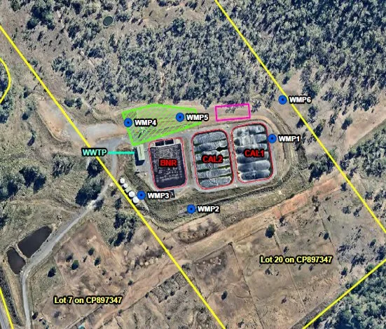
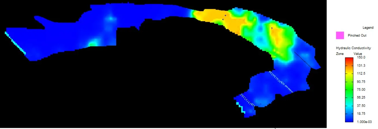
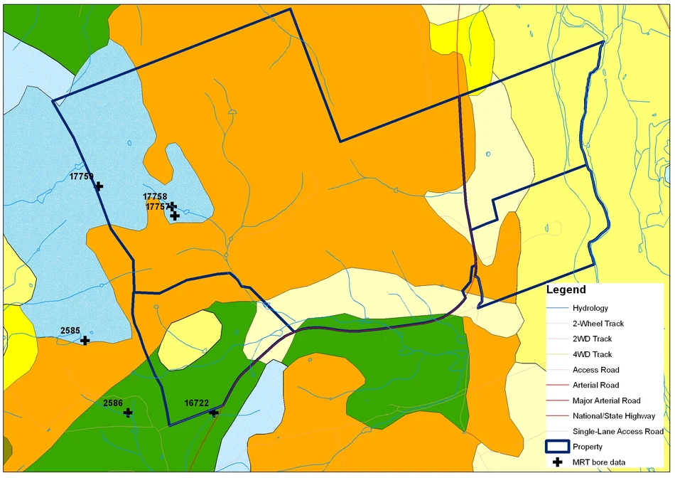
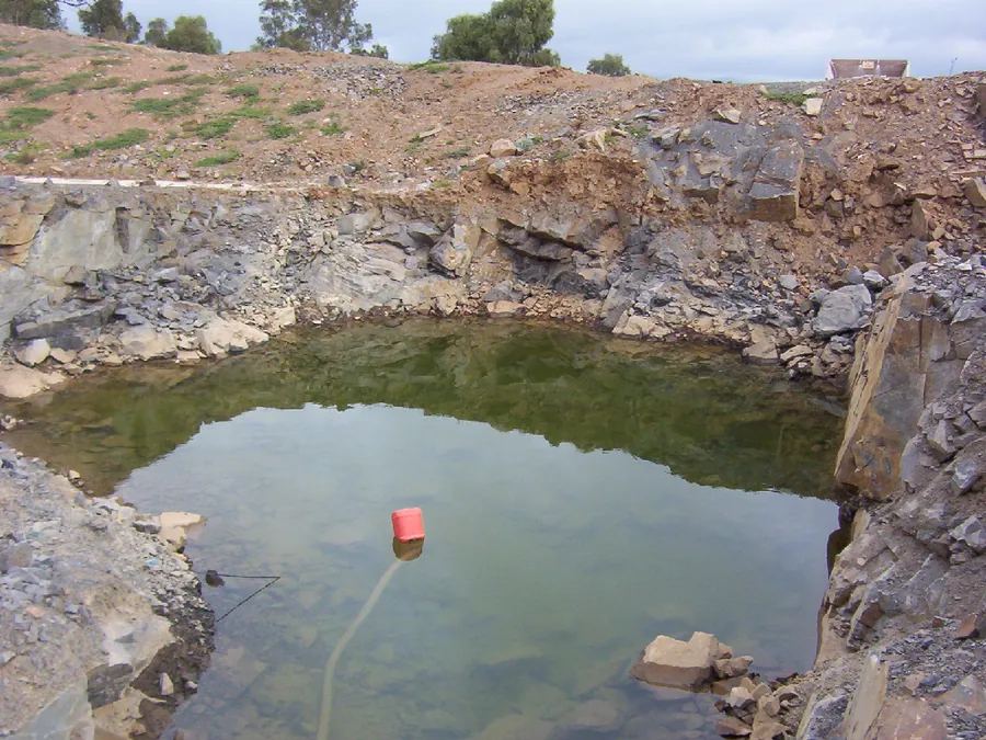
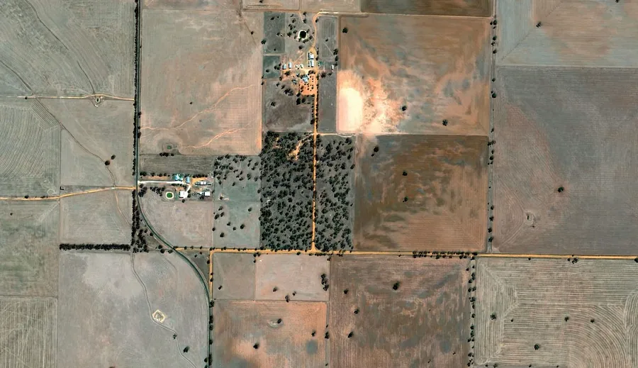
How much water would the proposed mine need, and how much would enter its workings? We used a year of surface water monitoring, catchment modelling and mine plans to estimate both.
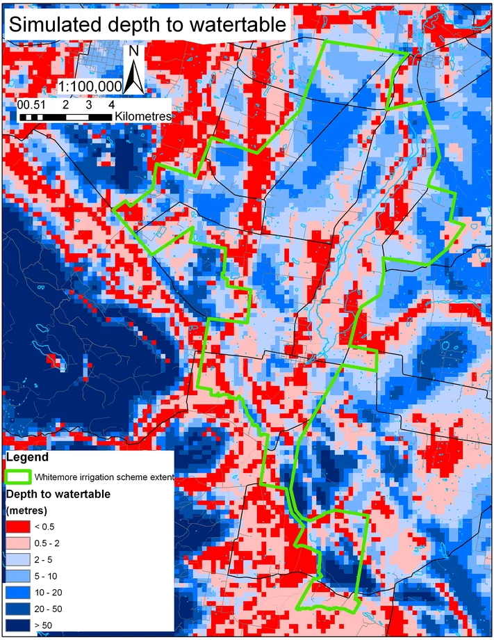
Further information about Mount Lindsay mine water balance
Project enquiry
Mount Lindsay mine water balance
How much water would the proposed mine need, and how much would enter its workings? We used a year of surface water monitoring, catchment modelling and mine plans to estimate both.
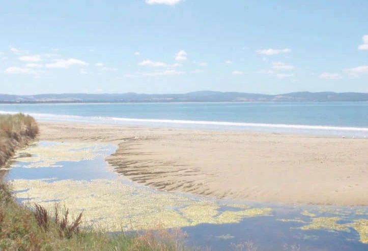
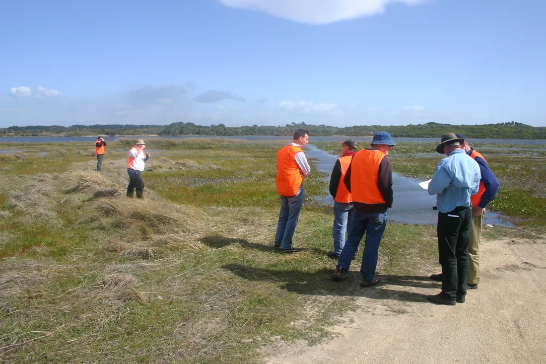
Mouth of Acton Creek, Seven Mile Beach, February 2010. Source: Bill Cromer (2010).
CoastsSeven Mile Beach, Tasmania
Seven Mile Beach flood mitigation
Client Clarence City Council
For Clarence City Council, we modelled how heavy rainfall and rising sea levels could raise the shallow coastal watertable. Bill Cromer’s monitoring helped test the model against observed water levels.
For Clarence City Council, we modelled how heavy rainfall and rising sea levels could raise the shallow coastal watertable. Bill Cromer’s monitoring helped test the model against observed water levels.
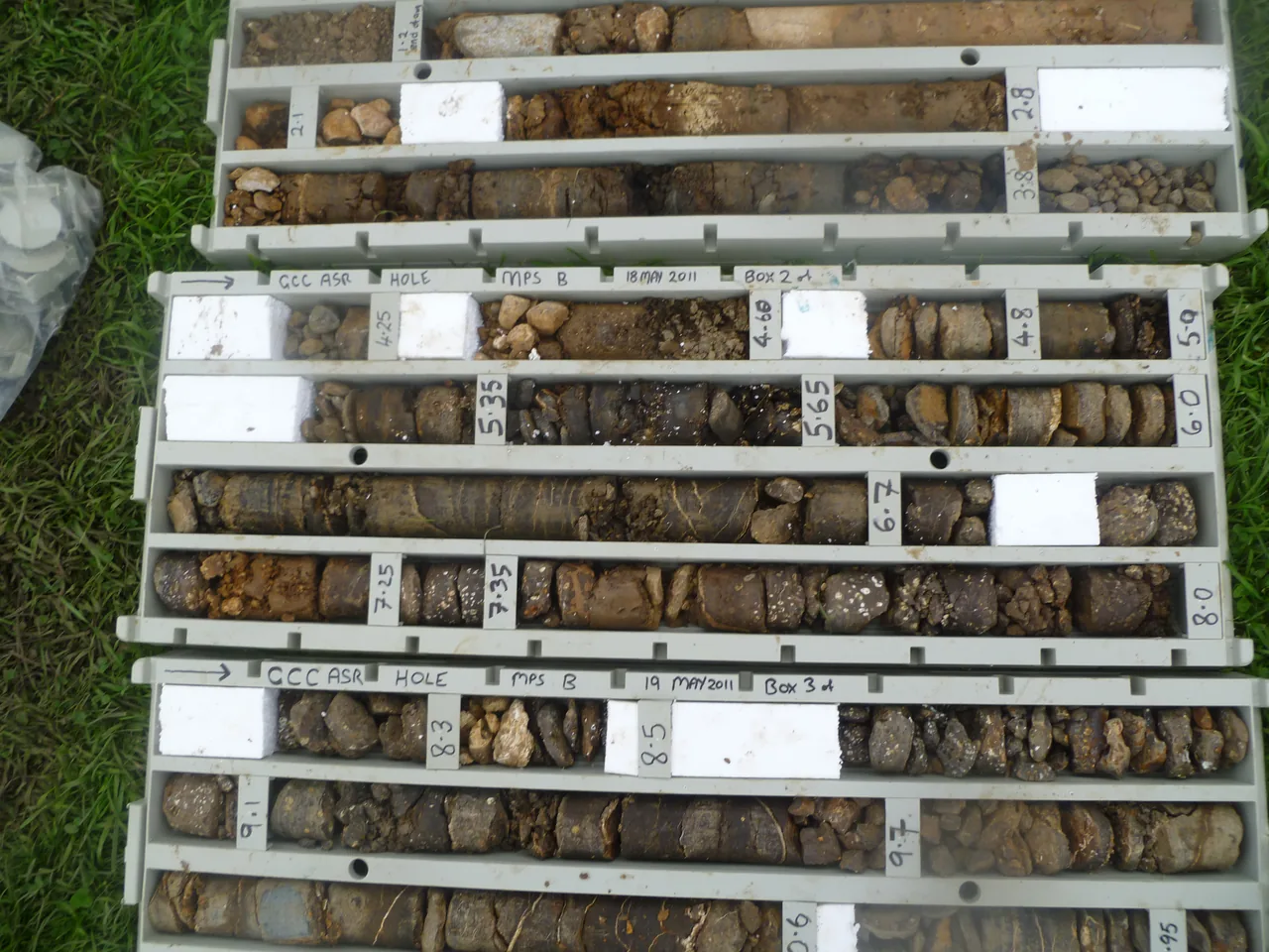
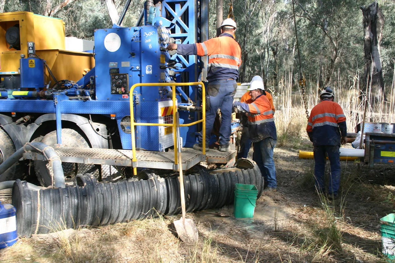
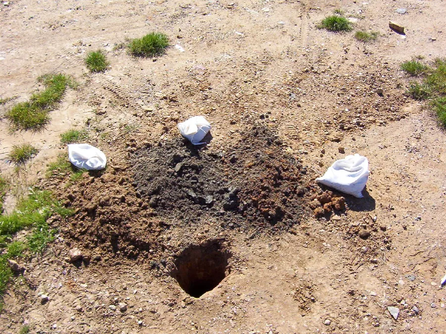
Drilling samples from the Glenorchy aquifer investigation.
Water resourcesMoonah, Tasmania
Glenorchy aquifer storage
Client Glenorchy City Council
Could an aquifer beneath a school oval store stormwater for later use? Drilling and packer tests helped assess how quickly the rock could accept water and what volume it might hold.
Further information about Glenorchy aquifer storage
Project enquiry
Glenorchy aquifer storage
Could an aquifer beneath a school oval store stormwater for later use? Drilling and packer tests helped assess how quickly the rock could accept water and what volume it might hold.
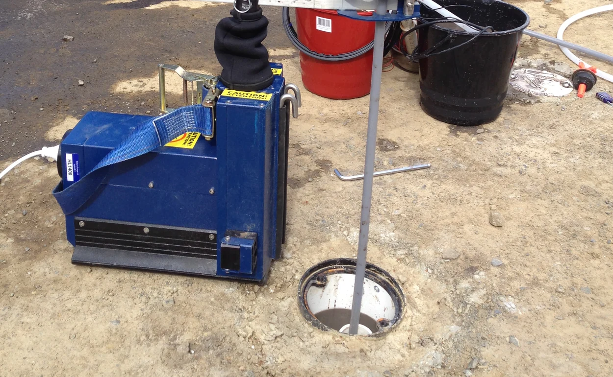
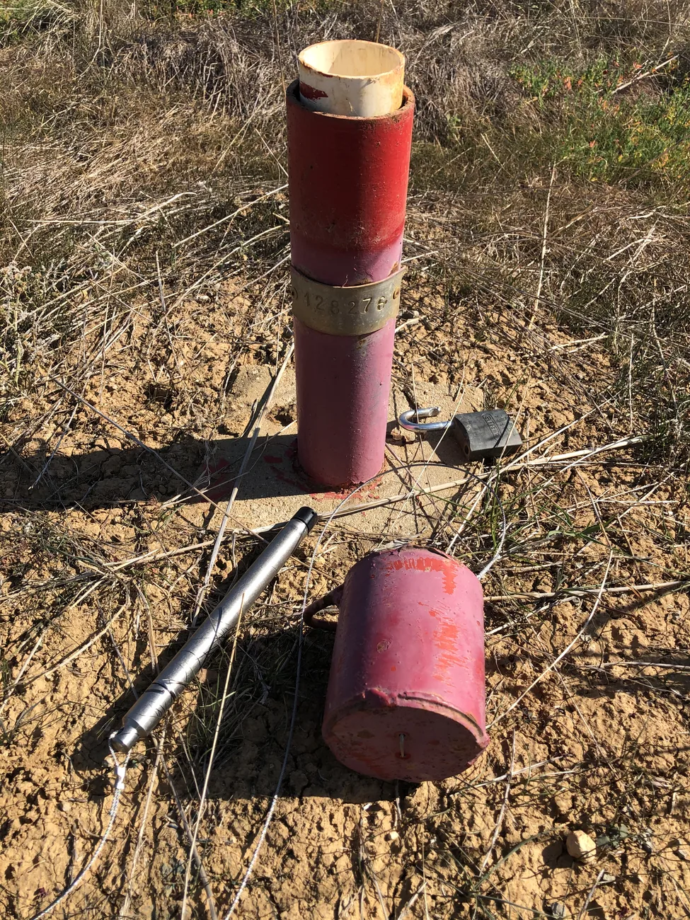
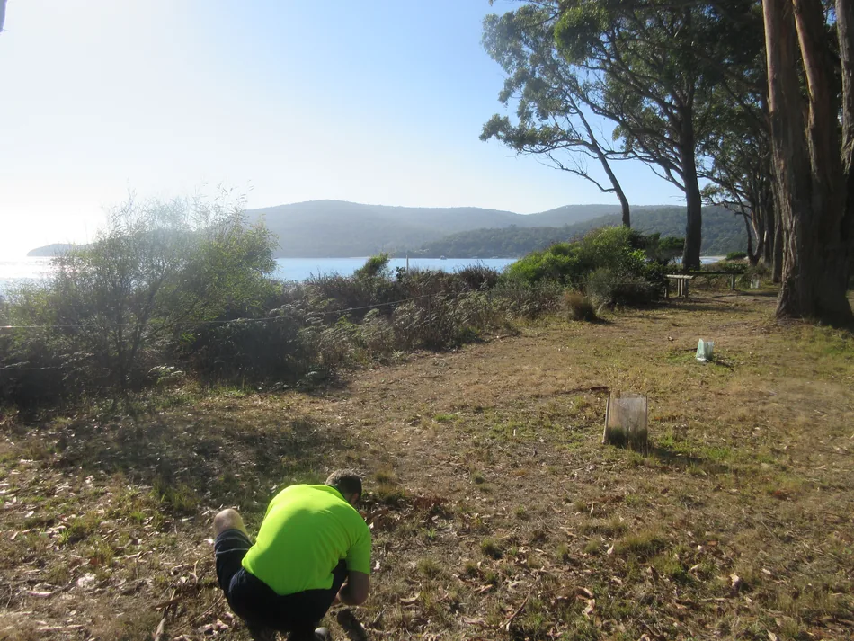
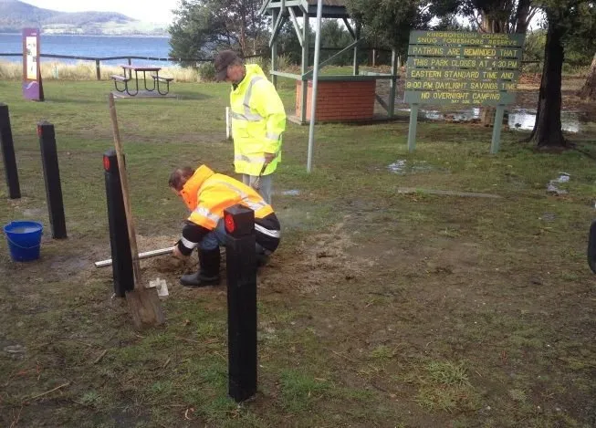
Bore opening, sampling equipment and tubing at Kingston Beach.
CoastsKingston Beach, Tasmania
Kingston Beach sea-level rise
Client Kingborough Council
For Kingborough Council, HGEC assessed how sea-level rise could affect shallow groundwater at Kingston Beach. Monitoring records helped characterise how groundwater levels varied along this urban coast.
Further information about Kingston Beach sea-level rise
Project enquiry
Kingston Beach sea-level rise
For Kingborough Council, HGEC assessed how sea-level rise could affect shallow groundwater at Kingston Beach. Monitoring records helped characterise how groundwater levels varied along this urban coast.
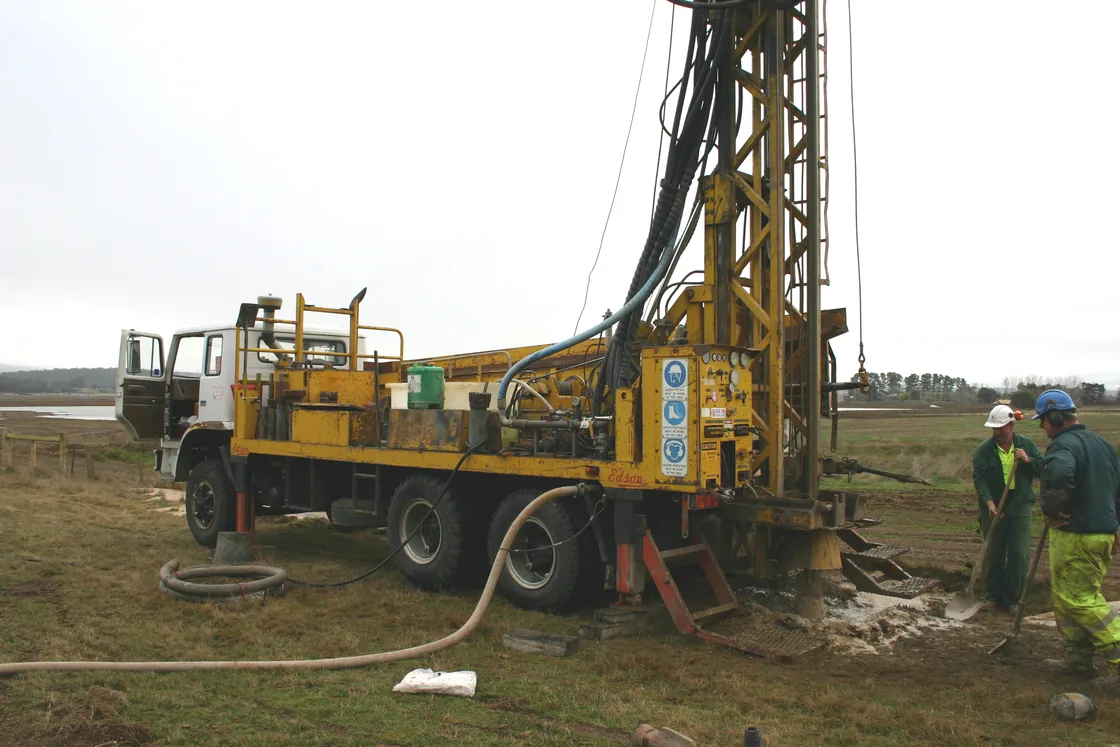
Drilling at the Livingstone prospect.
MiningWestern Tasmania
Livingstone groundwater investigation
Client Venture Minerals
At Venture Minerals’ Livingstone prospect, HGEC contributed numerical groundwater modelling alongside Bill Cromer. The field program included drilling and logging bores to investigate conditions beneath the site.
Further information about Livingstone groundwater investigation
Project enquiry
Livingstone groundwater investigation
At Venture Minerals’ Livingstone prospect, HGEC contributed numerical groundwater modelling alongside Bill Cromer. The field program included drilling and logging bores to investigate conditions beneath the site.
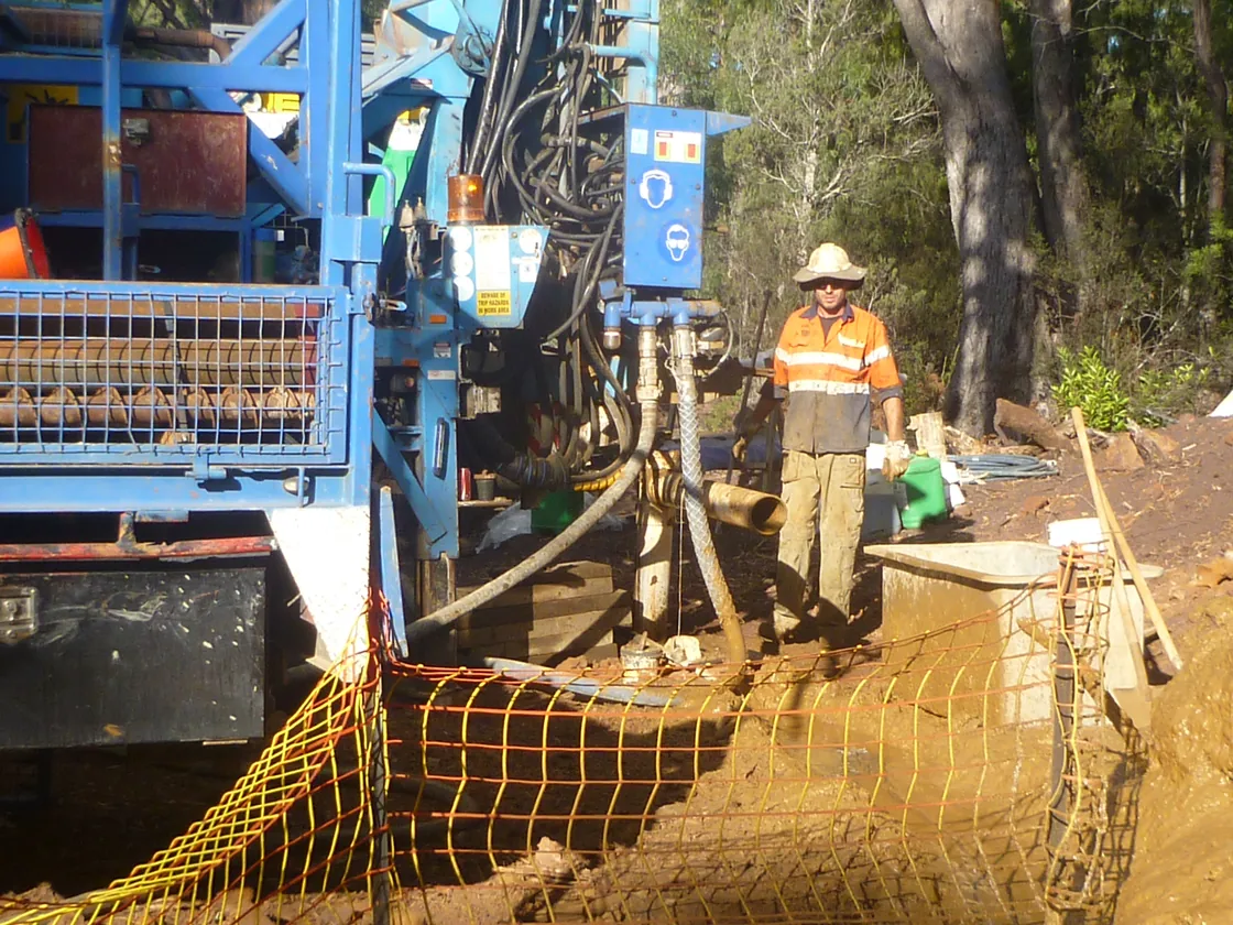
Bore installation at Riley.
MiningWestern Tasmania
Riley groundwater investigation
Client Venture Minerals
HGEC worked with Bill Cromer on numerical groundwater modelling for Venture Minerals’ Riley project. Field records from the bore program document the materials encountered during drilling.
Further information about Riley groundwater investigation
Project enquiry
Riley groundwater investigation
HGEC worked with Bill Cromer on numerical groundwater modelling for Venture Minerals’ Riley project. Field records from the bore program document the materials encountered during drilling.
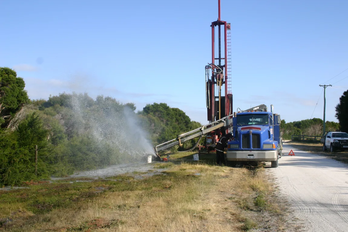
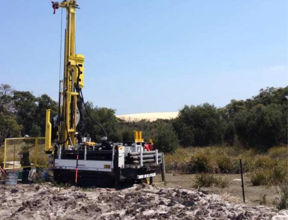
Groundwater drilling on Flinders Island.
Water resourcesFlinders Island, Tasmania
Flinders Island groundwater resources
Client Flinders Council
Which basalt aquifers could supply small-scale irrigation on Flinders Island? For Flinders Council, we combined drilling, groundwater monitoring and modelling to identify suitable areas in the island’s south-east.
Further information about Flinders Island groundwater resources
Project enquiry
Flinders Island groundwater resources
Which basalt aquifers could supply small-scale irrigation on Flinders Island? For Flinders Council, we combined drilling, groundwater monitoring and modelling to identify suitable areas in the island’s south-east.
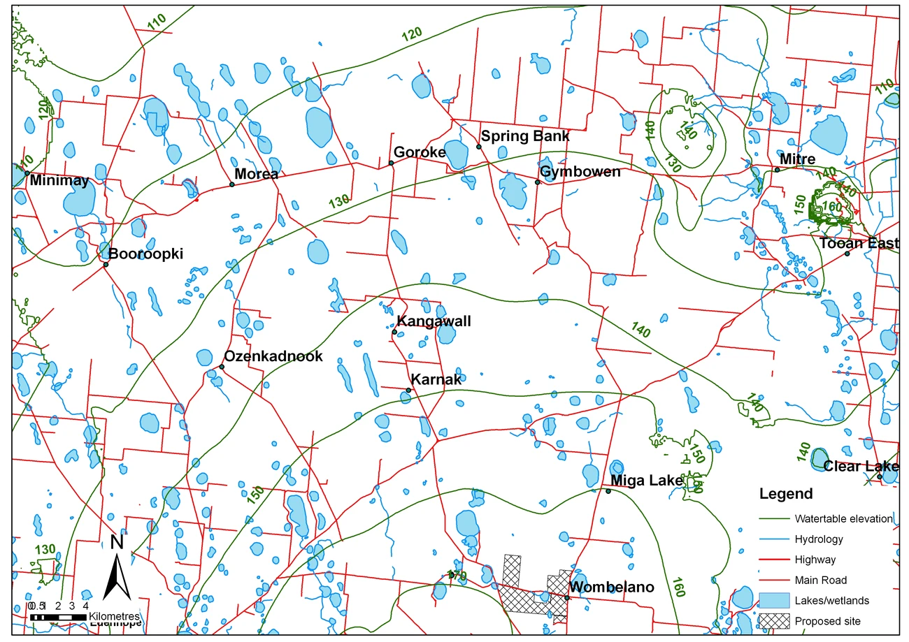
Groundwater contours and wetlands near Wombelano.
Water resourcesWombelano, Victoria
Wombelano groundwater appraisal
Client Private landholder
Groundwater levels, chemistry and bore records helped us trace how water moves through the Wombelano district. The preliminary appraisal identified local patterns of groundwater recharge and discharge.
Further information about Wombelano groundwater appraisal
Project enquiry
Wombelano groundwater appraisal
Groundwater levels, chemistry and bore records helped us trace how water moves through the Wombelano district. The preliminary appraisal identified local patterns of groundwater recharge and discharge.
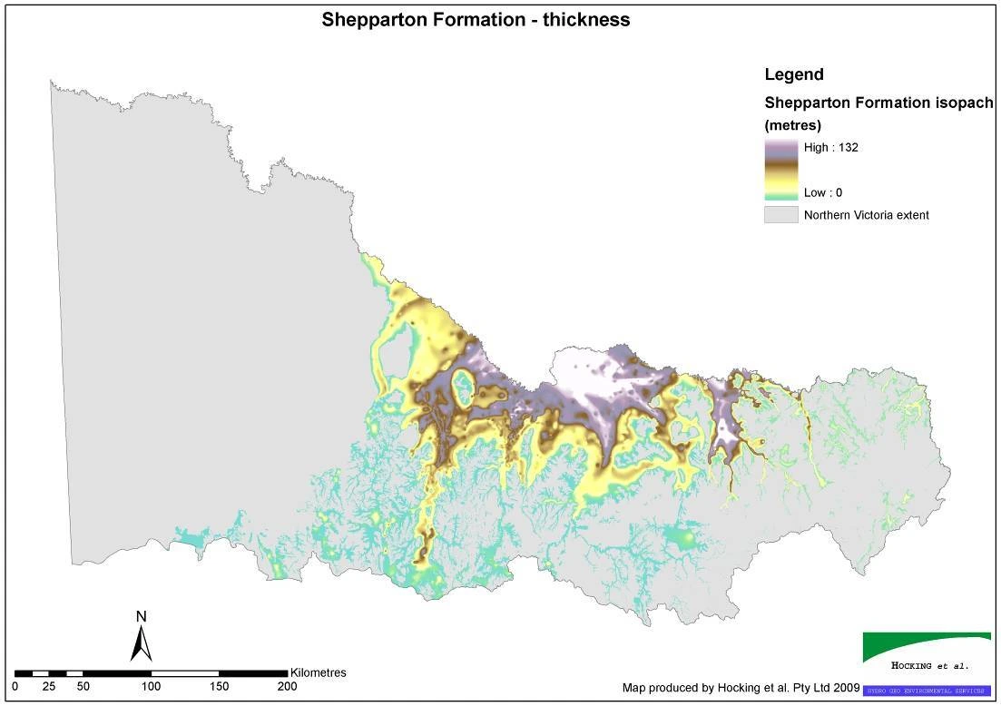
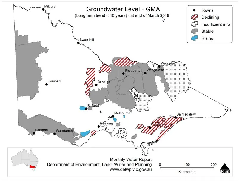
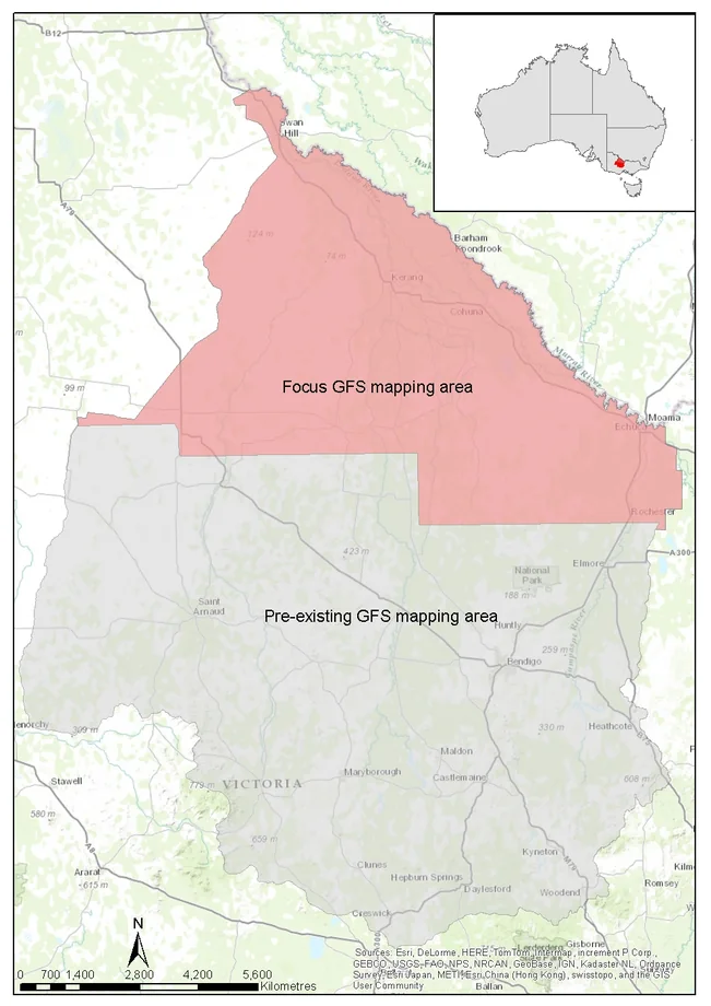
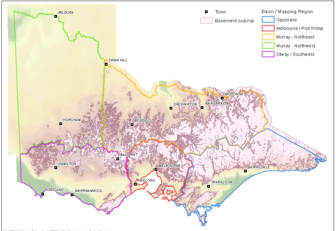
Across 13.6 million hectares of northern Victoria, we brought geological maps together to describe the regional aquifers in three dimensions. This work informed a review of groundwater management boundaries.
Further information about Northern Victoria aquifer framework
Project enquiry
Northern Victoria aquifer framework
Across 13.6 million hectares of northern Victoria, we brought geological maps together to describe the regional aquifers in three dimensions. This work informed a review of groundwater management boundaries.
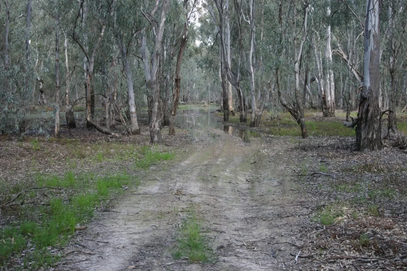
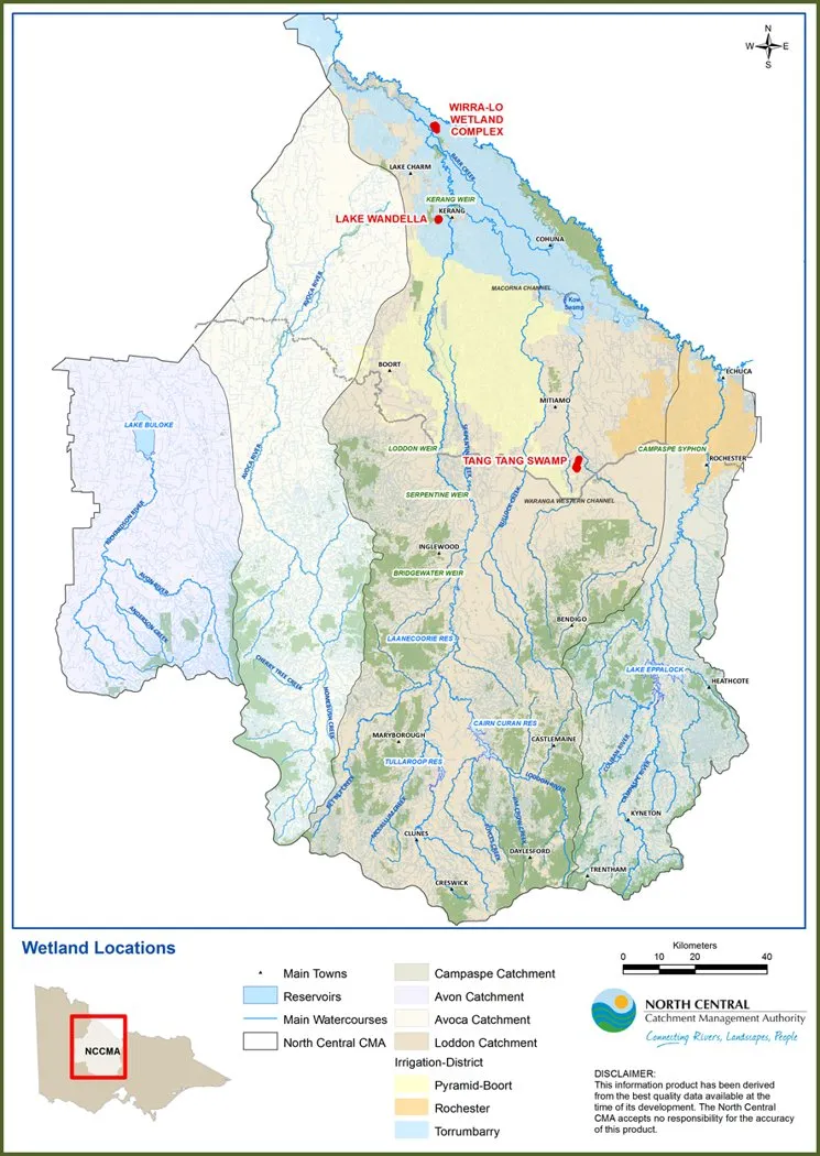
Installing a groundwater logger on Gunbower Island.
Water resourcesGunbower Forest, Victoria
Gunbower Island monitoring
Client North Central Catchment Management Authority
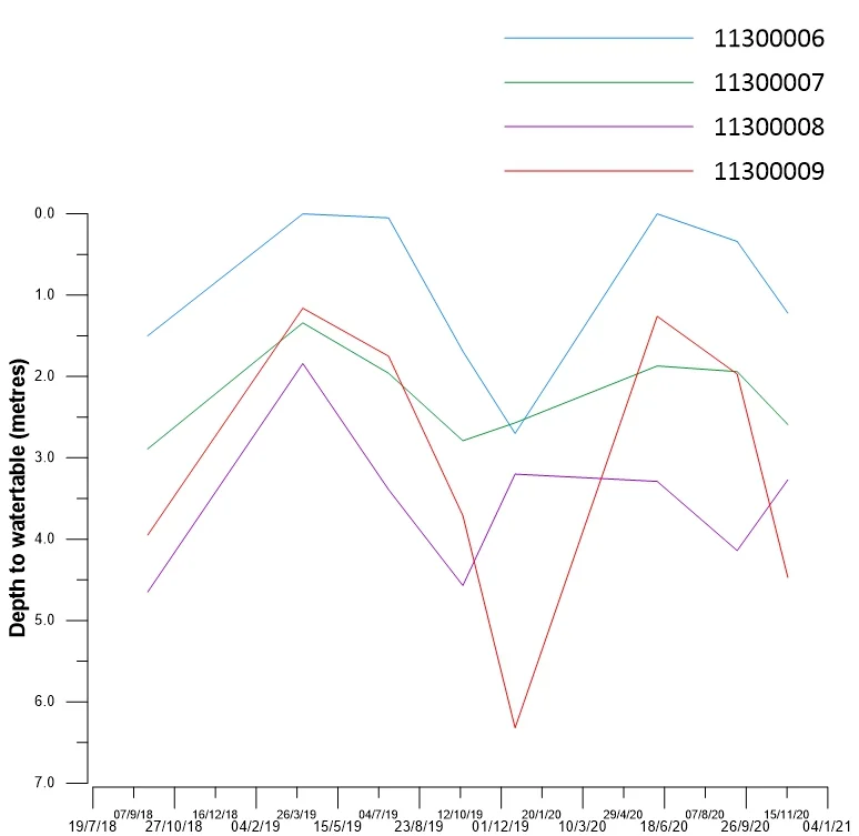
For North Central Catchment Management Authority, HGEC investigated groundwater beneath Gunbower Island. Interpreting monitoring records helped distinguish how forest groundwater responded to natural floods and managed environmental watering.
Further information about Gunbower Island monitoring
Project enquiry
Gunbower Island monitoring
For North Central Catchment Management Authority, HGEC investigated groundwater beneath Gunbower Island. Interpreting monitoring records helped distinguish how forest groundwater responded to natural floods and managed environmental watering.
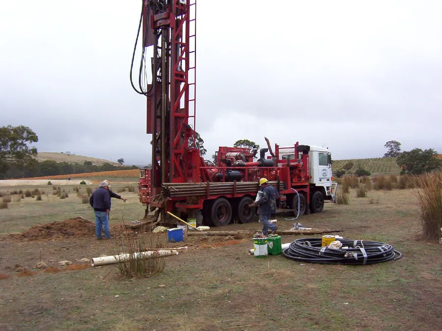
North Central CMA drilling in the Benwell and Guttrum forests.
Water resourcesMurray floodplain, Victoria
Guttrum and Benwell forest monitoring
Client North Central Catchment Management Authority
We investigated groundwater conditions for North Central Catchment Management Authority before managed flooding was introduced. Drilling and water-level monitoring established a baseline for the two Murray River floodplain forests.
Further information about Guttrum and Benwell forest monitoring
Project enquiry
Guttrum and Benwell forest monitoring
We investigated groundwater conditions for North Central Catchment Management Authority before managed flooding was introduced. Drilling and water-level monitoring established a baseline for the two Murray River floodplain forests.
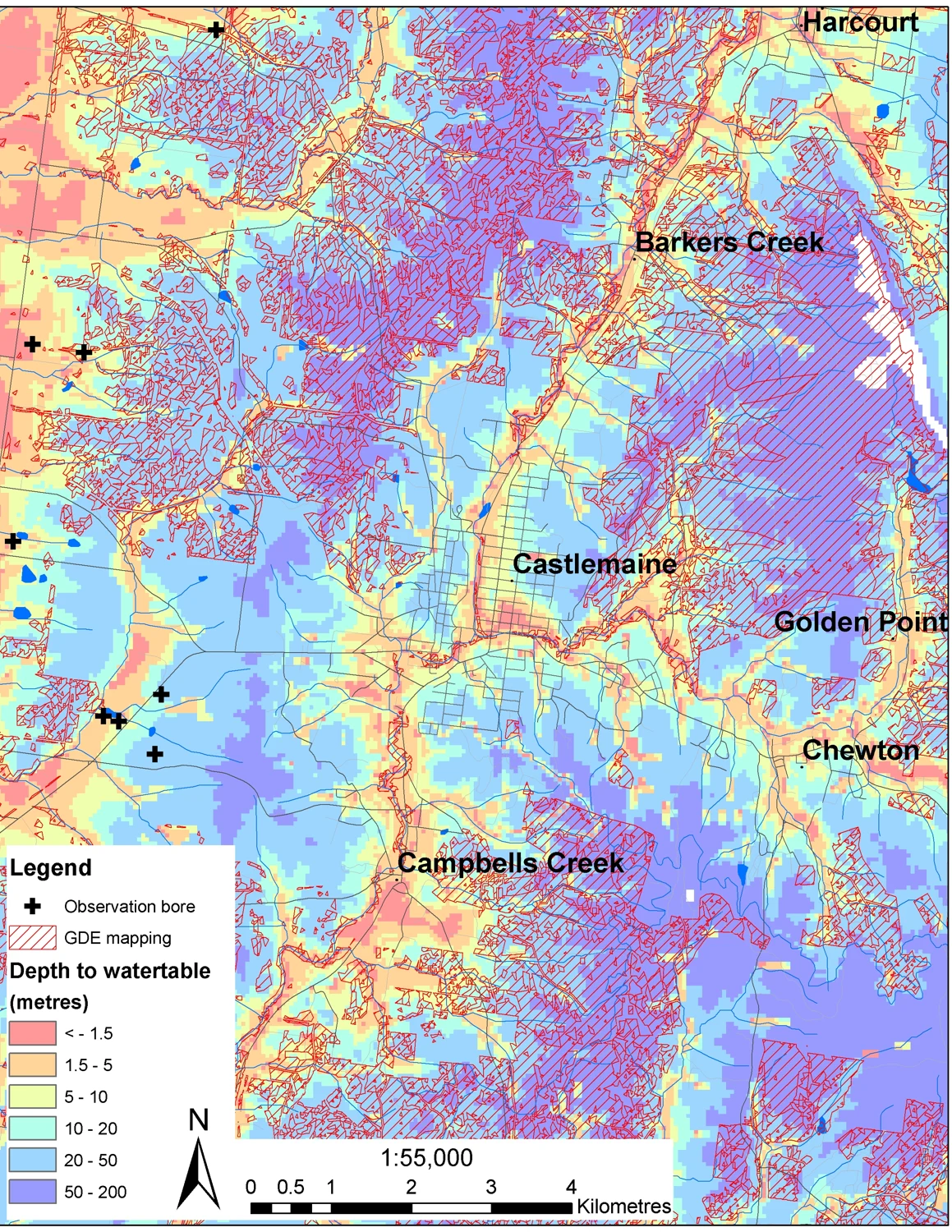
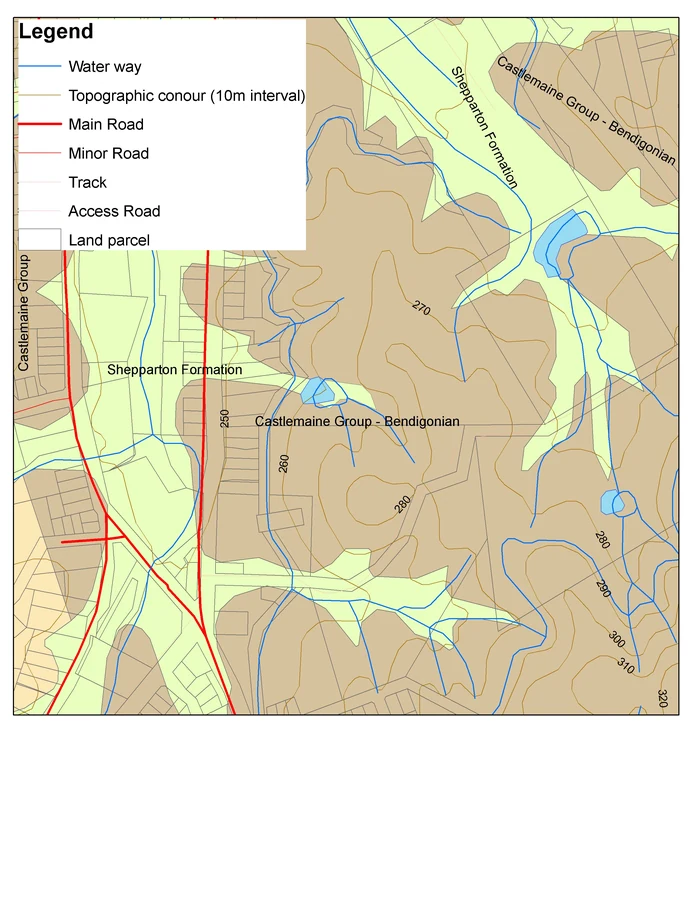
Loddon catchment model output around Castlemaine.
Water resourcesLoddon catchment, Victoria
Loddon groundwater-dependent ecosystems
Research collaboration with the Victorian Department of Primary Industries
With the Victorian Department of Primary Industries, we compared modelled shallow groundwater levels with maps of ecosystems in the Loddon catchment. Our research examined how climate and land use affect those ecosystems’ access to groundwater.
Further information about Loddon groundwater-dependent ecosystems
Project enquiry
Loddon groundwater-dependent ecosystems
With the Victorian Department of Primary Industries, we compared modelled shallow groundwater levels with maps of ecosystems in the Loddon catchment. Our research examined how climate and land use affect those ecosystems’ access to groundwater.
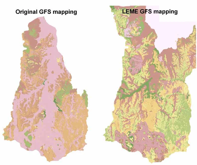
Field survey for the Tasmanian groundwater flow systems mapping program.
SalinityTasmania
Tasmanian groundwater flow systems
Client Tasmanian Department of Primary Industries and Water
For a mapping program covering 14 council areas, HGEC checked groundwater flow systems in the field across southern Tasmania, the north-east and Flinders Island. The maps support local salinity assessment.
Further information about Tasmanian groundwater flow systems
Project enquiry
Tasmanian groundwater flow systems
For a mapping program covering 14 council areas, HGEC checked groundwater flow systems in the field across southern Tasmania, the north-east and Flinders Island. The maps support local salinity assessment.
Groundwater monitoring in the Back Creek catchment.
SalinityNorthern Midlands, Tasmania
Back Creek farm salinity planning
Client NRM North
At Back Creek, we traced groundwater movement between farms and the wider catchment. Drilling, electromagnetic surveys, soil mapping and crop water-use modelling helped explain where salt accumulated and guided local planning.
Further information about Back Creek farm salinity planning
Project enquiry
Back Creek farm salinity planning
At Back Creek, we traced groundwater movement between farms and the wider catchment. Drilling, electromagnetic surveys, soil mapping and crop water-use modelling helped explain where salt accumulated and guided local planning.
St Leonards Sports Complex monitoring site, Launceston.
SalinityLaunceston, Tasmania
Greater Launceston urban salinity
Client Tamar NRM on behalf of NRM North
Across Greater Launceston, we worked with the project team to design an urban salinity monitoring network. The joint report documented the first measurements and explained how planners could use the network.
Further information about Greater Launceston urban salinity
Project enquiry
Greater Launceston urban salinity
Across Greater Launceston, we worked with the project team to design an urban salinity monitoring network. The joint report documented the first measurements and explained how planners could use the network.
Upper Wimmera landscape, from the catchment authority salt-load trading project.
SalinityUpper Wimmera, Victoria
Upper Wimmera salt-load modelling
Client Wimmera Catchment Management Authority
Which revegetation options would do most to reduce stream salinity? By linking groundwater and farm models, we helped the Wimmera Catchment Management Authority rank land management proposals in the Upper Wimmera.
Further information about Upper Wimmera salt-load modelling
Project enquiry
Upper Wimmera salt-load modelling
Which revegetation options would do most to reduce stream salinity? By linking groundwater and farm models, we helped the Wimmera Catchment Management Authority rank land management proposals in the Upper Wimmera.
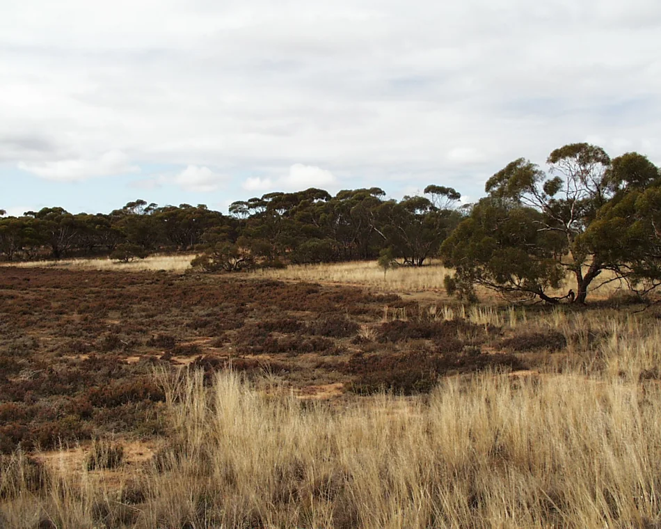
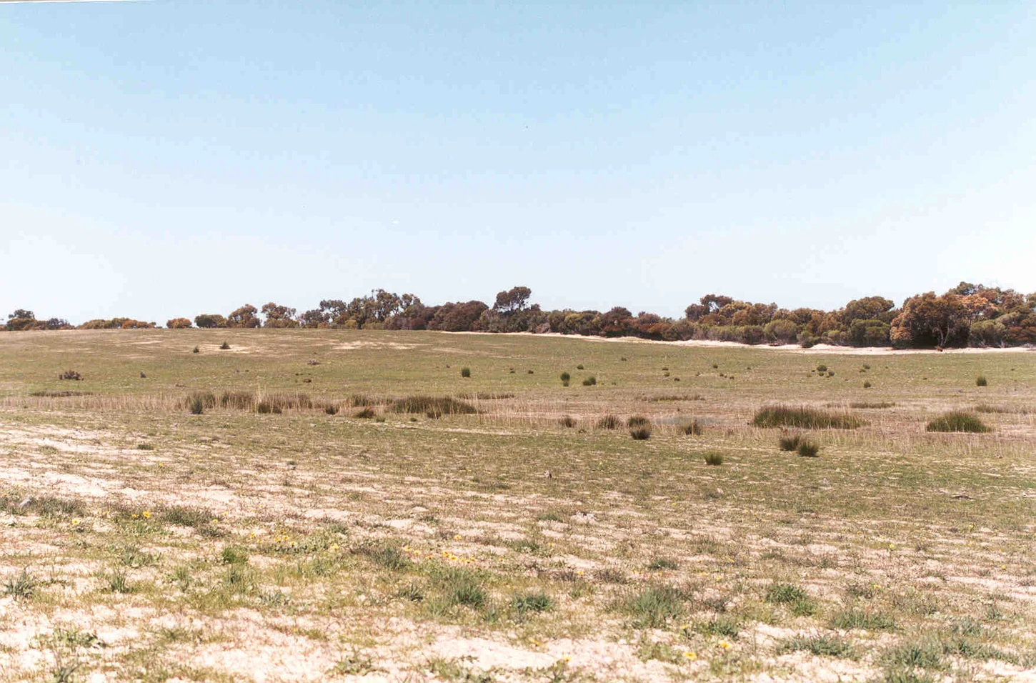
Saltpan at Hattah in the Victorian Mallee. Regional landscape.
SalinityVictorian Mallee
Mallee dryland water balance
Client Wimmera Mallee Water on behalf of Mallee Catchment Management Authority
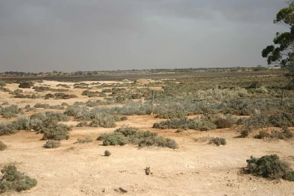
Across the Mallee, we worked with another hydrogeologist to compare groundwater discharge with evaporation. The regional model helped explain why higher recharge might cause only a small increase in the area affected by dryland salinity.
Across the Mallee, we worked with another hydrogeologist to compare groundwater discharge with evaporation. The regional model helped explain why higher recharge might cause only a small increase in the area affected by dryland salinity.
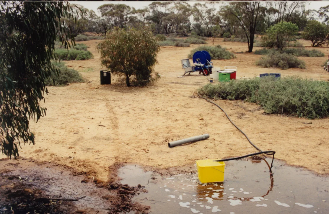
Pumping trial at Ouyen.
SalinityOuyen, Victoria
Ouyen watertable feasibility study
Client Ouyen Inc.
At Ouyen, our modelling showed that draining saline land would have little effect on the regional watertable. Pumping groundwater offered a more effective way to lower it.
Further information about Ouyen watertable feasibility study
Project enquiry
Ouyen watertable feasibility study
At Ouyen, our modelling showed that draining saline land would have little effect on the regional watertable. Pumping groundwater offered a more effective way to lower it.
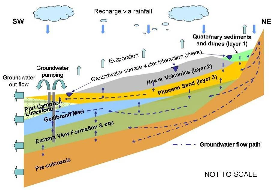
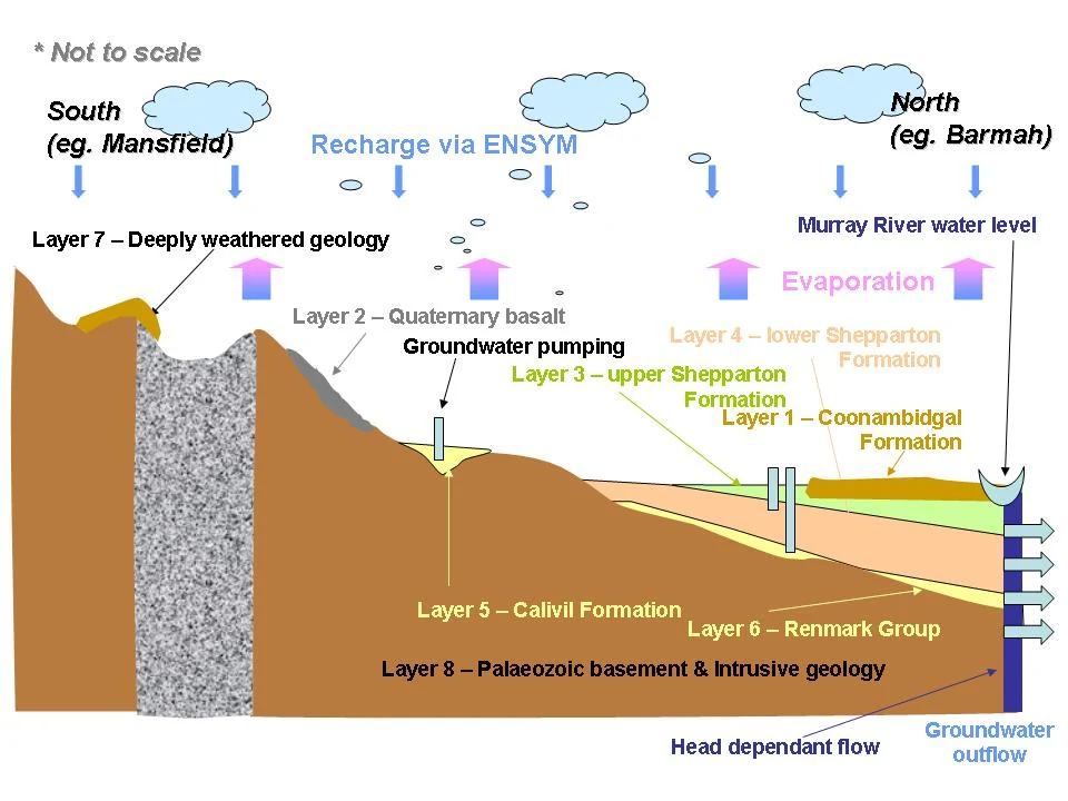
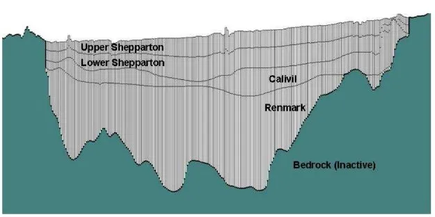
Conceptual section through the Corangamite aquifers.
Water resourcesCorangamite, Victoria
Corangamite catchment water balance
Client Victorian Government
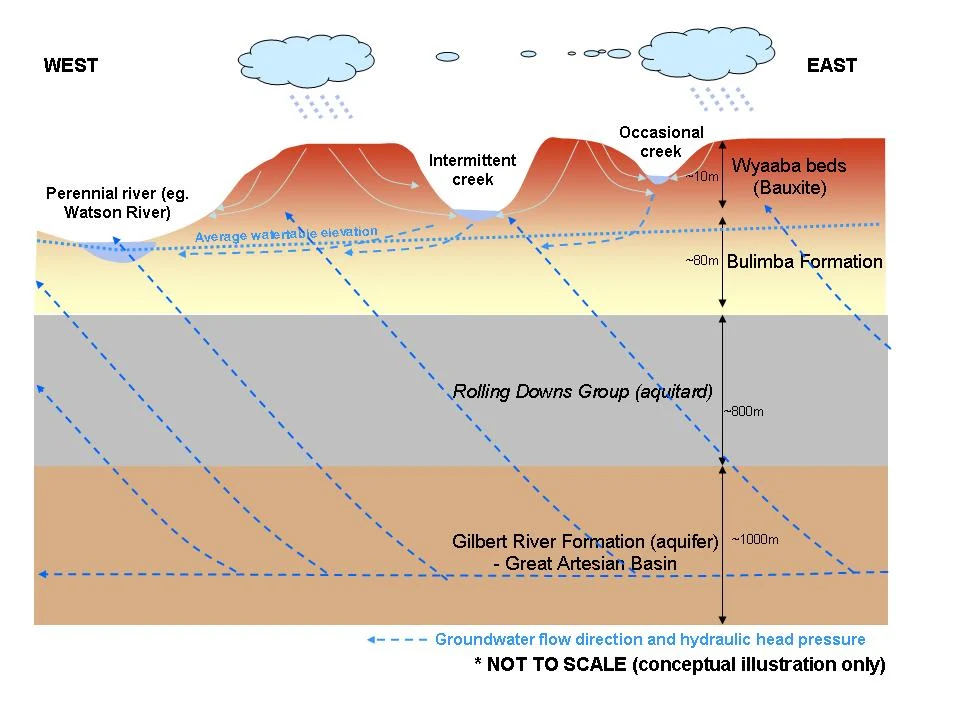
Corangamite served as the pilot region for a statewide modelling program. We calculated its annual water balance, bringing rainfall, runoff and groundwater into a single regional assessment.
Further information about Corangamite catchment water balance
Project enquiry
Corangamite catchment water balance
Corangamite served as the pilot region for a statewide modelling program. We calculated its annual water balance, bringing rainfall, runoff and groundwater into a single regional assessment.
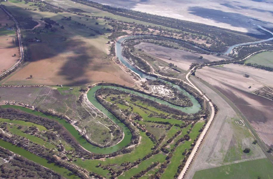
Wimmera River at Jeparit, looking towards Lake Hindmarsh. Photograph by Mark Hocking (2005).
SalinityWimmera, Victoria
Wimmera salinity monitoring review
Client Wimmera Catchment Management Authority
How well did the Wimmera’s monitoring network capture regional salinity trends? We combined salinity records across the catchment, identified gaps in coverage and reviewed the contribution of community monitoring.
Further information about Wimmera salinity monitoring review
Project enquiry
Wimmera salinity monitoring review
How well did the Wimmera’s monitoring network capture regional salinity trends? We combined salinity records across the catchment, identified gaps in coverage and reviewed the contribution of community monitoring.
Field photograph from the Tasmanian regional salinity audit.
SalinityTasmania
Tasmanian regional salinity audit
Client NRM North
A common database brought together groundwater and salinity records from Tasmania’s National Action Plan region. We used it to identify gaps in monitoring coverage and priorities for improving data quality.
Further information about Tasmanian regional salinity audit
Project enquiry
Tasmanian regional salinity audit
A common database brought together groundwater and salinity records from Tasmania’s National Action Plan region. We used it to identify gaps in monitoring coverage and priorities for improving data quality.
Northern Midlands groundwater flow systems field survey.
SalinityNorthern Midlands, Tasmania
Northern Midlands flow system mapping
Client Northern Midlands Council
We worked with local government and technical specialists to map groundwater flow systems at a scale of 1:100,000. Drilling and community consultation helped relate groundwater movement to salinity in the Northern Midlands.
Further information about Northern Midlands flow system mapping
Project enquiry
Northern Midlands flow system mapping
We worked with local government and technical specialists to map groundwater flow systems at a scale of 1:100,000. Drilling and community consultation helped relate groundwater movement to salinity in the Northern Midlands.
Southern Midlands groundwater flow systems field survey.
SalinitySouthern Midlands, Tasmania
Southern Midlands flow system mapping
Client Southern Midlands Council
Drilling and mapping helped identify the groundwater processes behind salinity in the Southern Midlands and parts of Clarence. We worked with council and technical specialists to produce maps for local salinity planning.
Further information about Southern Midlands flow system mapping
Project enquiry
Southern Midlands flow system mapping
Drilling and mapping helped identify the groundwater processes behind salinity in the Southern Midlands and parts of Clarence. We worked with council and technical specialists to produce maps for local salinity planning.
Farmland photographed for the Tasmanian landscape salinity assessment.
SalinityTasmania
Irrigation and landscape salinity
Client NRM North
At four field transects, we combined drilling, soil testing and electromagnetic surveys to investigate salinity. Groundwater modelling identified landscapes where irrigation could raise water levels and where monitoring should be prioritised.
Further information about Irrigation and landscape salinity
Project enquiry
Irrigation and landscape salinity
At four field transects, we combined drilling, soil testing and electromagnetic surveys to investigate salinity. Groundwater modelling identified landscapes where irrigation could raise water levels and where monitoring should be prioritised.
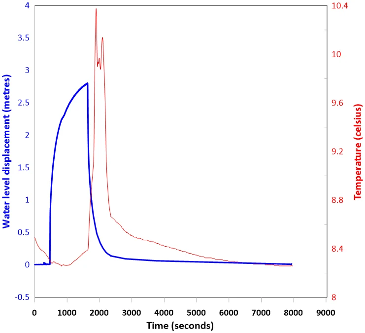
Groundwater level and temperature recorded during a bore pumping test at St Patricks Plains.
InfrastructureCentral Highlands, Tasmania
St Patricks Plains Wind Farm
Client Arc Energy
For the proposed St Patricks Plains Wind Farm, HGEC worked with Bill Cromer and a consulting geologist on the hydrogeological assessment. We tested and sampled groundwater and conceptualised groundwater processes.
Further information about St Patricks Plains Wind Farm
Project enquiry
St Patricks Plains Wind Farm
For the proposed St Patricks Plains Wind Farm, HGEC worked with Bill Cromer and a consulting geologist on the hydrogeological assessment. We tested and sampled groundwater and conceptualised groundwater processes.
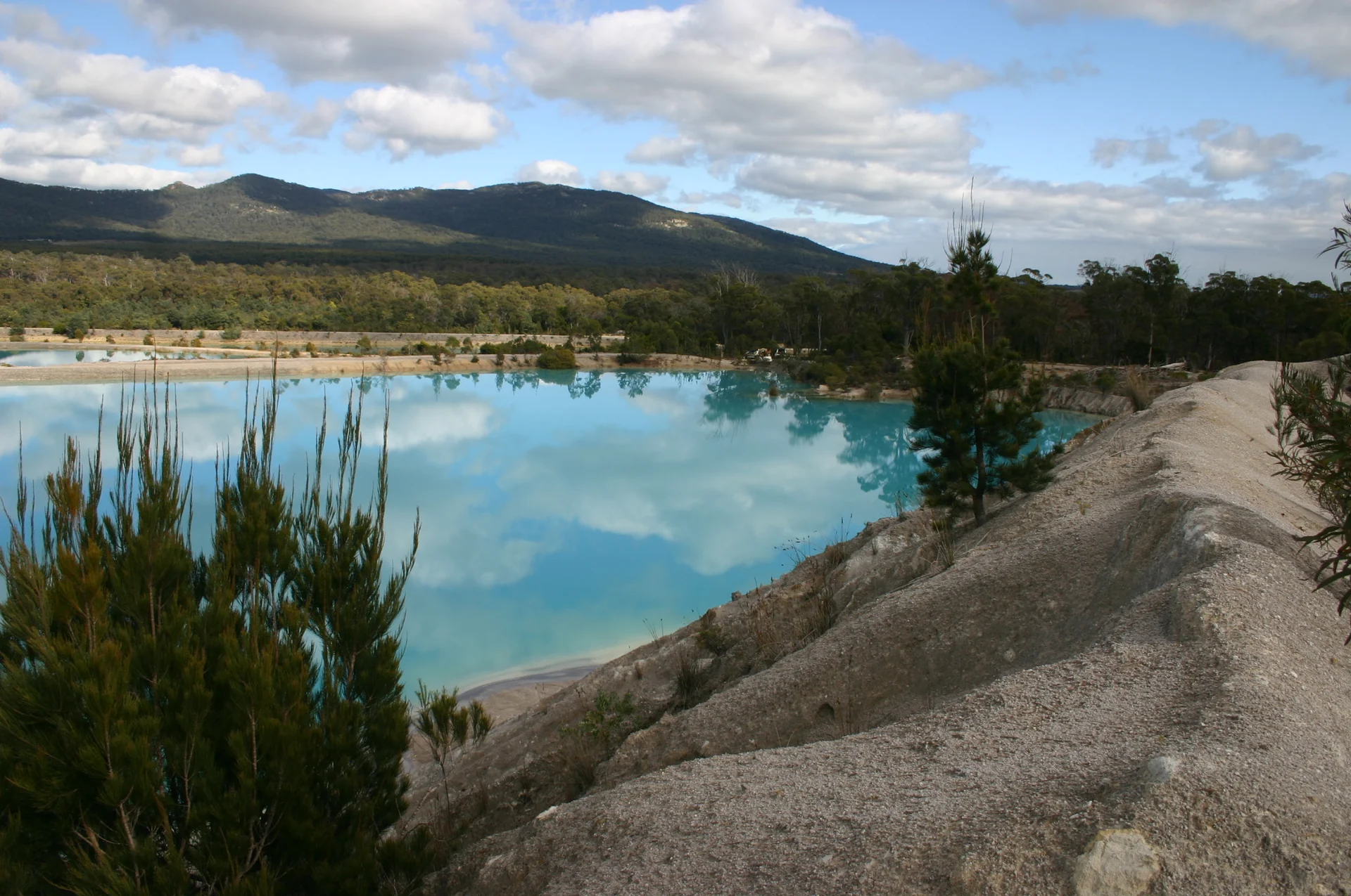
Former Scotia tin mine, north-east Tasmania.
MiningNorth-east Tasmania
Scotia mine bore testing
Client Mineral Resources Tasmania
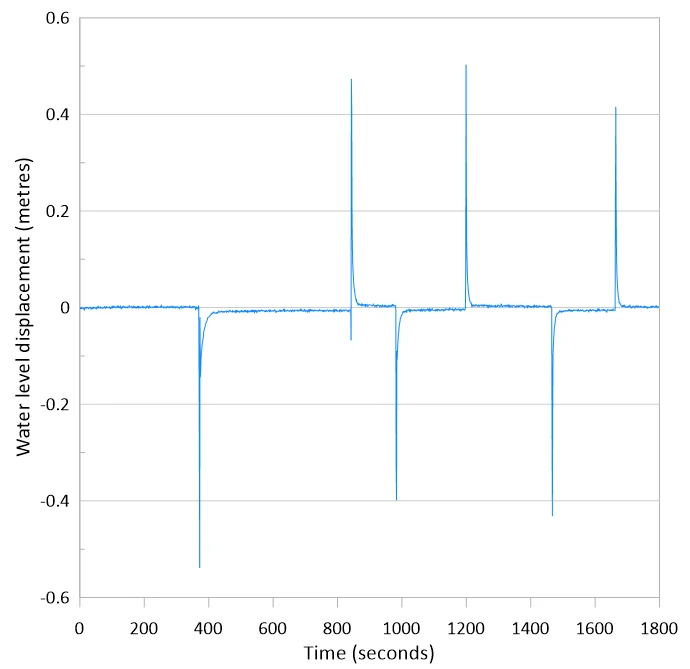
HGEC carried out slug tests in groundwater monitoring bores at the former Scotia tin mine for Mineral Resources Tasmania. The tests measured how readily water could move through materials surrounding each bore.
Further information about Scotia mine bore testing
Project enquiry
Scotia mine bore testing
HGEC carried out slug tests in groundwater monitoring bores at the former Scotia tin mine for Mineral Resources Tasmania. The tests measured how readily water could move through materials surrounding each bore.
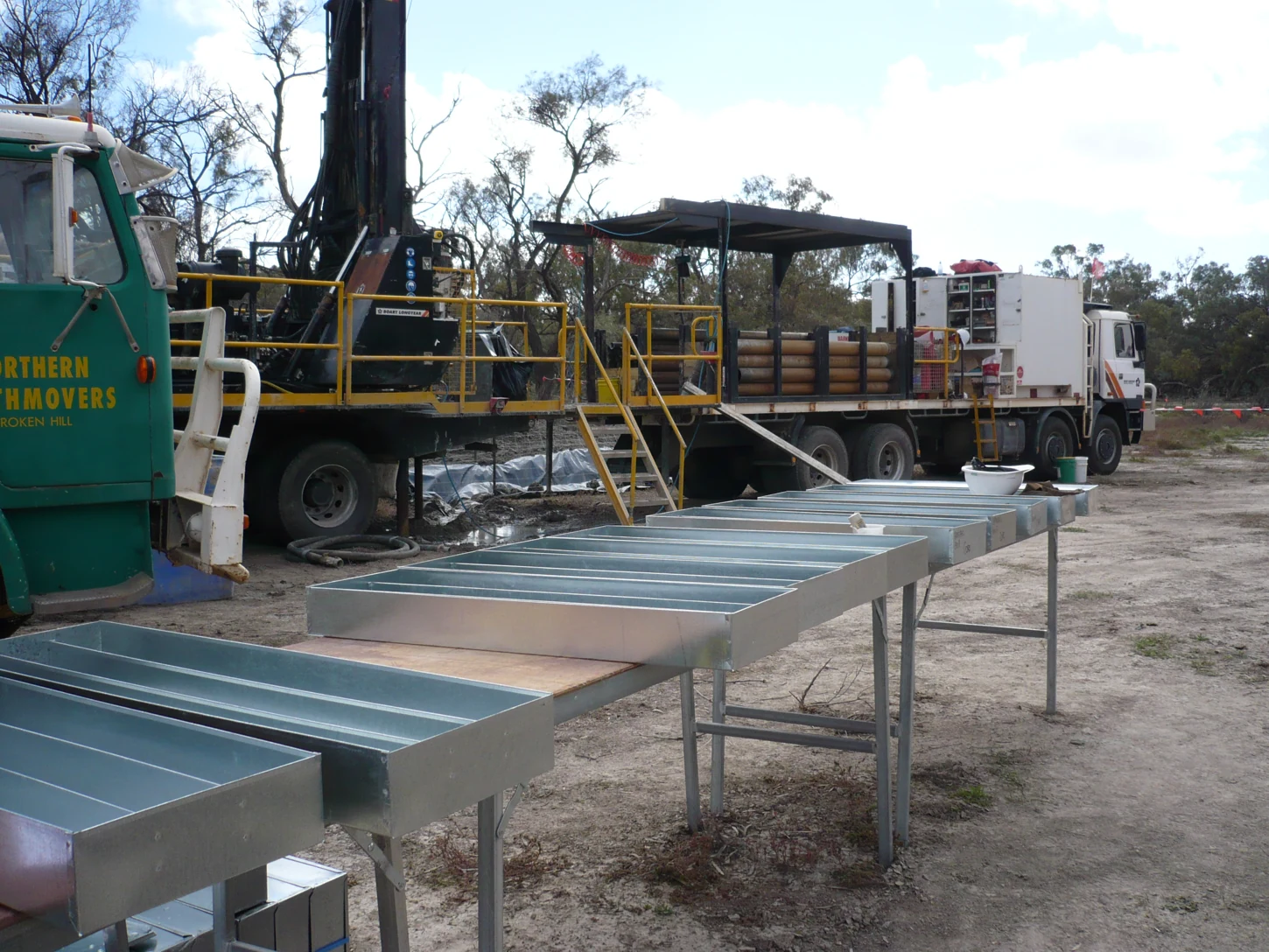
Drilling equipment during the Menindee aquifer investigation.
Water resourcesMenindee, New South Wales
Menindee aquifer storage
Client Geoscience Australia
For Geoscience Australia’s investigation into drought supplies for Broken Hill, HGEC supported field supervision, groundwater sampling, bore logging and long-duration pumping tests near the Menindee Lakes.
Further information about Menindee aquifer storage
Project enquiry
Menindee aquifer storage
For Geoscience Australia’s investigation into drought supplies for Broken Hill, HGEC supported field supervision, groundwater sampling, bore logging and long-duration pumping tests near the Menindee Lakes.
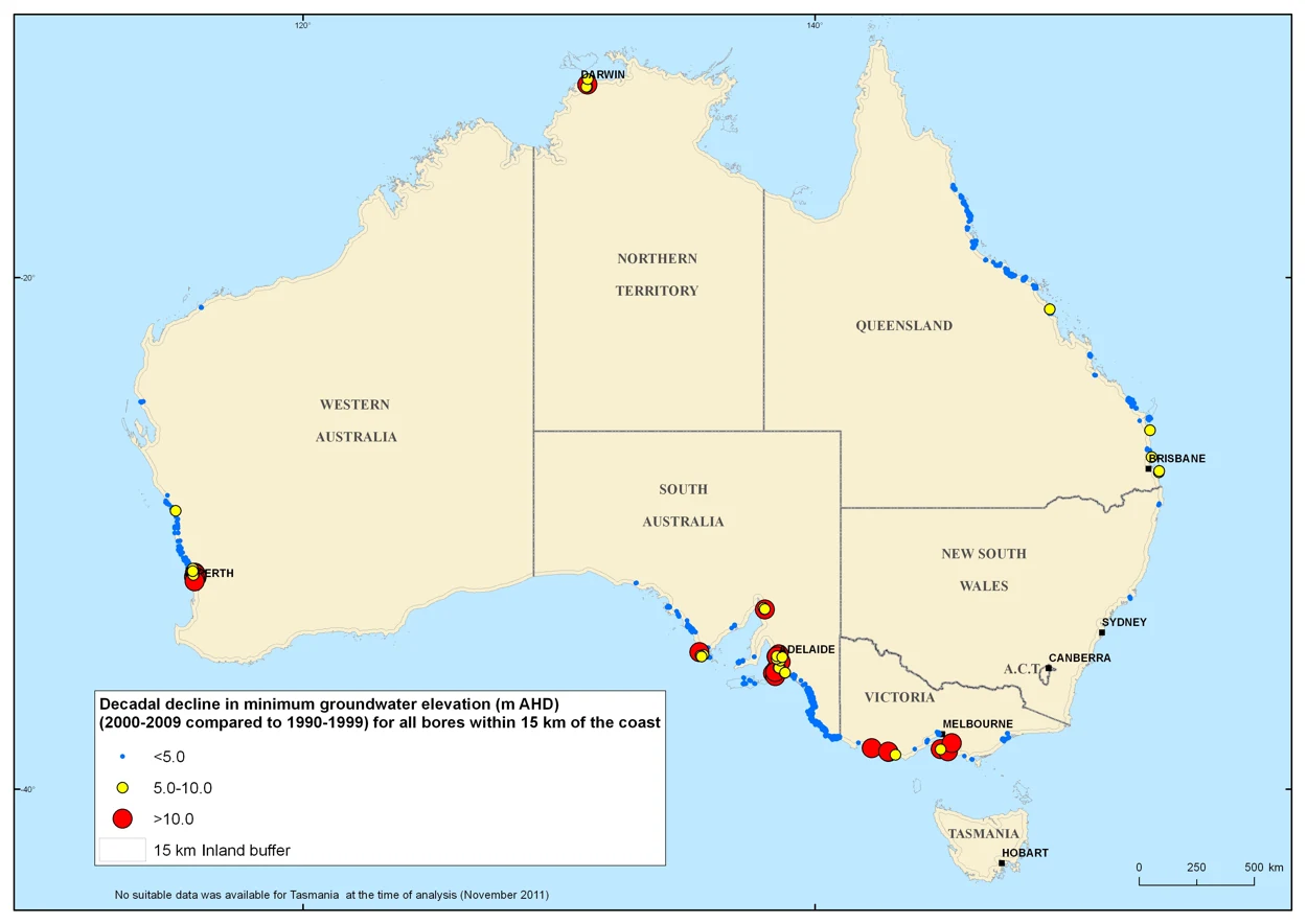
National map of interdecadal changes in groundwater elevation used in the coastal aquifer assessment.
CoastsAustralia
Australian coastal aquifer assessment
Client Geoscience Australia
HGEC reviewed and mapped indicators of seawater intrusion around the Australian coast for Geoscience Australia. The work contributed to a national assessment of the vulnerability of coastal groundwater resources.
Further information about Australian coastal aquifer assessment
Project enquiry
Australian coastal aquifer assessment
HGEC reviewed and mapped indicators of seawater intrusion around the Australian coast for Geoscience Australia. The work contributed to a national assessment of the vulnerability of coastal groundwater resources.
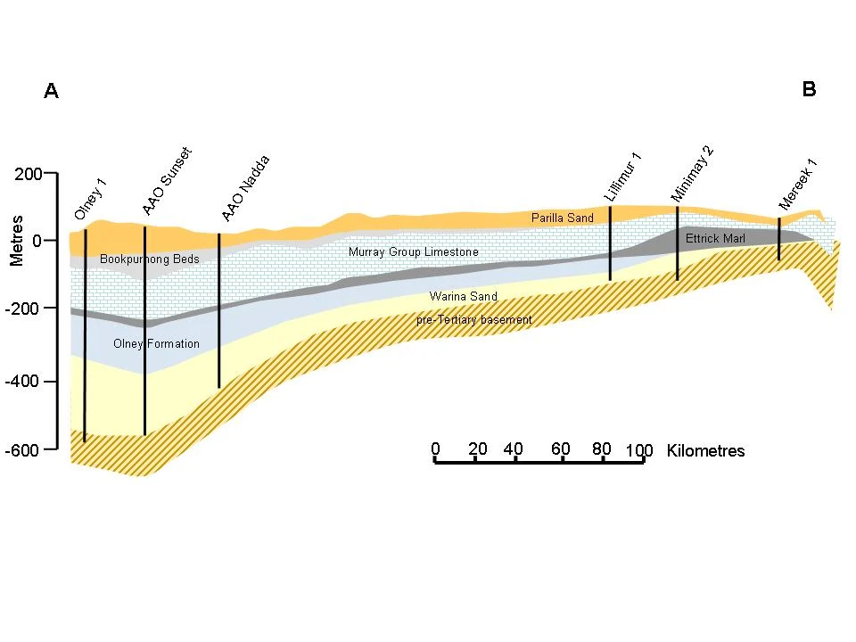
Geological transect used in the Wimmera groundwater model.
Water resourcesWimmera, Victoria
Wimmera catchment groundwater model
Client Victorian Government
For Victoria’s ecoTender program, we modelled how changes in land use could affect shallow watertables and the groundwater reaching streams in the Wimmera. This supported regional assessment of land management proposals.
Further information about Wimmera catchment groundwater model
Project enquiry
Wimmera catchment groundwater model
For Victoria’s ecoTender program, we modelled how changes in land use could affect shallow watertables and the groundwater reaching streams in the Wimmera. This supported regional assessment of land management proposals.
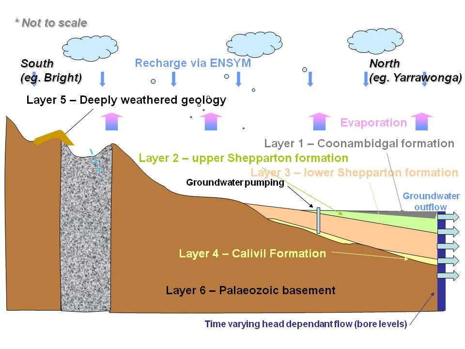
Conceptual cross-section used in the Goulburn Broken regional groundwater model.
Water resourcesGoulburn Broken, Victoria
Goulburn Broken catchment groundwater model
Client Victorian Government
HGEC modelled groundwater over time for Victoria’s ecoTender program. The study compared how changes in land management might affect baseflow to streams and the extent of shallow groundwater.
Further information about Goulburn Broken catchment groundwater model
Project enquiry
Goulburn Broken catchment groundwater model
HGEC modelled groundwater over time for Victoria’s ecoTender program. The study compared how changes in land management might affect baseflow to streams and the extent of shallow groundwater.
Conceptual cross-section used in the north-east Victoria groundwater model.
Water resourcesNorth-east Victoria
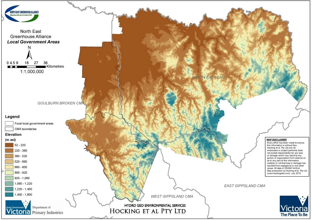
North East catchment water balance
Client Victorian Government
HGEC developed a regional groundwater model linking land use to recharge, shallow watertables and stream baseflow. It gave the state’s ecoTender program a way to compare proposed land management changes.
Further information about North East catchment water balance
Project enquiry
North East catchment water balance
HGEC developed a regional groundwater model linking land use to recharge, shallow watertables and stream baseflow. It gave the state’s ecoTender program a way to compare proposed land management changes.
Survey equipment at a long-term salinity monitoring field site in Tasmania.
SalinityTasmania
Long-term Tasmanian salinity monitoring
Client NRM North
Five Tasmanian sites needed salinity records that would remain comparable across funding cycles. Our monitoring design set out how to collect consistent observations at each site within the National Action Plan region.
Further information about Long-term Tasmanian salinity monitoring
Project enquiry
Long-term Tasmanian salinity monitoring
Five Tasmanian sites needed salinity records that would remain comparable across funding cycles. Our monitoring design set out how to collect consistent observations at each site within the National Action Plan region.
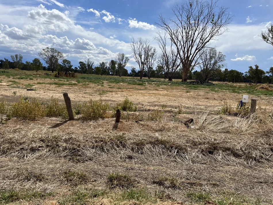
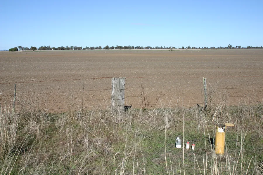
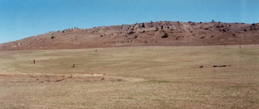
Dry ground and scattered trees on the Gannawarra site.
AdvisoryGannawarra, Victoria
Gannawarra piggery hydrological review
Client Gannawarra VCAT objection group
A proposed piggery raised questions about how water moved across the site. HGEC reviewed the hydrology and prepared an independent expert report and supplementary evidence for the planning matter.
Further information about Gannawarra piggery hydrological review
Project enquiry
Gannawarra piggery hydrological review
A proposed piggery raised questions about how water moved across the site. HGEC reviewed the hydrology and prepared an independent expert report and supplementary evidence for the planning matter.
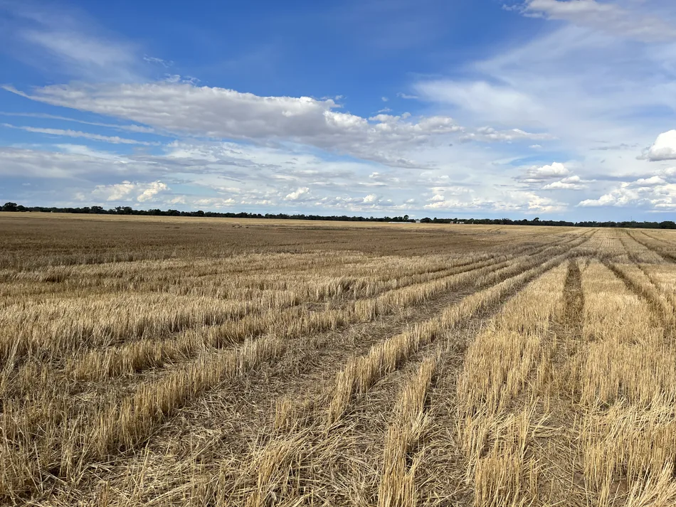
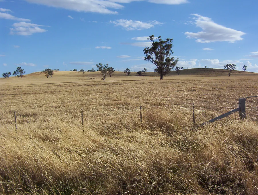
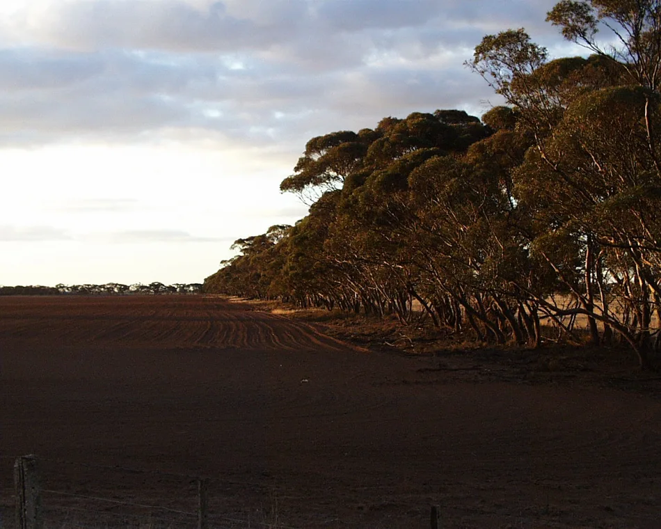
Stubble rows on farmland near Serpentine.
Water resourcesSerpentine, Victoria
Serpentine wetland assessment
Client Farm landholder
Near Serpentine, three depressions drained within three weeks of flooding. DEECA agreed in writing to exclude the assessed areas in March 2023. Our Victorian mapped wetland guide explains the hydrological evidence relevant to the DEECA guideline.
Near Serpentine, three depressions drained within three weeks of flooding. DEECA agreed in writing to exclude the assessed areas in March 2023. Our Victorian mapped wetland guide explains the hydrological evidence relevant to the DEECA guideline.
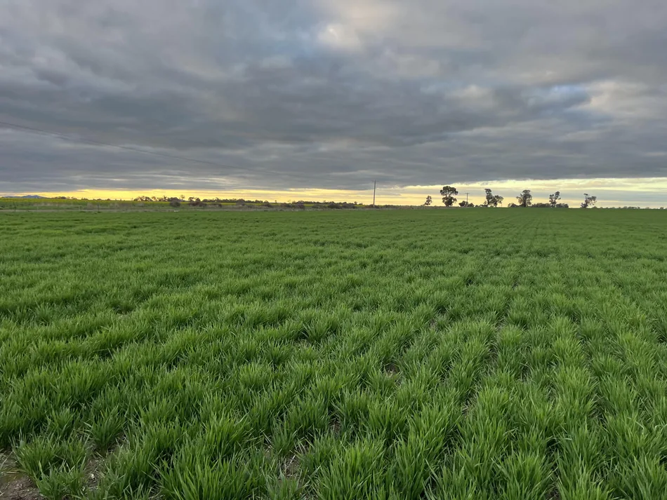
A green crop beneath cloud cover at Carisbrook.
Water resourcesCarisbrook, Victoria
Carisbrook wetland assessment
Client Private landholder
The Carisbrook assessment examined soils, slope and a roadside drain to estimate how long water could pond. Our Victorian mapped wetland guide explains how that evidence informs a request under the DEECA guideline.
Further information about Carisbrook wetland assessment
Project enquiry
Carisbrook wetland assessment
The Carisbrook assessment examined soils, slope and a roadside drain to estimate how long water could pond. Our Victorian mapped wetland guide explains how that evidence informs a request under the DEECA guideline.
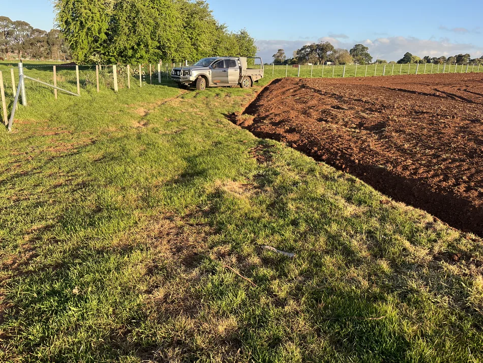
Fenced farmland and a cultivated paddock at the Newlyn site.
Water resourcesNewlyn, Victoria
Newlyn wetland assessment
Client Farm landholder
At Newlyn, the assessment examined soils, land slope and drainage near the farm boundary. The Victorian mapped wetland guide explains why the capacity to retain water matters under the DEECA guideline.
Further information about Newlyn wetland assessment
Project enquiry
Newlyn wetland assessment
At Newlyn, the assessment examined soils, land slope and drainage near the farm boundary. The Victorian mapped wetland guide explains why the capacity to retain water matters under the DEECA guideline.
Prospect Vale Park, photographed for the earlier Syrinx soil and groundwater study (2016).
SalinityProspect Vale, Tasmania
Prospect Vale Park groundwater review
Client AK Consultants
HGEC reviewed groundwater monitoring records from Prospect Vale Park for AK Consultants. The review examined trends in the measurements collected through Meander Valley Council’s park monitoring program.
Further information about Prospect Vale Park groundwater review
Project enquiry
Prospect Vale Park groundwater review
HGEC reviewed groundwater monitoring records from Prospect Vale Park for AK Consultants. The review examined trends in the measurements collected through Meander Valley Council’s park monitoring program.
A water-quality sample collected from bore EMW07 at Shoalwater Bay.
Water resourcesShoalwater Bay, Queensland
Shoalwater Bay groundwater supply
Client CQG Consulting
HGEC reviewed existing geological and groundwater information to identify promising sites for water supply bores in the training area. The desktop assessment guided where the next field investigation could focus.
Further information about Shoalwater Bay groundwater supply
Project enquiry
Shoalwater Bay groundwater supply
HGEC reviewed existing geological and groundwater information to identify promising sites for water supply bores in the training area. The desktop assessment guided where the next field investigation could focus.
Field technicians beside a bore installation at East Point.
CoastsMackay, Queensland
East Point groundwater monitoring design
Client CQG Consulting for Urbex
HGEC designed a groundwater chemistry monitoring network for the East Point development. The work identified what to sample and how trigger levels could be used to interpret measurements over time.
Further information about East Point groundwater monitoring design
Project enquiry
East Point groundwater monitoring design
HGEC designed a groundwater chemistry monitoring network for the East Point development. The work identified what to sample and how trigger levels could be used to interpret measurements over time.
Hydrogeological cross-section showing groundwater flow below the Fitzroy Terminal site.
InfrastructureCentral Queensland
Fitzroy Terminal groundwater baseline
Client Fitzroy Terminal Project Pty Ltd
HGEC reviewed and described groundwater resources in the proposed terminal area. The assessment established a baseline against which potential changes associated with development could be considered.
Further information about Fitzroy Terminal groundwater baseline
Project enquiry
Fitzroy Terminal groundwater baseline
HGEC reviewed and described groundwater resources in the proposed terminal area. The assessment established a baseline against which potential changes associated with development could be considered.
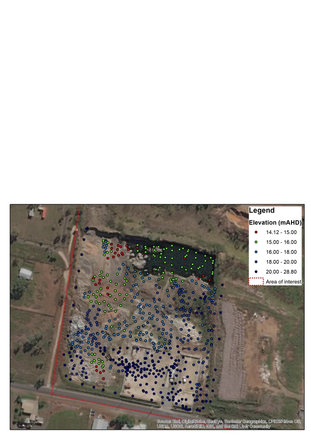
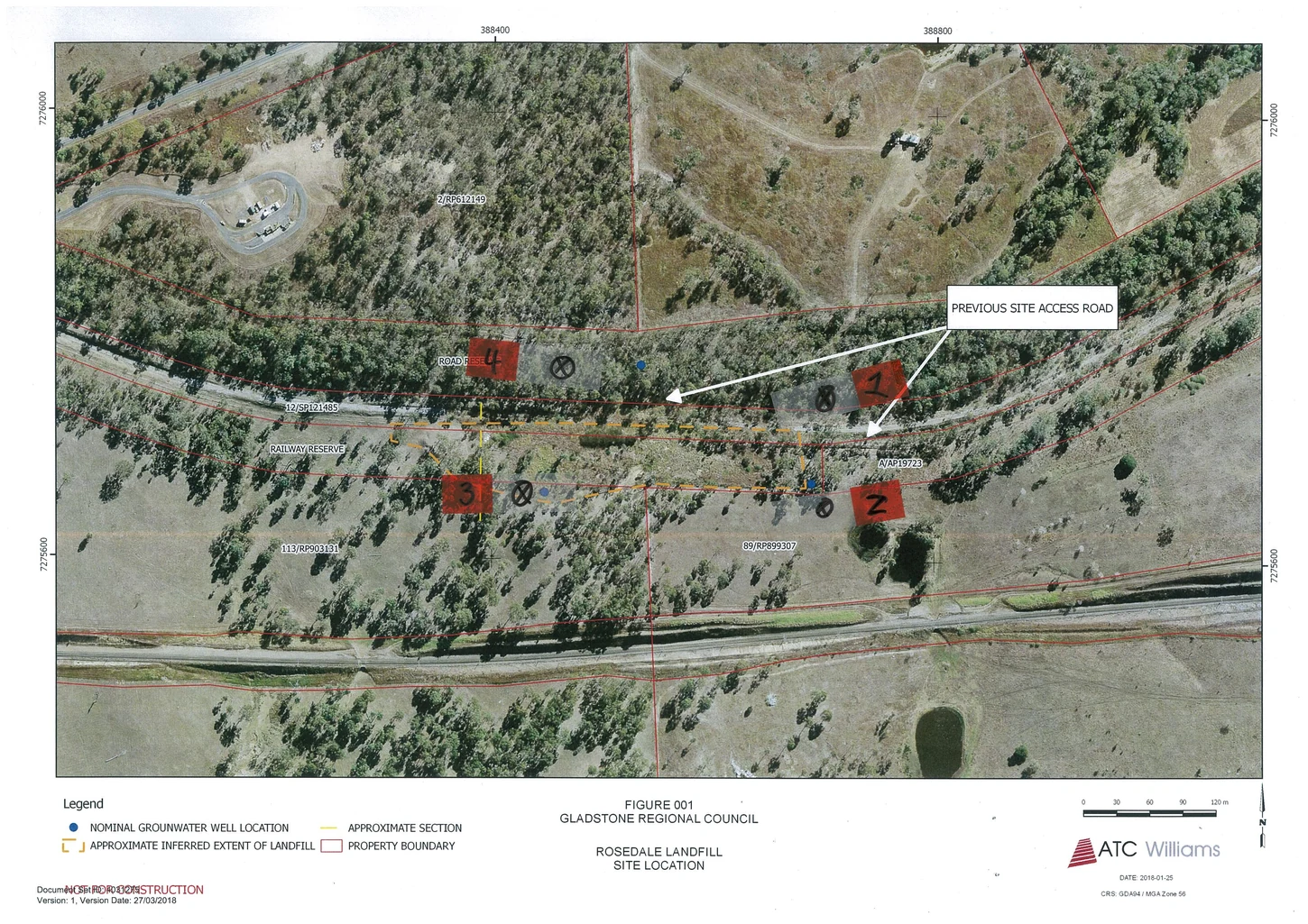
Aerial site plan showing the Gracemere bore network.
Water resourcesGracemere, Queensland
Gracemere landfill and the watertable
Client CQG Consulting
HGEC compared the landfill pit floor with groundwater elevations, drawing on bore records, site topography and depth-to-water information. The review addressed whether excavation had reached the watertable.
Further information about Gracemere landfill and the watertable
Project enquiry
Gracemere landfill and the watertable
HGEC compared the landfill pit floor with groundwater elevations, drawing on bore records, site topography and depth-to-water information. The review addressed whether excavation had reached the watertable.
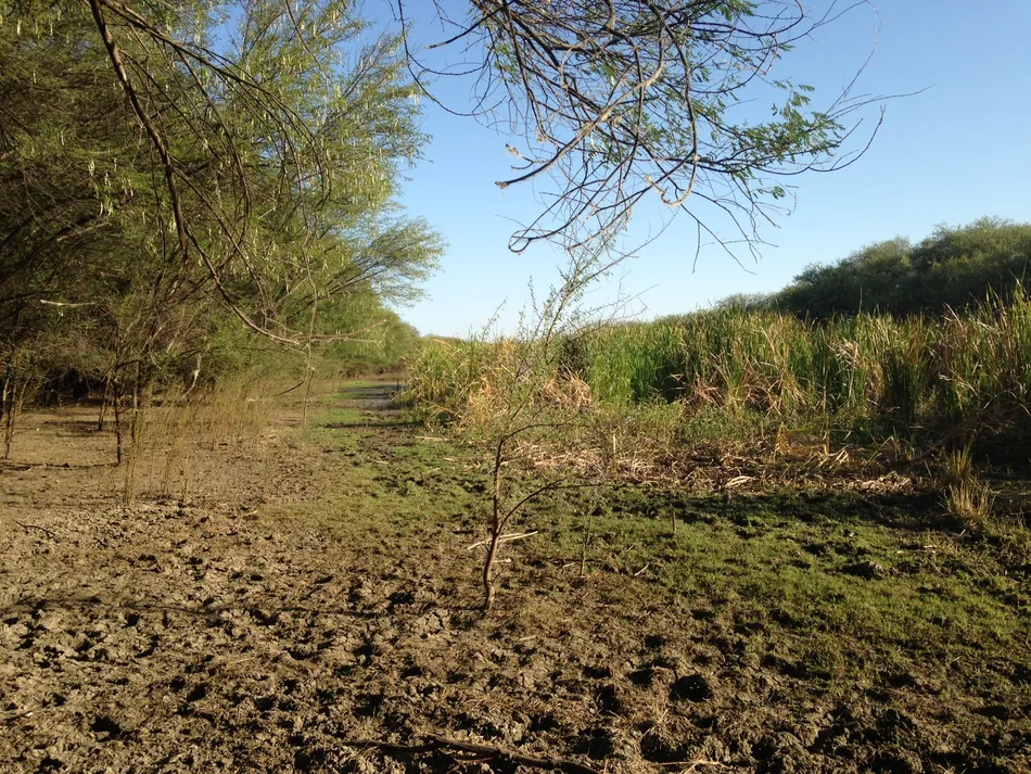
A tree-lined watercourse in the Julia Creek project area.
MiningJulia Creek, Queensland
Julia Creek groundwater baseline
Client Northern Ventures Australia
HGEC collated existing hydrogeological information for the Julia Creek project. The desktop study described local groundwater conditions and documented the evidence available before further project investigations.
Further information about Julia Creek groundwater baseline
Project enquiry
Julia Creek groundwater baseline
HGEC collated existing hydrogeological information for the Julia Creek project. The desktop study described local groundwater conditions and documented the evidence available before further project investigations.
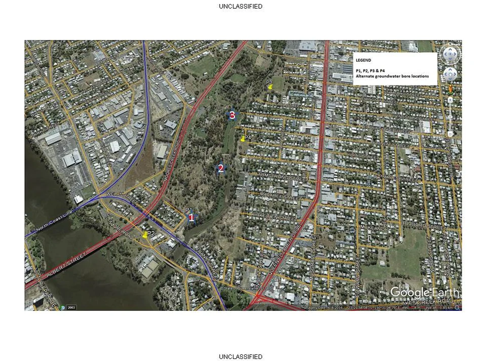
Kershaw Gardens and the surrounding Rockhampton street network from above.
Water resourcesRockhampton, Queensland
Kershaw Gardens monitoring bores
Client CQG Consulting
HGEC reviewed proposed monitoring locations at the former Kershaw Gardens landfill and advised on where to install groundwater bores. The recommendations informed the design of the site monitoring network.
Further information about Kershaw Gardens monitoring bores
Project enquiry
Kershaw Gardens monitoring bores
HGEC reviewed proposed monitoring locations at the former Kershaw Gardens landfill and advised on where to install groundwater bores. The recommendations informed the design of the site monitoring network.
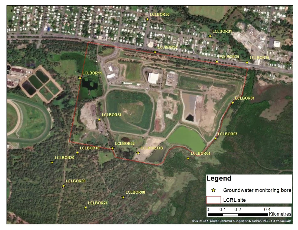
Aerial site plan showing bore locations at Lakes Creek Road landfill.
Water resourcesRockhampton, Queensland
Lakes Creek Road landfill review
Client CQG Consulting for Rockhampton Regional Council
HGEC prepared a hydrogeological assessment addendum for the Lakes Creek Road landfill. The work updated the groundwater assessment for the council’s waste and recycling team through CQG Consulting.
Further information about Lakes Creek Road landfill review
Project enquiry
Lakes Creek Road landfill review
HGEC prepared a hydrogeological assessment addendum for the Lakes Creek Road landfill. The work updated the groundwater assessment for the council’s waste and recycling team through CQG Consulting.
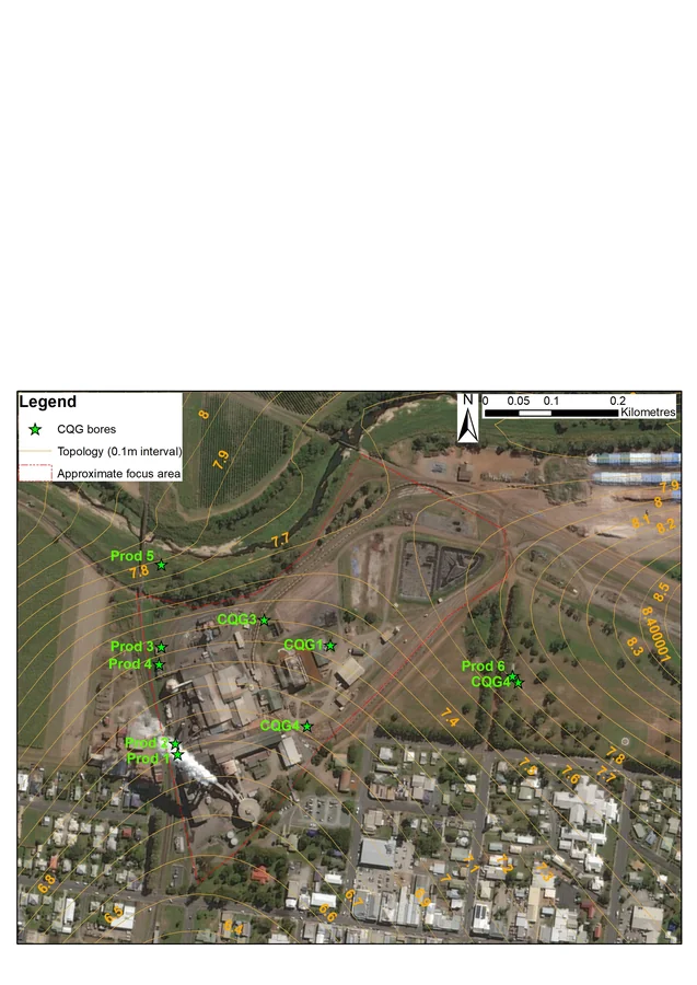
Aerial plan of local groundwater monitoring bores at Proserpine.
Water resourcesProserpine, Queensland
Proserpine Sugar Mill groundwater review
Client CQG Consulting for Wilmar Sugar Australia
HGEC reviewed groundwater conditions at the Proserpine Sugar Mill. The desktop assessment compiled site information to clarify groundwater movement and identify what further investigation might be needed.
Further information about Proserpine Sugar Mill groundwater review
Project enquiry
Proserpine Sugar Mill groundwater review
HGEC reviewed groundwater conditions at the Proserpine Sugar Mill. The desktop assessment compiled site information to clarify groundwater movement and identify what further investigation might be needed.
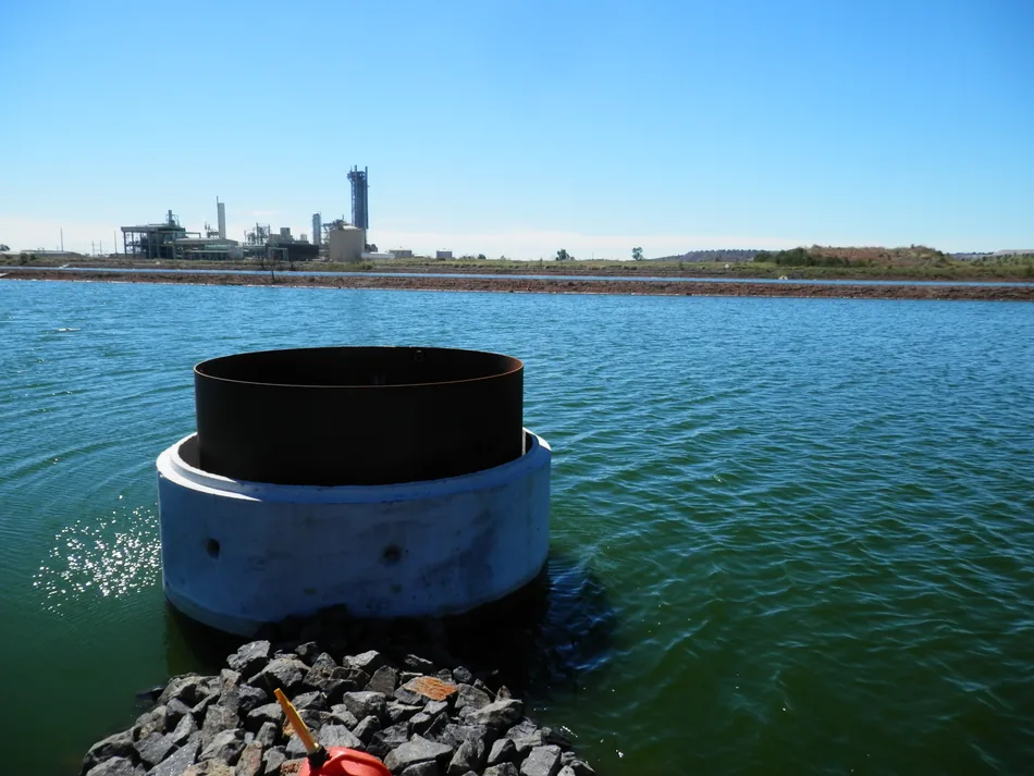
Monitoring infrastructure beside a water storage at Moura.
Water resourcesMoura, Queensland
Moura groundwater monitoring network
Client CQG Consulting for Queensland Nitrates Pty Ltd
HGEC advised on groundwater monitoring at the Queensland Nitrates site. The assessment used neighbouring mine information to interpret the likely depth of groundwater and consider the design of monitoring bores.
Further information about Moura groundwater monitoring network
Project enquiry
Moura groundwater monitoring network
HGEC advised on groundwater monitoring at the Queensland Nitrates site. The assessment used neighbouring mine information to interpret the likely depth of groundwater and consider the design of monitoring bores.
Annotated aerial view of the Rockhampton abattoir investigation area.
Water resourcesRockhampton, Queensland
Rockhampton abattoir groundwater review
Client CQG Consulting for Teys Australia
HGEC reviewed groundwater and monitoring plans alongside measurements from the Rockhampton abattoir. The desktop assessment considered how the existing monitoring program addressed site conditions and environmental authority requirements.
Further information about Rockhampton abattoir groundwater review
Project enquiry
Rockhampton abattoir groundwater review
HGEC reviewed groundwater and monitoring plans alongside measurements from the Rockhampton abattoir. The desktop assessment considered how the existing monitoring program addressed site conditions and environmental authority requirements.
Groundwater fieldwork among coastal trees at Adventure Bay.
CoastsBruny Island, Tasmania
Adventure Bay coastal groundwater model
Client Kingborough Council
HGEC developed a numerical groundwater model for Adventure Bay. The work used the local aquifer setting and groundwater observations to investigate how the shallow watertable behaves in this coastal settlement.
Further information about Adventure Bay coastal groundwater model
Project enquiry
Adventure Bay coastal groundwater model
HGEC developed a numerical groundwater model for Adventure Bay. The work used the local aquifer setting and groundwater observations to investigate how the shallow watertable behaves in this coastal settlement.
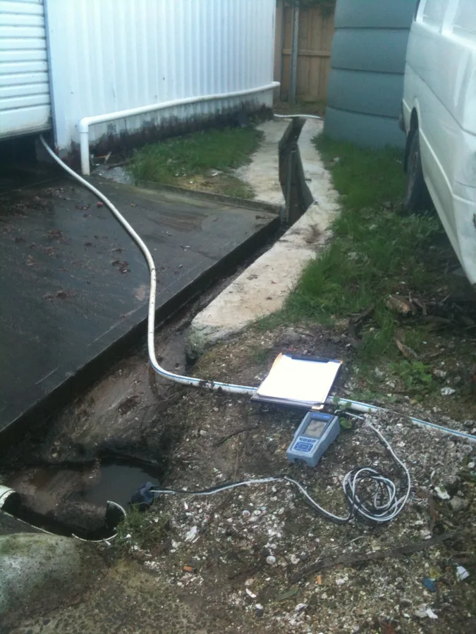
Drainage at a building examined in the Boomer Bay salinity investigation.
SalinityBoomer Bay, Tasmania
Boomer Bay salinity investigation
Client Sorell Council
A salinity complaint at Boomer Bay prompted the council to investigate. Working with Bill Cromer, we inspected the site and used environmental measurements to examine possible salt sources and how water moved through the area.
Further information about Boomer Bay salinity investigation
Project enquiry
Boomer Bay salinity investigation
A salinity complaint at Boomer Bay prompted the council to investigate. Working with Bill Cromer, we inspected the site and used environmental measurements to examine possible salt sources and how water moved through the area.
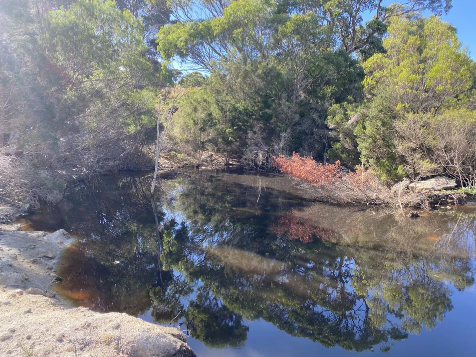
Surface water at a Whitemark Waste Facility monitoring location.
Water resourcesWhitemark, Tasmania
Whitemark Waste Facility monitoring
Client Flinders Council
HGEC analysed 2025 water monitoring records for the Whitemark Waste Facility. The work brought together surface water and groundwater observations so council could assess conditions across the monitoring network.
Further information about Whitemark Waste Facility monitoring
Project enquiry
Whitemark Waste Facility monitoring
HGEC analysed 2025 water monitoring records for the Whitemark Waste Facility. The work brought together surface water and groundwater observations so council could assess conditions across the monitoring network.
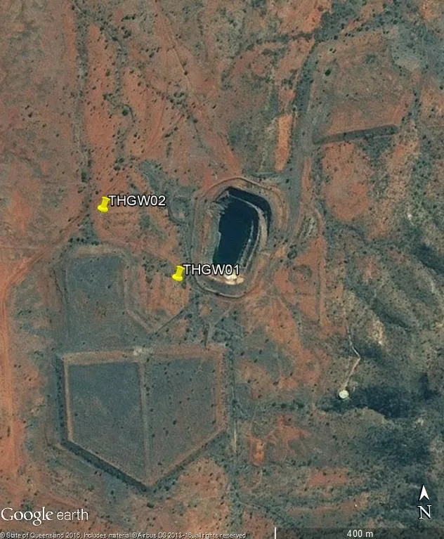
Aerial site view from the earlier Tick Hill groundwater monitoring report by EnviroAg Australia (2016).
At Tick Hill, HGEC and Bill Cromer recommended additional monitoring bores. The aim was to help the mine detect changes in groundwater and assess the impacts of mining.
Further information about Tick Hill monitoring bore design
Project enquiry
Tick Hill monitoring bore design
At Tick Hill, HGEC and Bill Cromer recommended additional monitoring bores. The aim was to help the mine detect changes in groundwater and assess the impacts of mining.
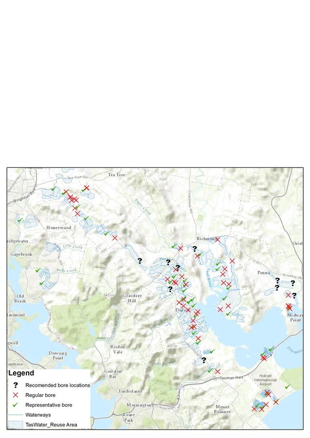
Map of groundwater monitoring bores for the recycled-water review.
Water resourcesSouth-east Tasmania
Clarence, Brighton and Penna recycled water schemes
Across three TasWater recycled water schemes, HGEC and Bill Cromer reviewed the available groundwater monitoring records and reported the findings to Macquarie Franklin.
Further information about Clarence, Brighton and Penna recycled water schemes
Project enquiry
Clarence, Brighton and Penna recycled water schemes
Across three TasWater recycled water schemes, HGEC and Bill Cromer reviewed the available groundwater monitoring records and reported the findings to Macquarie Franklin.
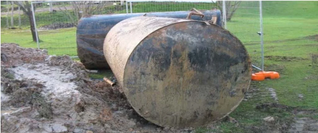
Fuel storage tank shown on the cover of HGEC’s 2017 Goughs Bay groundwater assessment.
Water resourcesGoughs Bay, Victoria
Goughs Bay groundwater impact assessment
Client EnviroRisk for FuelCo Pty Ltd
HGEC assessed groundwater conditions at Goughs Bay Caravan Park. The work used groundwater analysis and modelling to investigate potential impacts and document the hydrogeological setting for the environmental consultant.
Further information about Goughs Bay groundwater impact assessment
Project enquiry
Goughs Bay groundwater impact assessment
HGEC assessed groundwater conditions at Goughs Bay Caravan Park. The work used groundwater analysis and modelling to investigate potential impacts and document the hydrogeological setting for the environmental consultant.
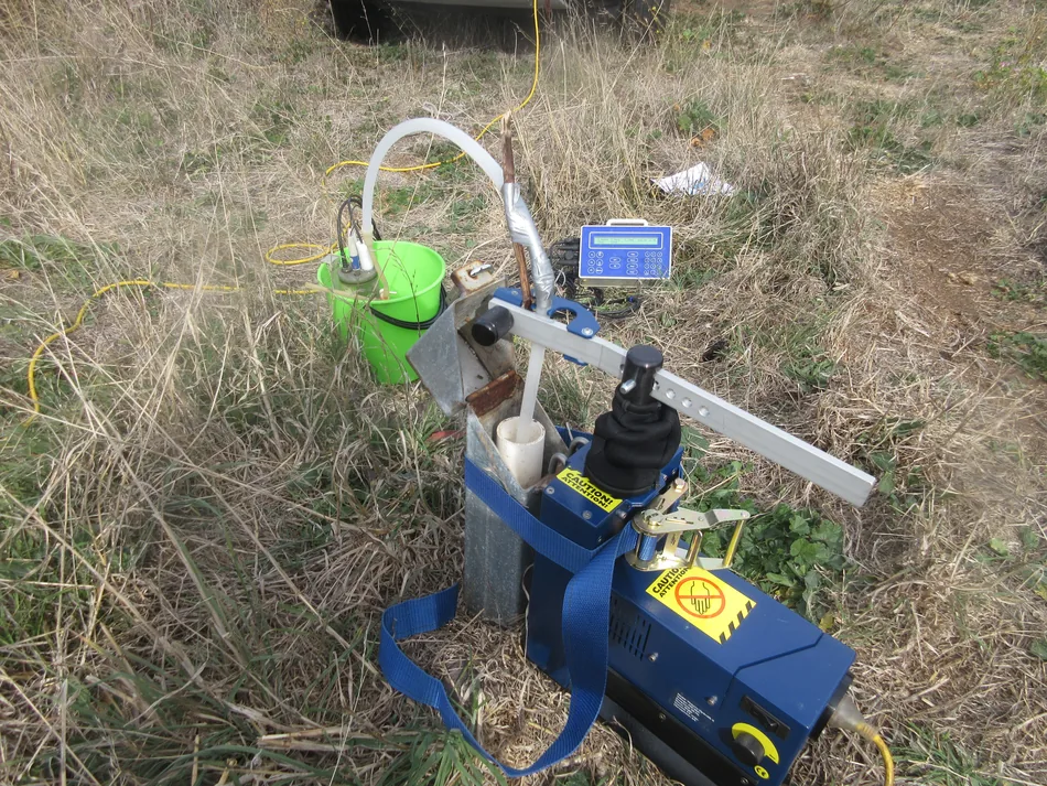
Portable water sampling equipment connected to a monitoring bore at Sorell.
Water resourcesSorell, Tasmania
Sorell processing facility monitoring
Client Ingham Enterprises Pty Ltd
HGEC sampled groundwater at the Sorell processing facility and prepared monitoring reports over successive years. The program provided recurring observations of groundwater quality under the site’s operating conditions.
Further information about Sorell processing facility monitoring
Project enquiry
Sorell processing facility monitoring
HGEC sampled groundwater at the Sorell processing facility and prepared monitoring reports over successive years. The program provided recurring observations of groundwater quality under the site’s operating conditions.
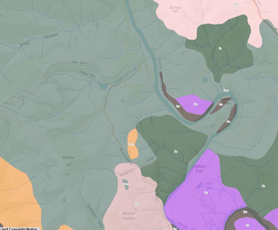
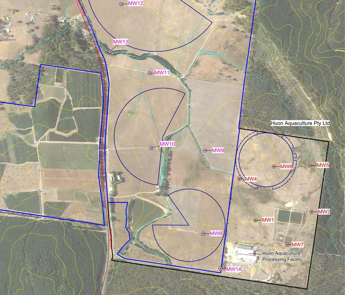
The distribution of soil types mapped around the Meadowbank Hatchery site.
Water resourcesMeadowbank, Tasmania
Meadowbank Hatchery irrigation assessment
Client Pinion Advisory for Huon Aquaculture
HGEC assessed groundwater risks from the proposed use of hatchery effluent for irrigation. The hydrogeological assessment examined the site’s groundwater setting and the pathways through which irrigation could affect it.
Further information about Meadowbank Hatchery irrigation assessment
Project enquiry
Meadowbank Hatchery irrigation assessment
HGEC assessed groundwater risks from the proposed use of hatchery effluent for irrigation. The hydrogeological assessment examined the site’s groundwater setting and the pathways through which irrigation could affect it.
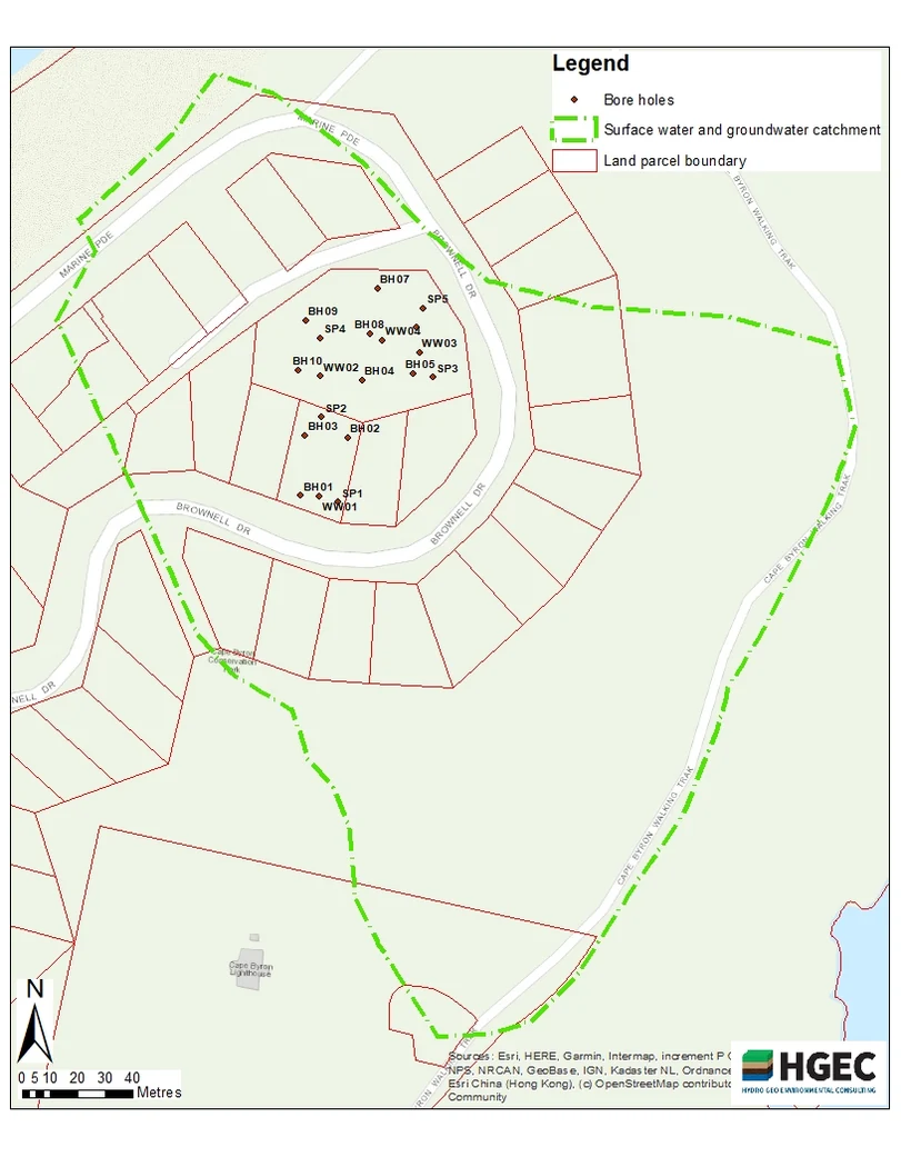
Borehole locations and the interpreted surface-water and groundwater catchment in Byron Bay.
CoastsByron Bay, New South Wales
Byron Bay residential groundwater assessment
Client Pacific Geotech Pty Ltd
HGEC assessed groundwater impacts for a proposed residential development at Byron Bay. The assessment examined site groundwater observations and their relationship with climate to inform interpretation of the proposed development.
Further information about Byron Bay residential groundwater assessment
Project enquiry
Byron Bay residential groundwater assessment
HGEC assessed groundwater impacts for a proposed residential development at Byron Bay. The assessment examined site groundwater observations and their relationship with climate to inform interpretation of the proposed development.
Aerial view of the Turee Creek borefield study area.
MiningPilbara, Western Australia
Turee Creek borefield recovery
Client Rio Tinto
HGEC used numerical modelling to investigate how groundwater levels could recover following abstraction at the Turee Creek borefield. The assessment examined management options and their implications for groundwater levels.
Further information about Turee Creek borefield recovery
Project enquiry
Turee Creek borefield recovery
HGEC used numerical modelling to investigate how groundwater levels could recover following abstraction at the Turee Creek borefield. The assessment examined management options and their implications for groundwater levels.
Aerial imagery and site locations used for the Mesa A model.
MiningPilbara, Western Australia
Mesa A borefield model update
Client Rio Tinto
HGEC updated the Mesa A borefield groundwater model after examining metering and model inputs. The revised model provided a basis for assessing abstraction and comparing groundwater responses under proposed scenarios.
Further information about Mesa A borefield model update
Project enquiry
Mesa A borefield model update
HGEC updated the Mesa A borefield groundwater model after examining metering and model inputs. The revised model provided a basis for assessing abstraction and comparing groundwater responses under proposed scenarios.
A monitoring bore beside vegetation at the Beaconsfield reuse site.
Water resourcesBeaconsfield, Tasmania
Beaconsfield wastewater and reuse monitoring
Client AK Consultants for Ben Lomond Water
HGEC established groundwater monitoring sites and sampled the Beaconsfield wastewater treatment and reuse scheme. The report documented both the monitoring network and the results of the sampling event.
Further information about Beaconsfield wastewater and reuse monitoring
Project enquiry
Beaconsfield wastewater and reuse monitoring
HGEC established groundwater monitoring sites and sampled the Beaconsfield wastewater treatment and reuse scheme. The report documented both the monitoring network and the results of the sampling event.
Vegetated low ground at the proposed Nimitabel dam site.
Water resourcesTasmania
Nimitabel dam assessment
Client Farm dam proponents
HGEC prepared supplementary technical information for the committee assessing the proposed Nimitabel dam. The report addressed water-related questions raised during review of the proposed farm water storage.
Further information about Nimitabel dam assessment
Project enquiry
Nimitabel dam assessment
HGEC prepared supplementary technical information for the committee assessing the proposed Nimitabel dam. The report addressed water-related questions raised during review of the proposed farm water storage.
Conceptual aquifer cross-section used in the regional groundwater model.
SalinityNorthern Victoria
Barr Creek and Tragowel Plains salt accounting
Client North Central Catchment Management Authority
HGEC contributed to the regional groundwater model used to assess salt reaching the Murray River. The work documented conceptual design, calibration and scenarios for the Barr Creek and Tragowel Plains accounting areas.
Further information about Barr Creek and Tragowel Plains salt accounting
Project enquiry
Barr Creek and Tragowel Plains salt accounting
HGEC contributed to the regional groundwater model used to assess salt reaching the Murray River. The work documented conceptual design, calibration and scenarios for the Barr Creek and Tragowel Plains accounting areas.
Groundwater field equipment at a Parilla Sand investigation site.
SalinityLower Wimmera, Victoria
Lower Wimmera groundwater chemistry
Client Victorian Department of Primary Industries
HGEC worked with a consulting hydrogeologist to assess groundwater chemistry in the Parilla Sand aquifer. The investigation considered potential uses of this saline water in the Lower Wimmera.
Further information about Lower Wimmera groundwater chemistry
Project enquiry
Lower Wimmera groundwater chemistry
HGEC worked with a consulting hydrogeologist to assess groundwater chemistry in the Parilla Sand aquifer. The investigation considered potential uses of this saline water in the Lower Wimmera.
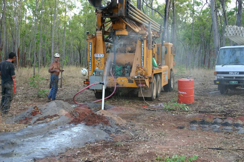
Drilling and discharge at a groundwater investigation bore at Wongai.
MiningCape York, Queensland
Wongai mine groundwater investigation
Client Aus-Pac Capital
HGEC investigated groundwater conditions for the Wongai project. The field program and technical reporting examined aquifer conditions and provided groundwater information for assessment of the proposed mine.
Further information about Wongai mine groundwater investigation
Project enquiry
Wongai mine groundwater investigation
HGEC investigated groundwater conditions for the Wongai project. The field program and technical reporting examined aquifer conditions and provided groundwater information for assessment of the proposed mine.
Aerial field photograph of the Great Western motorcycle complex site.
AdvisoryGreat Western, Victoria
Great Western motorcycle complex review
Client Private client
HGEC reviewed water-related issues raised by a proposed motorcycle complex at Great Western. The desktop appraisal examined information about the proposed development and the local water setting.
Further information about Great Western motorcycle complex review
Project enquiry
Great Western motorcycle complex review
HGEC reviewed water-related issues raised by a proposed motorcycle complex at Great Western. The desktop appraisal examined information about the proposed development and the local water setting.
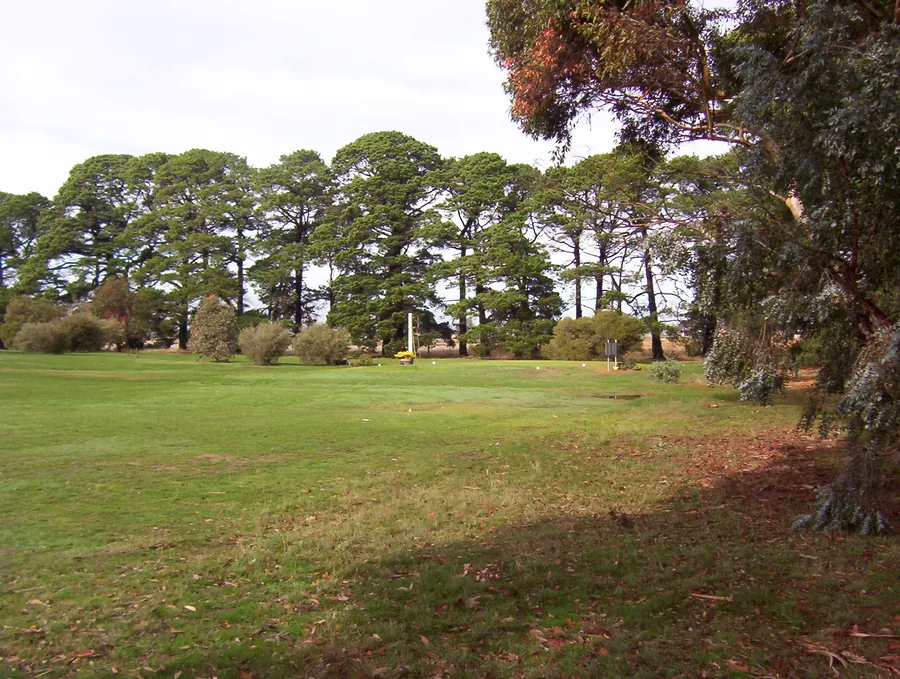
Fairway and trees at Royal Hobart Golf Club.
InfrastructureSeven Mile Beach, Tasmania
Royal Hobart Golf Club subdivision
Client Integral Consulting Engineers
HGEC prepared a groundwater management plan for the proposed subdivision. The plan brought local groundwater conditions into the design of the development and set out how they would be managed.
Further information about Royal Hobart Golf Club subdivision
Project enquiry
Royal Hobart Golf Club subdivision
HGEC prepared a groundwater management plan for the proposed subdivision. The plan brought local groundwater conditions into the design of the development and set out how they would be managed.
Regional bore locations and geology around Wodonga.
Water resourcesNorth-east Victoria
Wodonga and Yackandandah aquifer recharge
Client North East Water
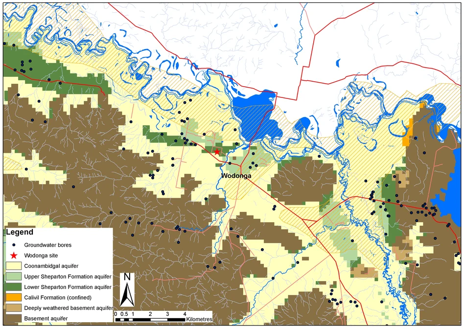
HGEC screened two towns for managed aquifer recharge. The assessment compared geology, groundwater bores and landform information to identify where further investigation of underground water storage might be worthwhile.
Further information about Wodonga and Yackandandah aquifer recharge
Project enquiry
Wodonga and Yackandandah aquifer recharge
HGEC screened two towns for managed aquifer recharge. The assessment compared geology, groundwater bores and landform information to identify where further investigation of underground water storage might be worthwhile.
Aerial site plan of the Alpha HPA project.
Water resourcesGladstone, Queensland
Alpha HPA monitoring well assessment
Client CQG Consulting
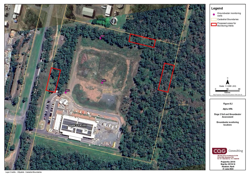
For the Alpha HPA development, we reviewed the wells used to monitor groundwater. Our technical advice examined the existing network and set out what to consider when assessing groundwater at the site.
Further information about Alpha HPA monitoring well assessment
Project enquiry
Alpha HPA monitoring well assessment
For the Alpha HPA development, we reviewed the wells used to monitor groundwater. Our technical advice examined the existing network and set out what to consider when assessing groundwater at the site.
Comparison of trends across assessment periods in the recycled water monitoring report.
Water resourcesTasmania
TasWater recycled water monitoring trends
Client Pinion Advisory for TasWater
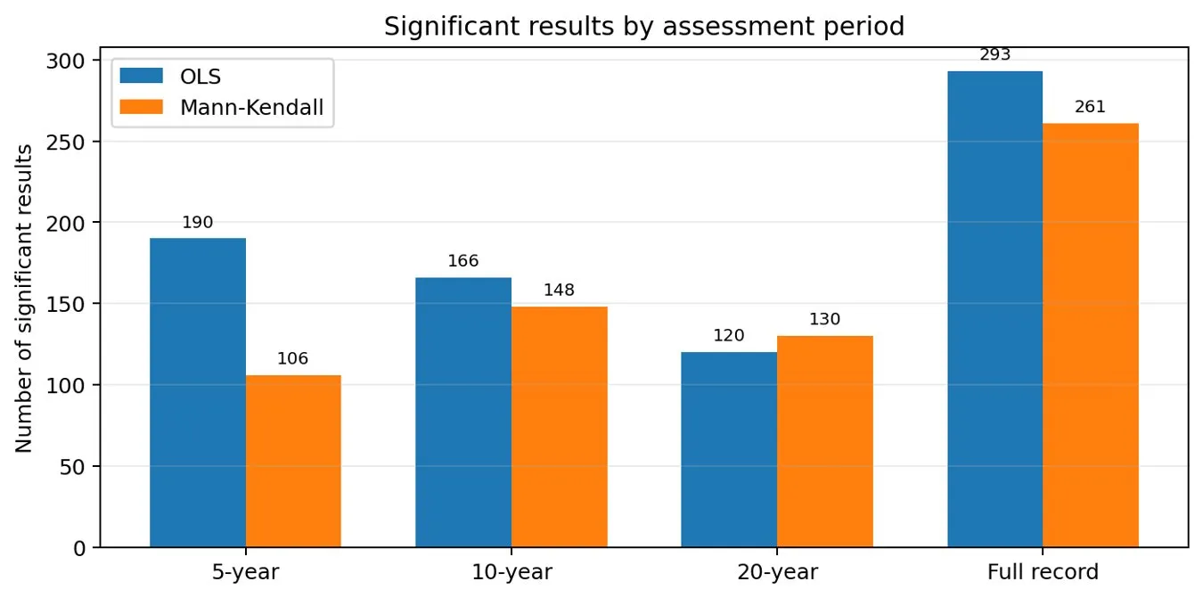
HGEC compared ordinary least squares regression with a rank-based test for groundwater quality trends at recycled water schemes. The review examined how the choice of statistical method affected interpretation of monitoring results.
Further information about TasWater recycled water monitoring trends
Project enquiry
TasWater recycled water monitoring trends
HGEC compared ordinary least squares regression with a rank-based test for groundwater quality trends at recycled water schemes. The review examined how the choice of statistical method affected interpretation of monitoring results.
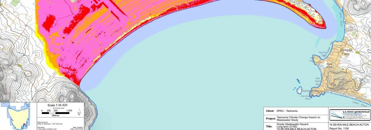
Coastal mapping from the Tasmanian on-site wastewater and climate study.
CoastsTasmania
Climate change and on-site wastewater
Client Tasmanian Department of Premier and Cabinet
Shallow groundwater can influence how on-site wastewater systems perform. Working with Bill Cromer and the wider project team, HGEC examined how a changing climate could affect treatment.
Further information about Climate change and on-site wastewater
Project enquiry
Climate change and on-site wastewater
Shallow groundwater can influence how on-site wastewater systems perform. Working with Bill Cromer and the wider project team, HGEC examined how a changing climate could affect treatment.
Woodland photograph from the Silvergrass East mine dewatering study.
MiningPilbara, Western Australia
Silvergrass East mine dewatering
Client Rio Tinto Iron Ore Pty Ltd
HGEC developed a groundwater model of the Caves Creek catchment for the Silvergrass East operations. The model examined mine dewatering impacts and informed the design of managed aquifer recharge.
Further information about Silvergrass East mine dewatering
Project enquiry
Silvergrass East mine dewatering
HGEC developed a groundwater model of the Caves Creek catchment for the Silvergrass East operations. The model examined mine dewatering impacts and informed the design of managed aquifer recharge.
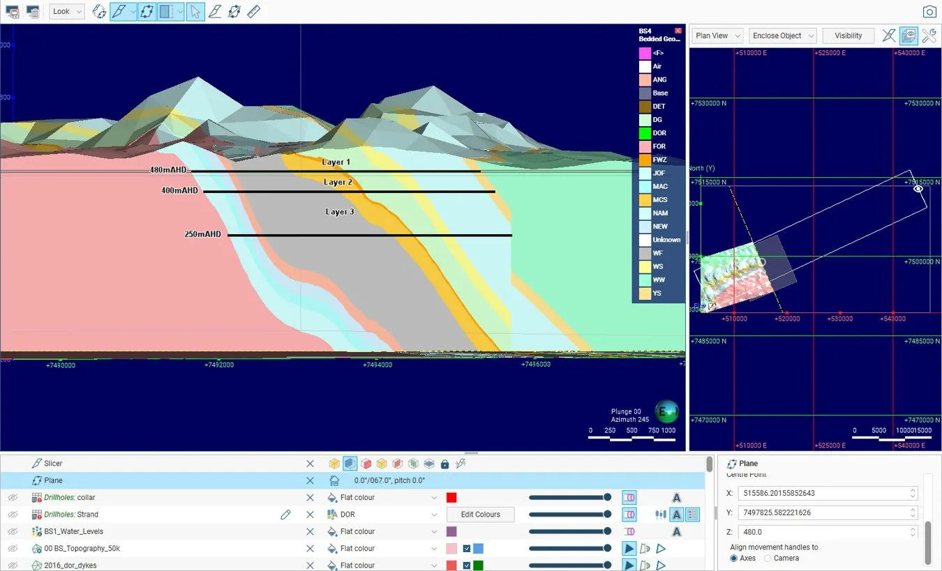
Groundwater model cross-section for Brockman Syncline 4.
MiningPilbara, Western Australia
Brockman Syncline 4 groundwater model
Client Rio Tinto Iron Ore
HGEC reviewed the original groundwater model and documented the build of an updated model for Brockman Syncline 4. The work addressed grid structure, hydrogeological layers, boundaries and calibration.
Further information about Brockman Syncline 4 groundwater model
Project enquiry
Brockman Syncline 4 groundwater model
HGEC reviewed the original groundwater model and documented the build of an updated model for Brockman Syncline 4. The work addressed grid structure, hydrogeological layers, boundaries and calibration.
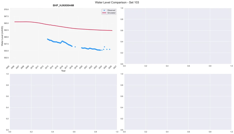
Groundwater-level observations and model results at Hope Downs 1.
MiningPilbara, Western Australia
Hope Downs 1 groundwater model
Client Rio Tinto
For Rio Tinto, HGEC used an unstructured groundwater model and PEST-IES to compare 735 realisations. Four calibration updates showed how historical observations constrained flow across a model boundary.
For Rio Tinto, HGEC used an unstructured groundwater model and PEST-IES to compare 735 realisations. Four calibration updates showed how historical observations constrained flow across a model boundary.
Groundwater model results from the Greater Nammuldi technical presentation.
MiningPilbara, Western Australia
Greater Nammuldi groundwater model
Client Rio Tinto
HGEC refined and recalibrated the regional groundwater model to improve predictions at monitoring bores and a proposed pit void. The work examined geological structures, layer elevations and boundary conditions.
Further information about Greater Nammuldi groundwater model
Project enquiry
Greater Nammuldi groundwater model
HGEC refined and recalibrated the regional groundwater model to improve predictions at monitoring bores and a proposed pit void. The work examined geological structures, layer elevations and boundary conditions.
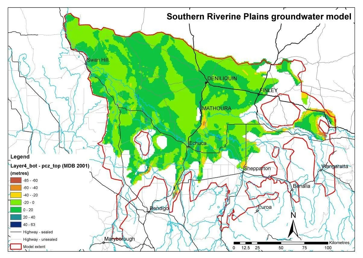
Regional map from the Southern Riverine Plains model review.
AdvisorySouthern Murray–Darling Basin
Southern Riverine Plains model review
Client Victorian Government
Together with a Victorian Government researcher, we reviewed the CSIRO groundwater model for the Southern Riverine Plains. The technical report examined the model used in the Sustainable Yields assessment.
Further information about Southern Riverine Plains model review
Project enquiry
Southern Riverine Plains model review
Together with a Victorian Government researcher, we reviewed the CSIRO groundwater model for the Southern Riverine Plains. The technical report examined the model used in the Sustainable Yields assessment.
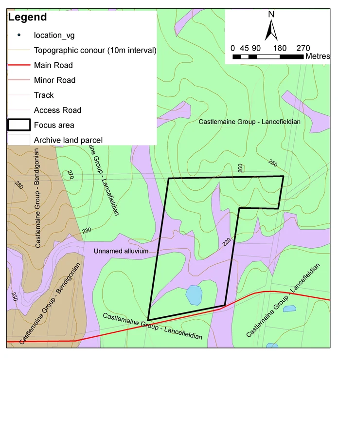
Geological mapping around the Mandurang assessment site.
Water resourcesMandurang, Victoria
Mandurang planning overlay assessment
Client Andriske Tablegrapes Pty Ltd
HGEC prepared a preliminary hydrogeological assessment for land covered by an environmental significance overlay. The report examined the local groundwater setting relevant to the planning application.
Further information about Mandurang planning overlay assessment
Project enquiry
Mandurang planning overlay assessment
HGEC prepared a preliminary hydrogeological assessment for land covered by an environmental significance overlay. The report examined the local groundwater setting relevant to the planning application.
Grassed slopes and eucalypts at Aradale.
Water resourcesArarat, Victoria
Aradale pre-drilling assessment
Client Northern Melbourne Institute of TAFE
HGEC reviewed the groundwater prospects at Aradale before drilling. The work compiled available geological and bore information for the institute to consider when planning a water supply investigation.
Further information about Aradale pre-drilling assessment
Project enquiry
Aradale pre-drilling assessment
HGEC reviewed the groundwater prospects at Aradale before drilling. The work compiled available geological and bore information for the institute to consider when planning a water supply investigation.
Land beneath the rocky ridge at Bullock Hills.
Water resourcesArarat district, Victoria
Bullock Hills water resource study
Client Bullock Hills Venture
HGEC assessed water resources at the Bullock Hills property. The investigation examined the geological setting and available information to identify prospects for developing a local water supply.
Further information about Bullock Hills water resource study
Project enquiry
Bullock Hills water resource study
HGEC assessed water resources at the Bullock Hills property. The investigation examined the geological setting and available information to identify prospects for developing a local water supply.
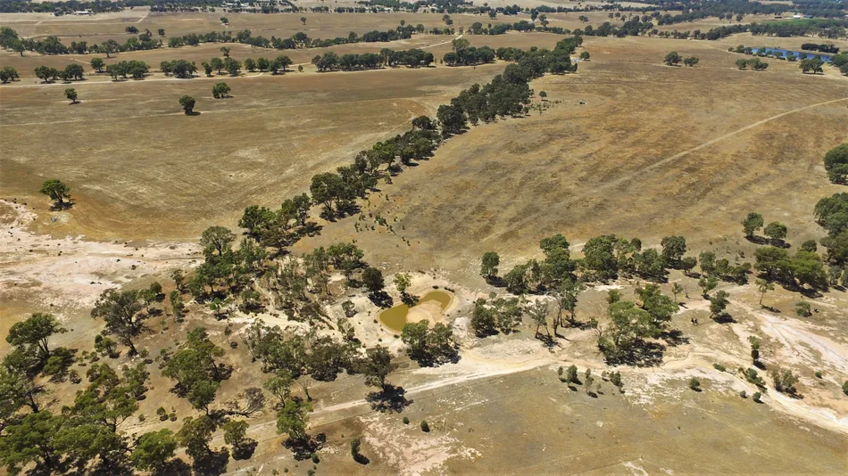
Dry farmland around the Corop bore investigation site.
Water resourcesCorop, Victoria
Corop pre-drilling groundwater review
Client Private landholder
HGEC reviewed groundwater records for a property near Corop before a bore was drilled. The report described the local geology and the groundwater conditions the landholder might encounter.
Further information about Corop pre-drilling groundwater review
Project enquiry
Corop pre-drilling groundwater review
HGEC reviewed groundwater records for a property near Corop before a bore was drilled. The report described the local geology and the groundwater conditions the landholder might encounter.
Regional geology and waterways around Bridgewater, Tasmania.
Water resourcesBridgewater, Tasmania
Bridgewater groundwater review
Client KMR drilling client
HGEC reviewed the groundwater setting at a Bridgewater site for the drilling contractor. The report brought existing geological and groundwater information together to inform the proposed work.
Further information about Bridgewater groundwater review
Project enquiry
Bridgewater groundwater review
HGEC reviewed the groundwater setting at a Bridgewater site for the drilling contractor. The report brought existing geological and groundwater information together to inform the proposed work.
Roadside view of the Caldermeade petroleum site.
Water resourcesCaldermeade, Victoria
Caldermeade petroleum site groundwater risk
Client EnviroRisk Management Pty Ltd for JASBE Petroleum
HGEC assessed groundwater risk at a petroleum site in Caldermeade. The report examined the local hydrogeological setting within the EPA assessment framework then applicable to the site.
Further information about Caldermeade petroleum site groundwater risk
Project enquiry
Caldermeade petroleum site groundwater risk
HGEC assessed groundwater risk at a petroleum site in Caldermeade. The report examined the local hydrogeological setting within the EPA assessment framework then applicable to the site.
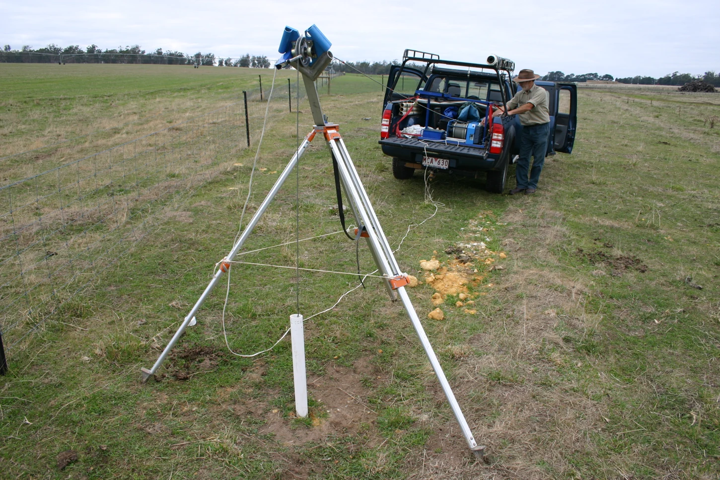
Pumping equipment at the Woodstock West extraction bore.
Water resourcesNorthern Victoria
Northern Victoria extraction bore pumping test
Client Bore owners, at the request of Goulburn-Murray Water
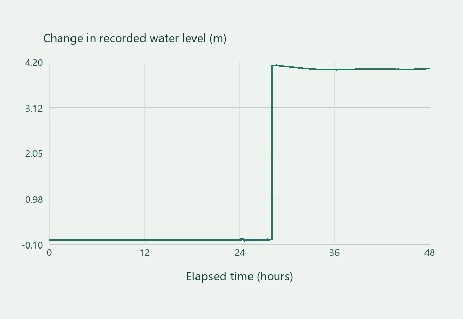
HGEC assessed groundwater drawdown during a 48-hour pumping test at a privately owned extraction bore. The results documented the response to abstraction for Goulburn-Murray Water.
Further information about Northern Victoria extraction bore pumping test
Project enquiry
Northern Victoria extraction bore pumping test
HGEC assessed groundwater drawdown during a 48-hour pumping test at a privately owned extraction bore. The results documented the response to abstraction for Goulburn-Murray Water.
Cultivated paddocks in the Baringhup study area.
Water resourcesBaringhup, Victoria
Baringhup irrigation development assessment
Client Irrigation landholders
HGEC examined local hydrogeology for an irrigation development at Baringhup. The report addressed the groundwater component of the irrigation development guidelines requested by Goulburn-Murray Water.
Further information about Baringhup irrigation development assessment
Project enquiry
Baringhup irrigation development assessment
HGEC examined local hydrogeology for an irrigation development at Baringhup. The report addressed the groundwater component of the irrigation development guidelines requested by Goulburn-Murray Water.
Agricultural land from the Newbridge irrigation assessment.
Water resourcesNewbridge, Victoria
Newbridge irrigation development assessment
Client Irrigation landholder
HGEC evaluated groundwater conditions at a proposed irrigation development near Newbridge. The work supplied the hydrogeological component required for review under Goulburn-Murray Water’s irrigation development guidelines.
Further information about Newbridge irrigation development assessment
Project enquiry
Newbridge irrigation development assessment
HGEC evaluated groundwater conditions at a proposed irrigation development near Newbridge. The work supplied the hydrogeological component required for review under Goulburn-Murray Water’s irrigation development guidelines.
Irrigated farmland at the Sebastian Road investigation site.
Water resourcesBridgewater, Victoria
Bridgewater irrigation hydrogeology
Client Irrigation landholders
HGEC assessed the hydrogeology of an irrigation property at Bridgewater. The report provided the groundwater information needed to assess irrigation development under the applicable guidelines.
Further information about Bridgewater irrigation hydrogeology
Project enquiry
Bridgewater irrigation hydrogeology
HGEC assessed the hydrogeology of an irrigation property at Bridgewater. The report provided the groundwater information needed to assess irrigation development under the applicable guidelines.
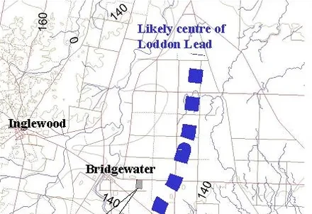
The likely centre of the Loddon Lead near Bridgewater. Detail from the project map.
Water resourcesBridgewater, Victoria
Bridgewater irrigation assessment update
Client Irrigation landholders
HGEC updated the groundwater assessment for a Bridgewater irrigation property. The report documented local hydrogeology and addressed the groundwater component of Goulburn-Murray Water’s development requirements.
Further information about Bridgewater irrigation assessment update
Project enquiry
Bridgewater irrigation assessment update
HGEC updated the groundwater assessment for a Bridgewater irrigation property. The report documented local hydrogeology and addressed the groundwater component of Goulburn-Murray Water’s development requirements.
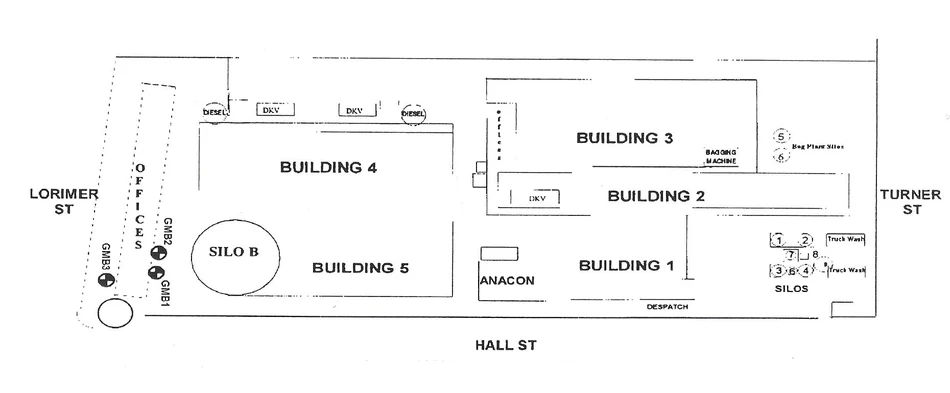
Monitoring locations and facilities on the Port Melbourne site plan.
Water resourcesPort Melbourne, Victoria
Port Melbourne groundwater monitoring
Client Independent Cement & Lime Pty Ltd
HGEC monitored groundwater at the company’s Port Melbourne facilities. The technical report documented the monitoring event and its results as part of the site's ongoing environmental record.
Further information about Port Melbourne groundwater monitoring
Project enquiry
Port Melbourne groundwater monitoring
HGEC monitored groundwater at the company’s Port Melbourne facilities. The technical report documented the monitoring event and its results as part of the site's ongoing environmental record.
A rust-coloured streak in exterior render at the Ascot Vale inspection site.
AdvisoryAscot Vale, Victoria
Ascot Vale rust staining investigation
Client BD Property Development Pty Ltd
HGEC investigated sporadic rust spotting on render and concrete at an Ascot Vale development. The technical review examined site evidence relevant to the source of the marks.
Further information about Ascot Vale rust staining investigation
Project enquiry
Ascot Vale rust staining investigation
HGEC investigated sporadic rust spotting on render and concrete at an Ascot Vale development. The technical review examined site evidence relevant to the source of the marks.
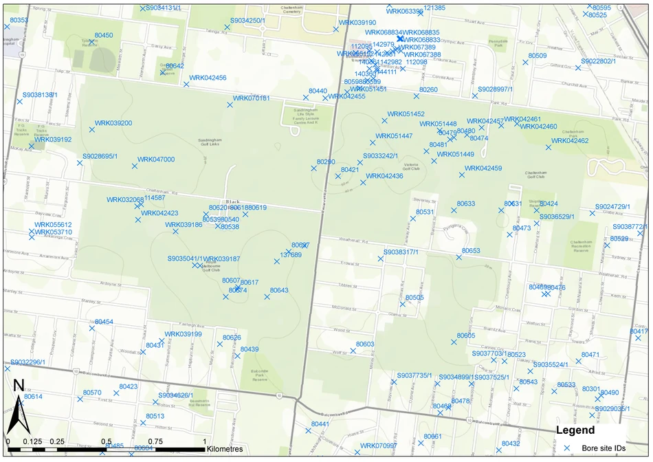
Mapped groundwater information around the Sandringham golf course.
Water resourcesSandringham, Victoria
Sandringham golf course drilling options
Client Royal Melbourne Golf Club
HGEC reviewed groundwater records and previous bore construction information around the golf club. The desktop assessment identified potential drilling sites for a further groundwater investigation.
Further information about Sandringham golf course drilling options
Project enquiry
Sandringham golf course drilling options
HGEC reviewed groundwater records and previous bore construction information around the golf club. The desktop assessment identified potential drilling sites for a further groundwater investigation.
Regional groundwater flow systems near Pipers River.
Water resourcesPipers River, Tasmania
Pipers River pre-drilling review
Client KMR drilling client
HGEC reviewed geology and groundwater records around a property at Pipers River. The pre-drilling report helped the landholder and drilling contractor assess the proposed bore site.
Further information about Pipers River pre-drilling review
Project enquiry
Pipers River pre-drilling review
HGEC reviewed geology and groundwater records around a property at Pipers River. The pre-drilling report helped the landholder and drilling contractor assess the proposed bore site.
Geology and waterways in the Sorell district.
Water resourcesSorell, Tasmania
Sorell pre-drilling review
Client KMR drilling client
HGEC prepared a pre-drilling assessment for a property at Sorell. The report brought regional geology and available bore information together to inform investigation of a local water supply.
Further information about Sorell pre-drilling review
Project enquiry
Sorell pre-drilling review
HGEC prepared a pre-drilling assessment for a property at Sorell. The report brought regional geology and available bore information together to inform investigation of a local water supply.
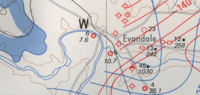
Regional hydrogeological mapping around Evandale.
Water resourcesEvandale, Tasmania
Evandale groundwater enquiry
Client KMR drilling client
HGEC assessed groundwater prospects at an Evandale property before drilling. The report compiled information about the local groundwater setting for the property owner and the drilling contractor.
Further information about Evandale groundwater enquiry
Project enquiry
Evandale groundwater enquiry
HGEC assessed groundwater prospects at an Evandale property before drilling. The report compiled information about the local groundwater setting for the property owner and the drilling contractor.
Coastal sand and basalt mapped near Weymouth.
Water resourcesWeymouth, Tasmania
Weymouth groundwater enquiry
Client KMR drilling client
HGEC assessed groundwater prospects near Weymouth. The pre-drilling report described local geological conditions and available bore information for the drilling contractor and property owner.
Further information about Weymouth groundwater enquiry
Project enquiry
Weymouth groundwater enquiry
HGEC assessed groundwater prospects near Weymouth. The pre-drilling report described local geological conditions and available bore information for the drilling contractor and property owner.
Regional groundwater flow systems on the east coast of Tasmania.
Water resourcesOkehampton Bay, Tasmania
Okehampton Bay groundwater enquiry
Client KMR drilling client
HGEC assessed groundwater prospects at Okehampton Bay. The pre-drilling review documented the available local geological and groundwater information to help guide investigation of a potential groundwater supply.
Further information about Okehampton Bay groundwater enquiry
Project enquiry
Okehampton Bay groundwater enquiry
HGEC assessed groundwater prospects at Okehampton Bay. The pre-drilling review documented the available local geological and groundwater information to help guide investigation of a potential groundwater supply.
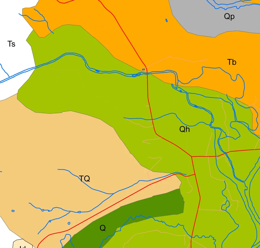
Dolerite and topographic contours from the regional geological map.
Water resourcesRichmond, Tasmania
Richmond vineyard bore prospects
Client KMR drilling client
HGEC reviewed the groundwater potential at a vineyard near Richmond. The study used existing geological and groundwater records to inform decisions about drilling for an additional water supply.
Further information about Richmond vineyard bore prospects
Project enquiry
Richmond vineyard bore prospects
HGEC reviewed the groundwater potential at a vineyard near Richmond. The study used existing geological and groundwater records to inform decisions about drilling for an additional water supply.
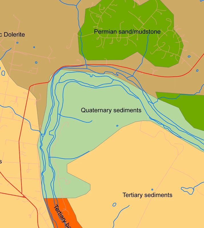
Mapped dolerite and recent sediments in the Little Swanport district.
Water resourcesLittle Swanport, Tasmania
Little Swanport pre-drilling review
Client KMR drilling client
HGEC assessed groundwater prospects before drilling at Little Swanport. The report brought together local geological information and available bore evidence for the landholder and drilling contractor.
Further information about Little Swanport pre-drilling review
Project enquiry
Little Swanport pre-drilling review
HGEC assessed groundwater prospects before drilling at Little Swanport. The report brought together local geological information and available bore evidence for the landholder and drilling contractor.
Geological mapping used in the Maiden Gully planning assessment.
Water resourcesMaiden Gully, Victoria
Maiden Gully planning overlay assessment
Client Villawood Investments Ltd
HGEC examined groundwater conditions at a development site within an environmental significance overlay. The assessment supplied hydrogeological information for the planning review at Maiden Gully.
Further information about Maiden Gully planning overlay assessment
Project enquiry
Maiden Gully planning overlay assessment
HGEC examined groundwater conditions at a development site within an environmental significance overlay. The assessment supplied hydrogeological information for the planning review at Maiden Gully.
Geology and surface drainage at the Montville study site.
Water resourcesMontville, Queensland
Montville springwater assessment
Client Springwater property owners
HGEC reviewed surface water and groundwater at a springwater property near Montville. The preliminary assessment brought the available evidence together to help the landholders understand the site’s water resources.
Further information about Montville springwater assessment
Project enquiry
Montville springwater assessment
HGEC reviewed surface water and groundwater at a springwater property near Montville. The preliminary assessment brought the available evidence together to help the landholders understand the site’s water resources.
Bores and geological units around the Mount Seymour site.
Water resourcesMount Seymour, Tasmania
Mount Seymour groundwater enquiry
Client Private landholder
HGEC reviewed groundwater prospects for the Mount Seymour property. The pre-drilling report described the area’s groundwater setting and the evidence available to inform decisions about bore construction.
Further information about Mount Seymour groundwater enquiry
Project enquiry
Mount Seymour groundwater enquiry
HGEC reviewed groundwater prospects for the Mount Seymour property. The pre-drilling report described the area’s groundwater setting and the evidence available to inform decisions about bore construction.
Geology and nearby bores in the Ross area.
Water resourcesRoss, Tasmania
Ross pre-drilling groundwater enquiry
Client Private landholder
HGEC prepared a pre-drilling assessment for a property near Ross. The report reviewed groundwater prospects and the information available for planning a bore at the site.
Further information about Ross pre-drilling groundwater enquiry
Project enquiry
Ross pre-drilling groundwater enquiry
HGEC prepared a pre-drilling assessment for a property near Ross. The report reviewed groundwater prospects and the information available for planning a bore at the site.
Geological map of the Spring Gully subdivision area.
Water resourcesSpring Gully, Victoria
Spring Gully subdivision assessment
Client Private development client
HGEC examined the hydrogeological setting of a proposed Spring Gully subdivision. The preliminary site assessment supplied groundwater information for consideration during development planning.
Further information about Spring Gully subdivision assessment
Project enquiry
Spring Gully subdivision assessment
HGEC examined the hydrogeological setting of a proposed Spring Gully subdivision. The preliminary site assessment supplied groundwater information for consideration during development planning.
Geological units mapped around the St Marys assessment site.
Water resourcesSt Marys, Tasmania
St Marys groundwater enquiry
Client Private client acting for the landholder
HGEC reviewed the available groundwater information for a property at St Marys. The report supported early investigation of local conditions before drilling for a water supply.
Further information about St Marys groundwater enquiry
Project enquiry
St Marys groundwater enquiry
HGEC reviewed the available groundwater information for a property at St Marys. The report supported early investigation of local conditions before drilling for a water supply.
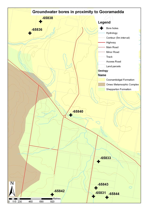
Mapped bores in the Gooramadda area.
Water resourcesGooramadda, Victoria
Gooramadda reserve bore assessment
Client Indigo Shire Council
HGEC assessed the potential for a water supply bore at a public reserve in Gooramadda. The report compiled groundwater information for council before further drilling decisions.
Further information about Gooramadda reserve bore assessment
Project enquiry
Gooramadda reserve bore assessment
HGEC assessed the potential for a water supply bore at a public reserve in Gooramadda. The report compiled groundwater information for council before further drilling decisions.
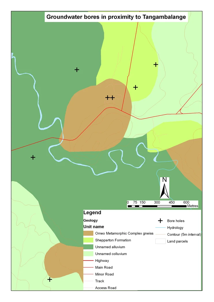
Groundwater bores and mapped geological units around Tangambalanga.
Water resourcesTangambalanga, Victoria
Coulston Park bore assessment
Client Indigo Shire Council
HGEC investigated groundwater prospects for a bore at Coulston Park. The review gave council a preliminary assessment of groundwater conditions at the reserve before committing to drilling.
Further information about Coulston Park bore assessment
Project enquiry
Coulston Park bore assessment
HGEC investigated groundwater prospects for a bore at Coulston Park. The review gave council a preliminary assessment of groundwater conditions at the reserve before committing to drilling.
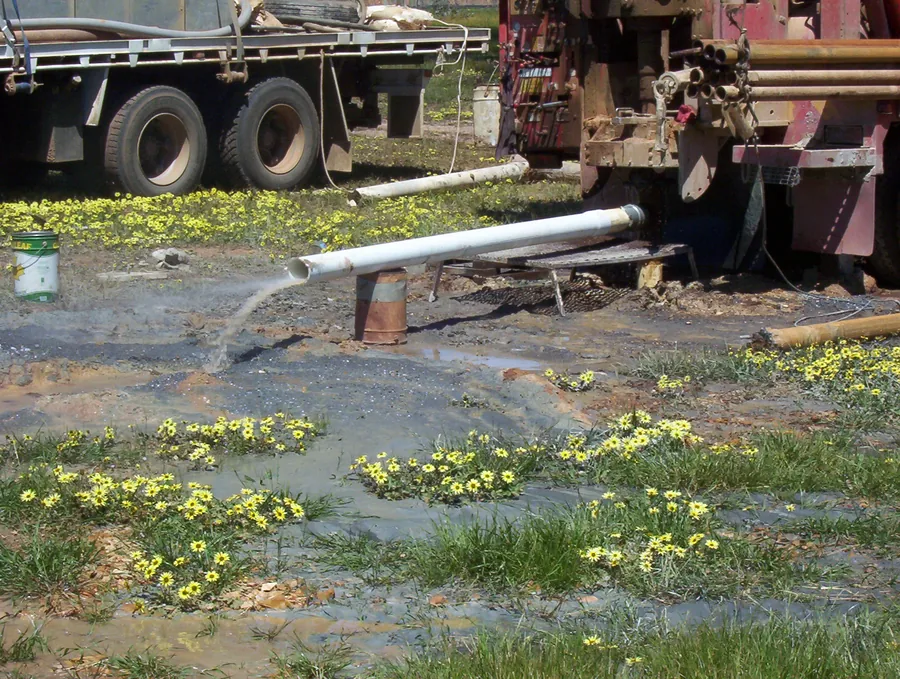
Discharge from groundwater pumping equipment at Balgownie Vineyard.
Water resourcesBendigo district, Victoria
Balgownie Vineyard bore testing
Client Balgownie Vineyard
HGEC reported on groundwater drilling and pumping tests at Balgownie Vineyard. The work documented bore construction and the response to pumping to inform the vineyard’s water supply decisions.
Further information about Balgownie Vineyard bore testing
Project enquiry
Balgownie Vineyard bore testing
HGEC reported on groundwater drilling and pumping tests at Balgownie Vineyard. The work documented bore construction and the response to pumping to inform the vineyard’s water supply decisions.
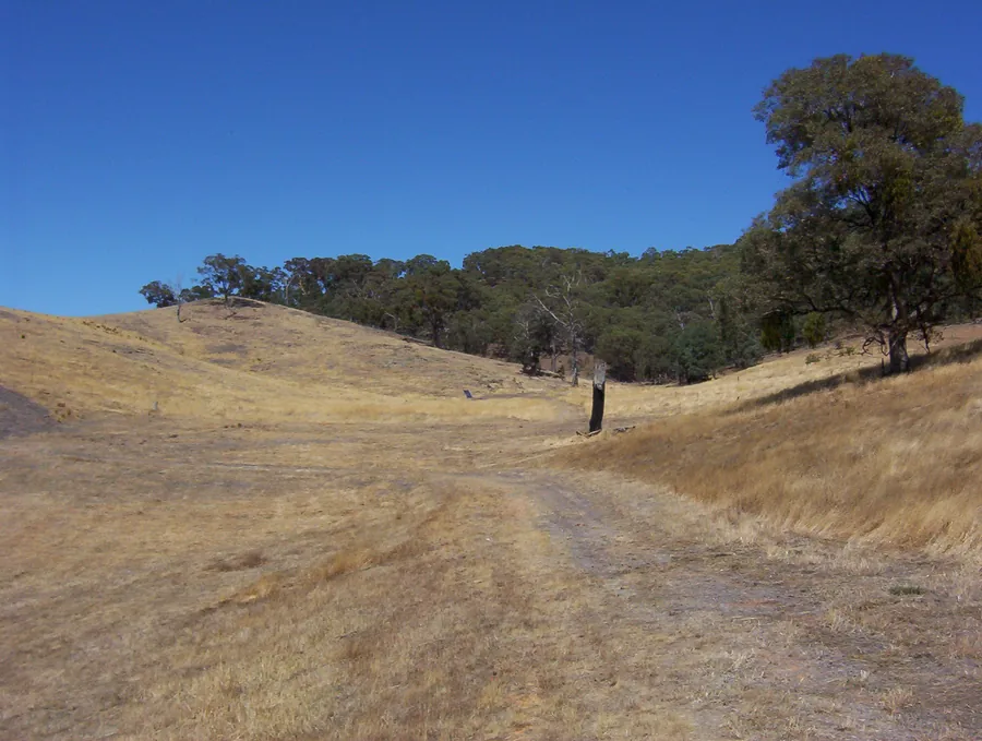
Dry vineyard slopes at the Glenlofty bore site.
Water resourcesGlenlofty, Victoria
Glenlofty Vineyard bore testing
Client FAA Pty Ltd
HGEC analysed groundwater drilling and pumping tests for Glenlofty Vineyard. The report documented construction by the drilling contractor and examined how the completed bore performed during testing.
Further information about Glenlofty Vineyard bore testing
Project enquiry
Glenlofty Vineyard bore testing
HGEC analysed groundwater drilling and pumping tests for Glenlofty Vineyard. The report documented construction by the drilling contractor and examined how the completed bore performed during testing.
Site mapping from the Cullenswood basin investigation.
Water resourcesCullenswood, Tasmania
Cullenswood basin suitability review
Client Private landholder
HGEC investigated the groundwater setting at Cullenswood in a desktop review of basin suitability. The report compiled local groundwater information to support the property owner’s assessment of the proposed site.
Further information about Cullenswood basin suitability review
Project enquiry
Cullenswood basin suitability review
HGEC investigated the groundwater setting at Cullenswood in a desktop review of basin suitability. The report compiled local groundwater information to support the property owner’s assessment of the proposed site.
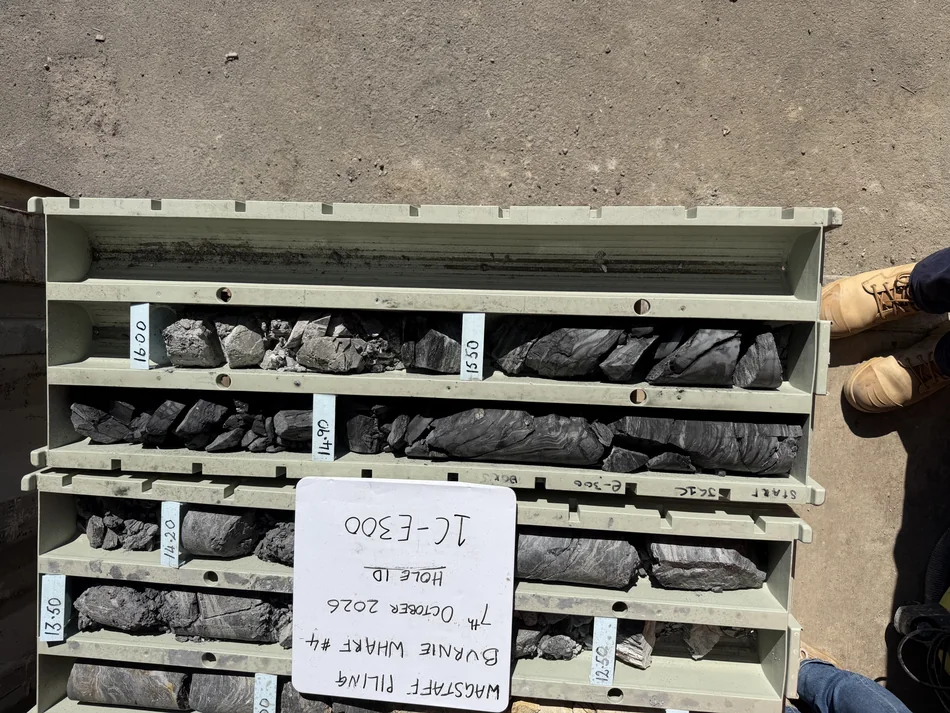
Core samples in a labelled tray from the Burnie Wharf grout verification works.
InfrastructureBurnie, Tasmania
Burnie Wharf grout verification
ClientBill Cromer for Wagstaff Ground Improvement Pty Ltd
At Berth 4, we logged cores from five boreholes drilled to check the jet grouting. Another subconsultant logged seven boreholes, and Bill Cromer incorporated both sets of results into the engineering geological assessment.
Further information about Burnie Wharf grout verification
Project enquiry
Burnie Wharf grout verification
At Berth 4, we logged cores from five boreholes drilled to check the jet grouting. Another subconsultant logged seven boreholes, and Bill Cromer incorporated both sets of results into the engineering geological assessment.
Fieldwork documented in the Snug Beach coastal groundwater study.
CoastsSnug, Tasmania
Snug Beach coastal groundwater monitoring
Client Kingborough Council
Repeated monitoring at Snug Beach recorded changes in shallow groundwater within the coastal sediments. For Kingborough Council’s Vulnerable Coasts project, we reported on those changes with Bill Cromer and a fellow consultant.
Further information about Snug Beach coastal groundwater monitoring
Project enquiry
Snug Beach coastal groundwater monitoring
Repeated monitoring at Snug Beach recorded changes in shallow groundwater within the coastal sediments. For Kingborough Council’s Vulnerable Coasts project, we reported on those changes with Bill Cromer and a fellow consultant.
Study areas considered in the long-term watering plans for northern Victoria.
AdvisoryNorthern Victoria
Northern Victoria long-term watering plans
Client Environmental consulting practice for the Victorian Government
HGEC reviewed how existing long-term watering plans considered groundwater. The assessment identified where groundwater information and monitoring could be incorporated into updated plans for environmental watering in northern Victoria.
Further information about Northern Victoria long-term watering plans
Project enquiry
Northern Victoria long-term watering plans
HGEC reviewed how existing long-term watering plans considered groundwater. The assessment identified where groundwater information and monitoring could be incorporated into updated plans for environmental watering in northern Victoria.
Recorded depth to the watertable at the Tully landfill monitoring bores.
Water resourcesTully, Queensland
Tully landfill groundwater and leachate
Client CQG Consulting for Cassowary Coast Regional Council
HGEC interpreted groundwater monitoring at the Tully landfill, including ammonia, salinity and water levels. The review compared conditions at individual bores and identified where further chemical analysis would help interpret trends.
Further information about Tully landfill groundwater and leachate
Project enquiry
Tully landfill groundwater and leachate
HGEC interpreted groundwater monitoring at the Tully landfill, including ammonia, salinity and water levels. The review compared conditions at individual bores and identified where further chemical analysis would help interpret trends.
Waterlogged ground beside a building at the Tyabb property.
Water resourcesTyabb, Victoria
Tyabb property waterlogging investigation
Client Private landholder
HGEC inspected a Tyabb property to examine surface drainage, waterlogged soil and groundwater conditions. The investigation documented the factors relevant to persistent wet ground at the site.
Further information about Tyabb property waterlogging investigation
Project enquiry
Tyabb property waterlogging investigation
HGEC inspected a Tyabb property to examine surface drainage, waterlogged soil and groundwater conditions. The investigation documented the factors relevant to persistent wet ground at the site.
Basalt cavity in material supplied for the Wallan quarry assessment.
MiningWallan, Victoria
Wallan quarry recharge and salinity
Client Conundrum Holdings Pty Ltd
HGEC examined groundwater recharge and land salinity for the proposed quarry at Wallan. The technical appendix documented the mapped recharge setting and available salinity indicators around the work authority area.
Further information about Wallan quarry recharge and salinity
Project enquiry
Wallan quarry recharge and salinity
HGEC examined groundwater recharge and land salinity for the proposed quarry at Wallan. The technical appendix documented the mapped recharge setting and available salinity indicators around the work authority area.
Location map for the North Central groundwater flow systems study.
SalinityNorth-central Victoria
North Central groundwater flow system mapping
Client North Central Catchment Management Authority
HGEC mapped groundwater flow systems across the region managed by the catchment authority. The work examined how geology and landform influence groundwater behaviour and inform regional salinity management.
Further information about North Central groundwater flow system mapping
Project enquiry
North Central groundwater flow system mapping
HGEC mapped groundwater flow systems across the region managed by the catchment authority. The work examined how geology and landform influence groundwater behaviour and inform regional salinity management.
Discharge at Port Latta, documented in 2002. Photograph from Mineral Resources Tasmania, Tasmanian Geological Survey Record 2002/07, plate 1.
At the Port Latta waste depot, we inspected the groundwater and surface water monitoring network with Bill Cromer. Site history and council records helped us identify improvements to the network.
Further information about Port Latta waste depot monitoring review
Project enquiry
Port Latta waste depot monitoring review
At the Port Latta waste depot, we inspected the groundwater and surface water monitoring network with Bill Cromer. Site history and council records helped us identify improvements to the network.
Groundwater sampling equipment in a paddock at Legana.
MonitoringLegana, Tasmania
Legana wastewater reuse monitoring
Client AK Consultants for Ben Lomond Water
For the Legana wastewater reuse scheme, HGEC sampled groundwater in October 2011 and interpreted the chemistry. The results informed a monitoring report prepared through AK Consultants for Ben Lomond Water.
Further information about Legana wastewater reuse monitoring
Project enquiry
Legana wastewater reuse monitoring
For the Legana wastewater reuse scheme, HGEC sampled groundwater in October 2011 and interpreted the chemistry. The results informed a monitoring report prepared through AK Consultants for Ben Lomond Water.
Pumping equipment in the Cape Barren Island field investigation.
Groundwater investigationsCape Barren Island, Tasmania
HGEC supported a groundwater pumping test on Cape Barren Island and analysed the water-level response during pumping and recovery. The investigation recorded the behaviour of the tested bore over several days.
Further information about Cape Barren Island aquifer pumping test
Project enquiry
Cape Barren Island aquifer pumping test
HGEC supported a groundwater pumping test on Cape Barren Island and analysed the water-level response during pumping and recovery. The investigation recorded the behaviour of the tested bore over several days.
Bore response recorded during the 10th Legion permeability tests.
HGEC programmed and downloaded water-level loggers and analysed slug tests at the 10th Legion prospect. The bore results provided estimates of hydraulic conductivity and transmissivity for the tested intervals.
Further information about 10th Legion bore permeability testing
Project enquiry
10th Legion bore permeability testing
HGEC programmed and downloaded water-level loggers and analysed slug tests at the 10th Legion prospect. The bore results provided estimates of hydraulic conductivity and transmissivity for the tested intervals.
Monitoring bore in the sand excavation at Llanherne.
HGEC downloaded groundwater logger records at the Llanherne Sand Mine and contributed to reporting on the monitoring data. The work supported Bill Cromer’s groundwater investigations for the sand extraction operation.
Further information about Llanherne Sand Mine groundwater monitoring
Project enquiry
Llanherne Sand Mine groundwater monitoring
HGEC downloaded groundwater logger records at the Llanherne Sand Mine and contributed to reporting on the monitoring data. The work supported Bill Cromer’s groundwater investigations for the sand extraction operation.
Existing and proposed monitoring bores at Parramatta Creek, Sassafras. Detail from the Macquarie Franklin monitoring plan.
HGEC reviewed groundwater monitoring data for Huon Aquaculture’s Sassafras operation and provided written advice. Bill Cromer commissioned the work as part of advice to Macquarie Franklin.
Further information about Sassafras aquaculture groundwater monitoring advice
HGEC reviewed groundwater monitoring data for Huon Aquaculture’s Sassafras operation and provided written advice. Bill Cromer commissioned the work as part of advice to Macquarie Franklin.
Geological units and drainage near Bushy Park.
Groundwater investigationsBushy Park, Tasmania
Bushy Park bore enquiry
Client KMR drilling client
HGEC prepared a desktop groundwater enquiry for a proposed bore at Bushy Park. The report reviewed the local groundwater setting and provided preliminary guidance for the drilling enquiry.
Further information about Bushy Park bore enquiry
Project enquiry
Bushy Park bore enquiry
HGEC prepared a desktop groundwater enquiry for a proposed bore at Bushy Park. The report reviewed the local groundwater setting and provided preliminary guidance for the drilling enquiry.
Geological units and the river corridor near Perth, Tasmania.
Groundwater investigationsPerth, Tasmania
Perth bore enquiry
Client KMR drilling client
HGEC reviewed groundwater prospects for a property near Perth as part of a pre-drilling enquiry. The assessment provided KMR Drilling with site-specific advice about the local groundwater setting.
Further information about Perth bore enquiry
Project enquiry
Perth bore enquiry
HGEC reviewed groundwater prospects for a property near Perth as part of a pre-drilling enquiry. The assessment provided KMR Drilling with site-specific advice about the local groundwater setting.
Vertosol soils and the extent of the Condamine floodplain in the research study area.
How quickly do groundwater levels respond to recharge through Vertosols? As part of research into uncertainty in groundwater impact predictions, we used impulse-response modelling to estimate the time involved.
Further information about Vertosol recharge and groundwater response times
Project enquiry
Vertosol recharge and groundwater response times
How quickly do groundwater levels respond to recharge through Vertosols? As part of research into uncertainty in groundwater impact predictions, we used impulse-response modelling to estimate the time involved.
Study area mapping from the North Central wetland watering plans review.
Environmental waterNorth-central Victoria
North Central wetland watering plans review
Client Water’s Edge Consulting for North Central Catchment Management Authority
For wetlands across north-central Victoria, HGEC reviewed the groundwater aspects of environmental water management plans. The work included site visits, a scientific workshop and advice on monitoring groundwater.
Further information about North Central wetland watering plans review
Project enquiry
North Central wetland watering plans review
For wetlands across north-central Victoria, HGEC reviewed the groundwater aspects of environmental water management plans. The work included site visits, a scientific workshop and advice on monitoring groundwater.
Drilling at Andersons Bay, pictured in the 2016 groundwater review by Bill Cromer
HGEC supported groundwater investigations for proposed sand extraction at Andersons Bay. The work contributed regional groundwater modelling information to Bill Cromer’s review of the sustainability of groundwater use.
Further information about Andersons Bay sand extraction groundwater review
Project enquiry
Andersons Bay sand extraction groundwater review
HGEC supported groundwater investigations for proposed sand extraction at Andersons Bay. The work contributed regional groundwater modelling information to Bill Cromer’s review of the sustainability of groundwater use.
The project compared two groundwater flow system maps in the Loddon catchment.
Groundwater modellingAustralia
Regolith groundwater flow system modelling
Client Geoscience Australia
HGEC completed two stages of hydrogeological modelling for Geoscience Australia. The work used groundwater flow system map data developed through the Cooperative Research Centre for Landscape Environments and Mineral Exploration.
Further information about Regolith groundwater flow system modelling
Project enquiry
Regolith groundwater flow system modelling
HGEC completed two stages of hydrogeological modelling for Geoscience Australia. The work used groundwater flow system map data developed through the Cooperative Research Centre for Landscape Environments and Mineral Exploration.
Drillers beside a rig during the Upper Wimmera granite aquifer investigation.
Groundwater investigationsWimmera, Victoria
Upper Wimmera granite pumping trial
Client Wimmera Catchment Management Authority
In the Upper Wimmera, we selected and drilled trial sites in fractured granite. A 2008 follow-up for the Wimmera Catchment Management Authority examined pumping rates, groundwater levels and salinity.
Further information about Upper Wimmera granite pumping trial
Project enquiry
Upper Wimmera granite pumping trial
In the Upper Wimmera, we selected and drilled trial sites in fractured granite. A 2008 follow-up for the Wimmera Catchment Management Authority examined pumping rates, groundwater levels and salinity.
Groundwater monitoring bores in pasture at Wynyard.
Groundwater investigationsWynyard, Tasmania
Wynyard wastewater monitoring bores
Client Serve-Ag for Fonterra
HGEC prepared the groundwater drilling report for Fonterra’s Wynyard site. Serve-Ag commissioned the report to document the groundwater drilling work undertaken at the north-west Tasmanian facility.
Further information about Wynyard wastewater monitoring bores
Project enquiry
Wynyard wastewater monitoring bores
HGEC prepared the groundwater drilling report for Fonterra’s Wynyard site. Serve-Ag commissioned the report to document the groundwater drilling work undertaken at the north-west Tasmanian facility.
Regional context from Mark Hocking's 2008 groundwater benchmarking proposal. The map shows the proposed irrigation area and its existing monitoring bores.
Groundwater modellingMidlands, Tasmania
Midlands irrigation groundwater impact modelling
Client Tasmanian Department of Primary Industries, Parks, Water and Environment
HGEC used the Tasmanian Catchment Analysis Tool groundwater model to assess the potential effects of proposed irrigation in the Midlands. The department commissioned the modelling for the irrigation proposal.
Further information about Midlands irrigation groundwater impact modelling
Project enquiry
Midlands irrigation groundwater impact modelling
HGEC used the Tasmanian Catchment Analysis Tool groundwater model to assess the potential effects of proposed irrigation in the Midlands. The department commissioned the modelling for the irrigation proposal.
Salinity during step testing at the Salvation Hill bore. The graph is from the 2009 Desaln8 assessment reviewed for Wimmera CMA.
SalinityWimmera, Victoria
Salvation Hill salinity proposal review
Client Wimmera Catchment Management Authority
HGEC reviewed the Dsaln8 proposal for Salvation Hill on behalf of the Wimmera Catchment Management Authority. The assignment provided the authority with a technical review of the proposed salinity work.
Further information about Salvation Hill salinity proposal review
Project enquiry
Salvation Hill salinity proposal review
HGEC reviewed the Dsaln8 proposal for Salvation Hill on behalf of the Wimmera Catchment Management Authority. The assignment provided the authority with a technical review of the proposed salinity work.
Regional geological units and drainage in the Broadmarsh district.
Groundwater investigationsBroadmarsh, Tasmania
Broadmarsh pre-drilling investigation
Client KMR drilling client
HGEC prepared a pre-drilling report for a property at Broadmarsh and subsequently provided additional groundwater information. The investigation reviewed the local geology and groundwater setting to inform drilling decisions.
Further information about Broadmarsh pre-drilling investigation
Project enquiry
Broadmarsh pre-drilling investigation
HGEC prepared a pre-drilling report for a property at Broadmarsh and subsequently provided additional groundwater information. The investigation reviewed the local geology and groundwater setting to inform drilling decisions.
Regional geology and groundwater bores in northern Bruny Island.
Groundwater investigationsBruny Island, Tasmania
Bruny Island groundwater drilling prospects
Client KMR drilling client
HGEC compared Bruny Island’s geology with available groundwater quality records to identify formations with prospects for a moderate-yield, low-salinity bore. The desktop review informed selection of potential drilling sites.
Further information about Bruny Island groundwater drilling prospects
Project enquiry
Bruny Island groundwater drilling prospects
HGEC compared Bruny Island’s geology with available groundwater quality records to identify formations with prospects for a moderate-yield, low-salinity bore. The desktop review informed selection of potential drilling sites.
Change in measured groundwater level from the start of a 48-hour monitoring record.
MonitoringTasmania
Industrial monitoring bore measurements
Client KMR drilling client
HGEC supplied water-level and barometric loggers and provided support for groundwater measurements at an industrial site. The contractor used the monitoring equipment during a month-long field program.
Further information about Industrial monitoring bore measurements
Project enquiry
Industrial monitoring bore measurements
HGEC supplied water-level and barometric loggers and provided support for groundwater measurements at an industrial site. The contractor used the monitoring equipment during a month-long field program.
Mapped regional groundwater flow systems in the Dunalley district.
Groundwater investigationsDunalley, Tasmania
Dunalley pre-drilling review
Client KMR drilling client
HGEC reviewed surface geology, potential deeper aquifers and nearby bore records for a proposed bore at Dunalley. The desktop assessment provided preliminary guidance on the local groundwater setting.
Further information about Dunalley pre-drilling review
Project enquiry
Dunalley pre-drilling review
HGEC reviewed surface geology, potential deeper aquifers and nearby bore records for a proposed bore at Dunalley. The desktop assessment provided preliminary guidance on the local groundwater setting.
Soil excavation and sample bags at the Bendigo subdivision site.
SalinityBendigo, Victoria
Bendigo subdivision salinity assessment
Client Private subdivision client
Soil samples showed high surface salinity on a proposed subdivision. We compared the soil profile, drainage and nearby bore records to distinguish local waterlogging from a shallow regional water table.
Further information about Bendigo subdivision salinity assessment
Project enquiry
Bendigo subdivision salinity assessment
Soil samples showed high surface salinity on a proposed subdivision. We compared the soil profile, drainage and nearby bore records to distinguish local waterlogging from a shallow regional water table.
Water collected in the Mount Drummond quarry excavation.
MiningStawell, Victoria
Mount Drummond quarry hydrogeology
Client Conundrum Holdings Pty Ltd
How do the workings at Mount Drummond quarry interact with the aquifer? Our investigation described the local geology and groundwater conditions to help the operator understand that connection.
Further information about Mount Drummond quarry hydrogeology
Project enquiry
Mount Drummond quarry hydrogeology
How do the workings at Mount Drummond quarry interact with the aquifer? Our investigation described the local geology and groundwater conditions to help the operator understand that connection.
Discharge pipe at a water-filled rock excavation at Tylden.
MiningTylden, Victoria
Tylden quarry water level assessment
Client Tylden Quarries Pty Ltd
What water level could the operator expect in the final excavation at Tylden Quarry? We combined quarry geometry, local geology and available groundwater information in a conceptual model to estimate it.
Further information about Tylden quarry water level assessment
Project enquiry
Tylden quarry water level assessment
What water level could the operator expect in the final excavation at Tylden Quarry? We combined quarry geometry, local geology and available groundwater information in a conceptual model to estimate it.
Agricultural land in an aerial image from the North Central catchment model report.
Water resourcesNorth Central Victoria
North Central catchment groundwater model
Client Victorian Government
The Victorian Government’s ecoMarkets program needed a picture of how aquifers in the North Central catchment behaved over time. We built a transient groundwater model to represent those regional changes.
Further information about North Central catchment groundwater model
Project enquiry
North Central catchment groundwater model
The Victorian Government’s ecoMarkets program needed a picture of how aquifers in the North Central catchment behaved over time. We built a transient groundwater model to represent those regional changes.
Elevation across the North East Greenhouse Alliance water availability study area.
Water resourcesNorth East Victoria
North East Victoria water availability
Client North East Greenhouse Alliance
Alpine resorts and communities in north-eastern Victoria were planning for changes in water availability. We linked surface water and groundwater models to compare possible future supplies under different climate scenarios.
Further information about North East Victoria water availability
Project enquiry
North East Victoria water availability
Alpine resorts and communities in north-eastern Victoria were planning for changes in water availability. We linked surface water and groundwater models to compare possible future supplies under different climate scenarios.
Modelled depth to the watertable across the Whitemore irrigation study area.
Water resourcesWhitemore, Tasmania
Whitemore irrigation land suitability
Scheme client Tasmanian Irrigation Development Board (study led by AK Consultants)
Groundwater flow-system maps and simulations of watertable depth informed the Whitemore land suitability assessment. Our contribution examined where increased irrigation could worsen waterlogging or affect ecosystems that depend on groundwater.
Further information about Whitemore irrigation land suitability
Project enquiry
Whitemore irrigation land suitability
Groundwater flow-system maps and simulations of watertable depth informed the Whitemore land suitability assessment. Our contribution examined where increased irrigation could worsen waterlogging or affect ecosystems that depend on groundwater.
Groundwater monitoring bores in the mapped Wimmera flow systems.
SalinityWimmera, Victoria
Wimmera salinity treatment effectiveness
Client Wimmera Catchment Management Authority
For its 2012 assessment, the catchment authority wanted to know how well salinity treatments had worked across the Wimmera. Our review brought together groundwater and surface water monitoring records.
Further information about Wimmera salinity treatment effectiveness
Project enquiry
Wimmera salinity treatment effectiveness
For its 2012 assessment, the catchment authority wanted to know how well salinity treatments had worked across the Wimmera. Our review brought together groundwater and surface water monitoring records.
Groundwater drilling rig at the Upper Hopkins pumping investigation.
Could pumping from fractured granite help manage dryland salinity in the Upper Hopkins? Field investigations examined potential extraction sites and assessed how much groundwater the rock could supply.
Further information about Upper Hopkins granite pumping feasibility
Project enquiry
Upper Hopkins granite pumping feasibility
Could pumping from fractured granite help manage dryland salinity in the Upper Hopkins? Field investigations examined potential extraction sites and assessed how much groundwater the rock could supply.
Aerial photograph from the Natimuk Lake outlet assessment.
Water resourcesNatimuk, Victoria
Natimuk Lake outlet excavation
Client Natimuk Lake Foreshore Committee
An outlet weir at Natimuk Lake needed to preserve the layer separating the lake from the saline Parilla Sand aquifer. We reviewed lake-bed layers and groundwater levels to advise on excavation depth.
Further information about Natimuk Lake outlet excavation
Project enquiry
Natimuk Lake outlet excavation
An outlet weir at Natimuk Lake needed to preserve the layer separating the lake from the saline Parilla Sand aquifer. We reviewed lake-bed layers and groundwater levels to advise on excavation depth.
Aerial photograph from the Upper Wimmera salinity action plan study.
SalinityUpper Wimmera, Victoria
Upper Wimmera salinity action plan modelling
Client Wimmera Catchment Management Authority
Monitoring bore records helped us calibrate a model of the Upper Wimmera water balance. We used it to assess how land management changes under the regional salinity action plan could affect the catchment.
Further information about Upper Wimmera salinity action plan modelling
Project enquiry
Upper Wimmera salinity action plan modelling
Monitoring bore records helped us calibrate a model of the Upper Wimmera water balance. We used it to assess how land management changes under the regional salinity action plan could affect the catchment.
Field drilling rig at the Heifer Station Creek study site.
Water resourcesUpper Wimmera, Victoria
Heifer Station Creek land-use assessment
Client Wimmera Catchment Management Authority
In the Heifer Station Creek catchment, we investigated how groundwater might respond to changes in land use. The assessment drew on local hydrogeology to inform catchment management.
Further information about Heifer Station Creek land-use assessment
Project enquiry
Heifer Station Creek land-use assessment
In the Heifer Station Creek catchment, we investigated how groundwater might respond to changes in land use. The assessment drew on local hydrogeology to inform catchment management.
Water-level scale boards from the Lake Wallace and Mosquito Creek study.
Water resourcesSouth West Wimmera, Victoria
Lake Wallace and Mosquito Creek surface water
Client Wimmera Catchment Management Authority
How does land use influence the water that reaches local waterways and wetlands? We examined surface water movement through the Lake Wallace and Mosquito Creek catchments to investigate that question.
Further information about Lake Wallace and Mosquito Creek surface water
Project enquiry
Lake Wallace and Mosquito Creek surface water
How does land use influence the water that reaches local waterways and wetlands? We examined surface water movement through the Lake Wallace and Mosquito Creek catchments to investigate that question.
Monitoring installations in a Wimmera paddock.
SalinityWimmera, Victoria
Wimmera baseline salinity network
Client Wimmera Catchment Management Authority
Which Wimmera bores best track regional salinity over time? A review of the catchment network identified sites for baseline monitoring and distinguished them from bores used to assess individual management actions.
Further information about Wimmera baseline salinity network
Project enquiry
Wimmera baseline salinity network
Which Wimmera bores best track regional salinity over time? A review of the catchment network identified sites for baseline monitoring and distinguished them from bores used to assess individual management actions.
Fields and mature trees from the Millicent Coast land-use investigation.
SalinityWest Wimmera, Victoria
Millicent Coast land-use scenarios
Client Victorian Department of Primary Industries
In the Victorian part of the Millicent Coast basin, we compared land-use scenarios to examine how potential salinity management measures could affect groundwater at both local and regional scales.
Further information about Millicent Coast land-use scenarios
Project enquiry
Millicent Coast land-use scenarios
In the Victorian part of the Millicent Coast basin, we compared land-use scenarios to examine how potential salinity management measures could affect groundwater at both local and regional scales.
Saline wetland landscape in the Tyrrell Basin.
SalinityTyrrell Basin, Victoria
Tyrrell Basin groundwater flow systems
Client Salient Solutions Australia for Mallee Catchment Management Authority
Groundwater moving beneath the Tyrrell Basin contributes to dryland salinity. The project team reviewed earlier investigations and developed conceptual models to explain how flow varies across the landscape.
Further information about Tyrrell Basin groundwater flow systems
Project enquiry
Tyrrell Basin groundwater flow systems
Groundwater moving beneath the Tyrrell Basin contributes to dryland salinity. The project team reviewed earlier investigations and developed conceptual models to explain how flow varies across the landscape.
Victorian Mallee. Regional landscape.
AdvisoryVictorian Mallee
Mallee hydrogeological expert panel
Client Mallee Catchment Management Authority
As part of the expert panel for the Mallee Catchment Management Authority, we reviewed maps of saline land and advised on groundwater monitoring proposals and program development.
Further information about Mallee hydrogeological expert panel
Project enquiry
Mallee hydrogeological expert panel
As part of the expert panel for the Mallee Catchment Management Authority, we reviewed maps of saline land and advised on groundwater monitoring proposals and program development.
Practical field activity during the Mallee ecology course.
AdvisoryWalpeup, Victoria
Mallee field ecology course
Client Mallee Catchment Management Authority
At the Walpeup field course, Mark demonstrated to participants how to interpret soils and landforms in the Mallee landscape. Field sessions linked observations at individual sites to broader biodiversity and land management questions.
Further information about Mallee field ecology course
Project enquiry
Mallee field ecology course
At the Walpeup field course, Mark demonstrated to participants how to interpret soils and landforms in the Mallee landscape. Field sessions linked observations at individual sites to broader biodiversity and land management questions.
Field team inspecting tussock-covered ground at Curringa.
SalinityTasmania
Tasmanian farm salinity management plans
Client NRM North
Working with AK Consultants and ARM in 2008–09, HGEC prepared 41 farm salinity plans for NRM North. Field inspections informed recommendations for managing waterlogging, salt-affected soils and groundwater monitoring on individual farms.
Further information about Tasmanian farm salinity management plans
Project enquiry
Tasmanian farm salinity management plans
Working with AK Consultants and ARM in 2008–09, HGEC prepared 41 farm salinity plans for NRM North. Field inspections informed recommendations for managing waterlogging, salt-affected soils and groundwater monitoring on individual farms.
Depth to the water table in the Latrobe Valley, from the Gippsland Basin modelling project.
Groundwater modellingGippsland, Victoria
Gippsland Basin energy and groundwater model
Client Victorian Government
An 18-layer model helped assess how energy and earth resource development could affect water resources in the Gippsland Basin. HGEC collated hydrogeological data and helped develop and calibrate the model.
Further information about Gippsland Basin energy and groundwater model
Project enquiry
Gippsland Basin energy and groundwater model
An 18-layer model helped assess how energy and earth resource development could affect water resources in the Gippsland Basin. HGEC collated hydrogeological data and helped develop and calibrate the model.
Study area of the original Northern Victoria groundwater model within the Murray-Darling Basin.
Groundwater modellingVictoria and New South Wales
Murray–Darling Basin cross-border groundwater model
Client Victorian Government
HGEC extended hydrogeological data layers into New South Wales and reviewed how aquifers were represented across the model area. The work included delivery of steady-state and transient groundwater models.
Further information about Murray–Darling Basin cross-border groundwater model
Project enquiry
Murray–Darling Basin cross-border groundwater model
HGEC extended hydrogeological data layers into New South Wales and reviewed how aquifers were represented across the model area. The work included delivery of steady-state and transient groundwater models.
The Calivil Formation layer of the groundwater model, shown at the Lower Campaspe Valley workshop.
Water resourcesTatura, Victoria
Lower Campaspe Valley groundwater workshop
Client Goulburn-Murray Water
At a Lower Campaspe Valley workshop, HGEC presented results from regional groundwater models. The presentation compared catchment water balances and examined the exchange of water between the Murray River and underlying aquifers.
Further information about Lower Campaspe Valley groundwater workshop
Project enquiry
Lower Campaspe Valley groundwater workshop
At a Lower Campaspe Valley workshop, HGEC presented results from regional groundwater models. The presentation compared catchment water balances and examined the exchange of water between the Murray River and underlying aquifers.
West Creek valley looking east-northeast towards the proposed Nelson Bay River mine, as shown in the 2011 assessment.
HGEC estimated hydraulic conductivity, catchment rainfall and groundwater inflow to the proposed mine pit. The calculations supported Bill Cromer’s hydrogeological investigation of the Nelson Bay River site.
Further information about Nelson Bay River mine inflow estimates
Project enquiry
Nelson Bay River mine inflow estimates
HGEC estimated hydraulic conductivity, catchment rainfall and groundwater inflow to the proposed mine pit. The calculations supported Bill Cromer’s hydrogeological investigation of the Nelson Bay River site.
Groundwater bore at the Devonport mill, photographed for the 2011 sustainability assessment.
HGEC mapped contributing subcatchments and estimated groundwater recharge to assess the sustainability of extraction at a Devonport textile mill. The work supported Bill Cromer’s assessment for Australian Weaving Mills.
Further information about Devonport mill groundwater sustainability
Project enquiry
Devonport mill groundwater sustainability
HGEC mapped contributing subcatchments and estimated groundwater recharge to assess the sustainability of extraction at a Devonport textile mill. The work supported Bill Cromer’s assessment for Australian Weaving Mills.
Water-level responses during testing of monitoring bore MW1 at Leslie Vale quarry.
At Leslie Vale quarry, HGEC analysed water-level changes following slug tests in two monitoring bores. The results supplied hydraulic conductivity estimates for the intervals screened by the bores.
Further information about Leslie Vale quarry aquifer testing
Project enquiry
Leslie Vale quarry aquifer testing
At Leslie Vale quarry, HGEC analysed water-level changes following slug tests in two monitoring bores. The results supplied hydraulic conductivity estimates for the intervals screened by the bores.
Conceptual cross-section from the Aurukun groundwater desktop assessment.
MiningCape York, Queensland
Aurukun groundwater desktop assessment
Client Aus-Pac Capital
For the Aurukun project, HGEC prepared a desktop assessment of regional groundwater conditions. The assessment brought together existing geological mapping, drainage and rainfall information to describe the hydrogeological setting.
Further information about Aurukun groundwater desktop assessment
Project enquiry
Aurukun groundwater desktop assessment
For the Aurukun project, HGEC prepared a desktop assessment of regional groundwater conditions. The assessment brought together existing geological mapping, drainage and rainfall information to describe the hydrogeological setting.
Kaolin-rich clay in weathered sediments near Campbell Town. Photograph by Mark Hocking, 2008.
SalinityTasmania
Tasmanian salinity field guide
Client NRM North
HGEC prepared the geology and groundwater section of a Tasmanian salinity field guide for NRM North. The contribution explained how local geological conditions influence groundwater movement and salinity.
Further information about Tasmanian salinity field guide
Project enquiry
Tasmanian salinity field guide
HGEC prepared the geology and groundwater section of a Tasmanian salinity field guide for NRM North. The contribution explained how local geological conditions influence groundwater movement and salinity.
The workshop used this photograph of bare ground to illustrate severe salinity in the Mallee.
SalinityVictorian Mallee
Kooloonong–Natya landcare groundwater workshop
Client Victorian Government
At a workshop for the Kooloonong–Natya Landcare Group, HGEC presented the groundwater setting of the Victorian Mallee. The session supported local discussion of groundwater and the region’s landscape.
Further information about Kooloonong–Natya landcare groundwater workshop
Project enquiry
Kooloonong–Natya landcare groundwater workshop
At a workshop for the Kooloonong–Natya Landcare Group, HGEC presented the groundwater setting of the Victorian Mallee. The session supported local discussion of groundwater and the region’s landscape.
Rosedale landfill monitoring locations in the project records. Original plan by Gladstone Regional Council and ATC Williams.
MonitoringGladstone region, Queensland
Gladstone regional landfill monitoring review
Client CQG Consulting
CQG commissioned HGEC to review technical information for former landfills around Gladstone. The review considered proposed groundwater monitoring locations at Bororen, Curtis Island, Miriam Vale and Rosedale.
Further information about Gladstone regional landfill monitoring review
Project enquiry
Gladstone regional landfill monitoring review
CQG commissioned HGEC to review technical information for former landfills around Gladstone. The review considered proposed groundwater monitoring locations at Bororen, Curtis Island, Miriam Vale and Rosedale.
Regional boundaries used in the Victorian Aquifer Framework update, with areas of exposed basement rock.
Groundwater modellingNorthern Victoria
Northern Victoria aquifer framework update
Client Victorian Government
HGEC revised aquifer layers for the Victorian Aquifer Framework, comparing bore stratigraphy with existing maps of northern Victoria. The updated datasets improved the geological representation available for regional groundwater modelling.
Further information about Northern Victoria aquifer framework update
Project enquiry
Northern Victoria aquifer framework update
HGEC revised aquifer layers for the Victorian Aquifer Framework, comparing bore stratigraphy with existing maps of northern Victoria. The updated datasets improved the geological representation available for regional groundwater modelling.
Salt-affected ground at Longford, Tasmania, used to teach salinity processes at the Australian Groundwater School.
AdvisoryHobart, Tasmania
Australian Groundwater School salinity session
Client National Centre for Groundwater Research and Training
At the 38th Australian Groundwater School in Hobart, HGEC delivered a session on salinity management. The presentation brought groundwater and catchment water-balance concepts into the course’s practical training program.
Further information about Australian Groundwater School salinity session
Project enquiry
Australian Groundwater School salinity session
At the 38th Australian Groundwater School in Hobart, HGEC delivered a session on salinity management. The presentation brought groundwater and catchment water-balance concepts into the course’s practical training program.
Grazing land shown in the Kaniva Landcare presentation on regional groundwater.
AdvisoryKaniva, Victoria
Kaniva Landcare groundwater presentation
Client Kaniva District Landcare
HGEC presented groundwater information to Kaniva District Landcare in October 2007. The session brought a practising hydrogeologist to Kaniva to discuss groundwater with the local land management group.
Further information about Kaniva Landcare groundwater presentation
Project enquiry
Kaniva Landcare groundwater presentation
HGEC presented groundwater information to Kaniva District Landcare in October 2007. The session brought a practising hydrogeologist to Kaniva to discuss groundwater with the local land management group.
A wet agricultural landscape pictured in the Wimmera World Wetlands Day forum presentation.
AdvisoryHorsham, Victoria
Wimmera World Wetlands Day presentation
Client Wimmera Catchment Management Authority
HGEC prepared and delivered a hydrogeology presentation for World Wetlands Day in Horsham. The Wimmera Catchment Management Authority commissioned the session for its February 2008 event.
Further information about Wimmera World Wetlands Day presentation
Project enquiry
Wimmera World Wetlands Day presentation
HGEC prepared and delivered a hydrogeology presentation for World Wetlands Day in Horsham. The Wimmera Catchment Management Authority commissioned the session for its February 2008 event.
A Mallee land-system example used in the 2010 environmental management workshops.
SalinityUnderbool and Lake Cullulleraine, Victoria
Mallee environmental management workshops
Client Victorian Government
At workshops in Underbool and Lake Cullulleraine, HGEC explained how Mallee geology and landforms affect salinity. Environmental management sessions connected landscape mapping with the movement of water and salt through farmland.
Further information about Mallee environmental management workshops
Project enquiry
Mallee environmental management workshops
At workshops in Underbool and Lake Cullulleraine, HGEC explained how Mallee geology and landforms affect salinity. Environmental management sessions connected landscape mapping with the movement of water and salt through farmland.
Baseline recharge volume by irrigation impact zone in the historical Mildura model.
Water resourcesMildura, Victoria
Mildura irrigation water trading
Client Victorian Government
HGEC calculated groundwater balances for Mildura’s high and low salinity impact zones and updated the project spreadsheets. The work supported the department’s assessment of water trading in the irrigation area.
Further information about Mildura irrigation water trading
Project enquiry
Mildura irrigation water trading
HGEC calculated groundwater balances for Mildura’s high and low salinity impact zones and updated the project spreadsheets. The work supported the department’s assessment of water trading in the irrigation area.
Groundwater monitoring bores in and around Lake Toolibin.
Groundwater modellingToolibin, Western Australia
Toolibin groundwater model
Client Victorian Government
At Toolibin, HGEC developed and recalibrated a groundwater model for a cooperative research project. The model examined recharge, evaporation and groundwater pumping in the catchment’s water balance.
Further information about Toolibin groundwater model
Project enquiry
Toolibin groundwater model
At Toolibin, HGEC developed and recalibrated a groundwater model for a cooperative research project. The model examined recharge, evaporation and groundwater pumping in the catchment’s water balance.
The Wild Duck Creek model used one 100 m layer, with aquifer properties varying by geology.
Groundwater modellingNorth-central Victoria
Bet Bet and Wild Duck Creek models
Client Victorian Government
HGEC developed groundwater models for the Upper Bet Bet and Wild Duck Creek catchments. The team prepared and checked hydrogeological layers to assess how changes in land use could affect groundwater.
Further information about Bet Bet and Wild Duck Creek models
Project enquiry
Bet Bet and Wild Duck Creek models
HGEC developed groundwater models for the Upper Bet Bet and Wild Duck Creek catchments. The team prepared and checked hydrogeological layers to assess how changes in land use could affect groundwater.
Four Avon–Richardson model structures produced different estimates of groundwater evaporation.
Groundwater modellingAvon–Richardson catchment, Victoria
Avon–Richardson aquifer model comparison
Client Victorian Government
Different assumptions about how aquifers connect can change a model’s predictions. HGEC built and calibrated groundwater models for the Avon–Richardson catchment to compare alternative ways of representing the aquifer system.
Further information about Avon–Richardson aquifer model comparison
Project enquiry
Avon–Richardson aquifer model comparison
Different assumptions about how aquifers connect can change a model’s predictions. HGEC built and calibrated groundwater models for the Avon–Richardson catchment to compare alternative ways of representing the aquifer system.
An observation bore beside a cultivated field during the Victorian sampling program.
MonitoringVictoria
Victorian observation bore sampling
Client Victorian Government
HGEC sampled six groundwater observation bores across Victoria for the department’s Chemical Standards group. Field records documented the bore locations and water levels alongside the sampling work.
Further information about Victorian observation bore sampling
Project enquiry
Victorian observation bore sampling
HGEC sampled six groundwater observation bores across Victoria for the department’s Chemical Standards group. Field records documented the bore locations and water levels alongside the sampling work.
Jeparit and the surrounding floodplain, shown as regional context for the pumping trial.
MonitoringJeparit, Victoria
Jeparit pumping trial monitoring
Client Wimmera Catchment Management Authority
At the Jeparit groundwater pumping trial, HGEC installed and downloaded water-level loggers for the catchment authority. The measurements tracked the response in observation bores during the trial.
Further information about Jeparit pumping trial monitoring
Project enquiry
Jeparit pumping trial monitoring
At the Jeparit groundwater pumping trial, HGEC installed and downloaded water-level loggers for the catchment authority. The measurements tracked the response in observation bores during the trial.
Groundwater flow systems and mapped salinity discharge across the Wimmera. Map by Wimmera Catchment Management Authority.
SalinityWimmera, Victoria
Wimmera groundwater flow system mapping method
Client Wimmera Catchment Management Authority
HGEC developed a method for mapping groundwater flow systems in the Wimmera. The report explained how to combine geology and landscape information into a consistent regional interpretation for salinity assessment.
Further information about Wimmera groundwater flow system mapping method
Project enquiry
Wimmera groundwater flow system mapping method
HGEC developed a method for mapping groundwater flow systems in the Wimmera. The report explained how to combine geology and landscape information into a consistent regional interpretation for salinity assessment.
Mitre Lake seen from Mount Arapiles, as shown during the Waterwatch field day.
AdvisoryWest Wimmera, Victoria
West Wimmera Waterwatch field day
Client Wimmera Catchment Management Authority
HGEC contributed to a West Wimmera Waterwatch tour and prepared teaching material on regional salinity. The presentation used local landscapes to explain how the water cycle affects salt in soils and waterways.
Further information about West Wimmera Waterwatch field day
Project enquiry
West Wimmera Waterwatch field day
HGEC contributed to a West Wimmera Waterwatch tour and prepared teaching material on regional salinity. The presentation used local landscapes to explain how the water cycle affects salt in soils and waterways.
A shallow watercourse near Edenhope, shown as regional context for the training.
AdvisoryEdenhope, Victoria
Edenhope groundwater flow systems training
Client Victorian Government
For a groundwater flow systems training session at Edenhope, HGEC prepared and presented an introduction to West Wimmera hydrogeology. The session used local groundwater conditions to explain how the regional flow systems work.
Further information about Edenhope groundwater flow systems training
Project enquiry
Edenhope groundwater flow systems training
For a groundwater flow systems training session at Edenhope, HGEC prepared and presented an introduction to West Wimmera hydrogeology. The session used local groundwater conditions to explain how the regional flow systems work.
The hillside assessed for bore siting on Bruny Island.
Groundwater investigationsBruny Island, Tasmania
Apollo Bay bore site assessment
Client KMR drilling client
Could fractured dolerite supply water at Apollo Bay? HGEC assessed alternative bore sites and set out drilling and casing objectives, with the choice of further sites depending on the yields encountered.
Further information about Apollo Bay bore site assessment
Project enquiry
Apollo Bay bore site assessment
Could fractured dolerite supply water at Apollo Bay? HGEC assessed alternative bore sites and set out drilling and casing objectives, with the choice of further sites depending on the yields encountered.
Further project records
Groundwater investigationsWoolnorth, Tasmania
Woolnorth farm groundwater prospects
Client TRT Pastoral Group
HGEC reviewed bore records, mapped geology and groundwater prospectivity at Heifer Block. The pre-drilling assessment helped TRT Pastoral Group consider where to investigate a groundwater supply for its Woolnorth property.
Further information about Woolnorth farm groundwater prospects
Project enquiry
Woolnorth farm groundwater prospects
HGEC reviewed bore records, mapped geology and groundwater prospectivity at Heifer Block. The pre-drilling assessment helped TRT Pastoral Group consider where to investigate a groundwater supply for its Woolnorth property.
MiningPort Alma and Bajool, Queensland
Port Alma and Bajool salt field rehabilitation
Client CQG Consulting for Cheetham Salt
HGEC contributed hydrogeological advice to rehabilitation and closure planning for the Port Alma and Bajool salt fields. The work considered groundwater occurrence, aquifers and their connections beneath the salt fields.
Further information about Port Alma and Bajool salt field rehabilitation
Project enquiry
Port Alma and Bajool salt field rehabilitation
HGEC contributed hydrogeological advice to rehabilitation and closure planning for the Port Alma and Bajool salt fields. The work considered groundwater occurrence, aquifers and their connections beneath the salt fields.
Environmental waterShoalwater Bay, Queensland
Shoalwater Bay groundwater-dependent ecosystems
Client CQG Consulting
HGEC provided specialist hydrogeological advice for an assessment of groundwater-dependent ecosystems at Shoalwater Bay. The work considered potential interactions between groundwater supply and ecosystems in the training area.
Further information about Shoalwater Bay groundwater-dependent ecosystems
Project enquiry
Shoalwater Bay groundwater-dependent ecosystems
HGEC provided specialist hydrogeological advice for an assessment of groundwater-dependent ecosystems at Shoalwater Bay. The work considered potential interactions between groundwater supply and ecosystems in the training area.
Groundwater modellingVictoria
EnSym basement geology mapping
Client Victorian Government
HGEC incorporated areas of exposed basement rock into EnSym for the Victorian Government. This spatial input helped represent where basement geology reaches the surface in the state’s environmental modelling system.
Further information about EnSym basement geology mapping
Project enquiry
EnSym basement geology mapping
HGEC incorporated areas of exposed basement rock into EnSym for the Victorian Government. This spatial input helped represent where basement geology reaches the surface in the state’s environmental modelling system.
Groundwater modellingSouth-west Victoria
South-west Victoria groundwater model development
Client Victorian Government
HGEC assembled hydrogeological maps, selected stream baseflow records and reviewed bore hydrographs for a south-west Victorian groundwater model. These datasets linked regional geology with observed changes in groundwater levels and streamflow.
Further information about South-west Victoria groundwater model development
Project enquiry
South-west Victoria groundwater model development
HGEC assembled hydrogeological maps, selected stream baseflow records and reviewed bore hydrographs for a south-west Victorian groundwater model. These datasets linked regional geology with observed changes in groundwater levels and streamflow.
Groundwater modellingWimmera and Mallee, Victoria
Wimmera–Mallee regional groundwater model
Client Victorian Government
For the Wimmera–Mallee model, HGEC represented bores, boundaries and weirs in a regional grid and tested calibration against watertable depth. The team incorporated revised recharge before handing the model to the department.
Further information about Wimmera–Mallee regional groundwater model
Project enquiry
Wimmera–Mallee regional groundwater model
For the Wimmera–Mallee model, HGEC represented bores, boundaries and weirs in a regional grid and tested calibration against watertable depth. The team incorporated revised recharge before handing the model to the department.
Groundwater investigationsMoonambel, Victoria
Taltarni vineyard bore site inspection
Client Taltarni Vineyards
HGEC inspected proposed bore sites at Taltarni Vineyards near Moonambel in March 2007. The field visit helped the vineyard consider prospective locations before committing to groundwater drilling.
Further information about Taltarni vineyard bore site inspection
Project enquiry
Taltarni vineyard bore site inspection
HGEC inspected proposed bore sites at Taltarni Vineyards near Moonambel in March 2007. The field visit helped the vineyard consider prospective locations before committing to groundwater drilling.
AdvisoryIrymple, Victoria
Mallee drilling priorities workshop
Client Wimmera Mallee Water
HGEC took part in a technical workshop at Irymple to review priorities for the Mallee drilling program. The group used the proposed drilling list and supporting information to discuss investigation needs.
Further information about Mallee drilling priorities workshop
Project enquiry
Mallee drilling priorities workshop
HGEC took part in a technical workshop at Irymple to review priorities for the Mallee drilling program. The group used the proposed drilling list and supporting information to discuss investigation needs.
AdvisoryWimmera and Mallee, Victoria
Wimmera and Mallee soil mapping
Client Victorian Government
HGEC provided soil mapping advice over two days in western Victoria in December 2002. The fieldwork took the team between Sea Lake, Nhill and Birchip.
Further information about Wimmera and Mallee soil mapping
Project enquiry
Wimmera and Mallee soil mapping
HGEC provided soil mapping advice over two days in western Victoria in December 2002. The fieldwork took the team between Sea Lake, Nhill and Birchip.
No projects match these filters. Try another location or clear the filters.